


Wenatchee Riverfront Park
/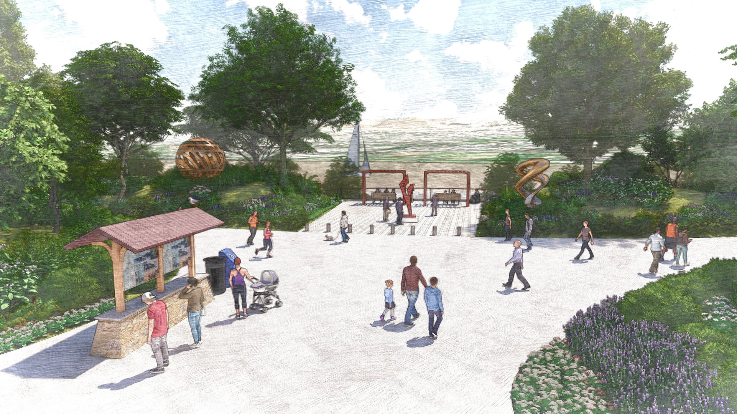
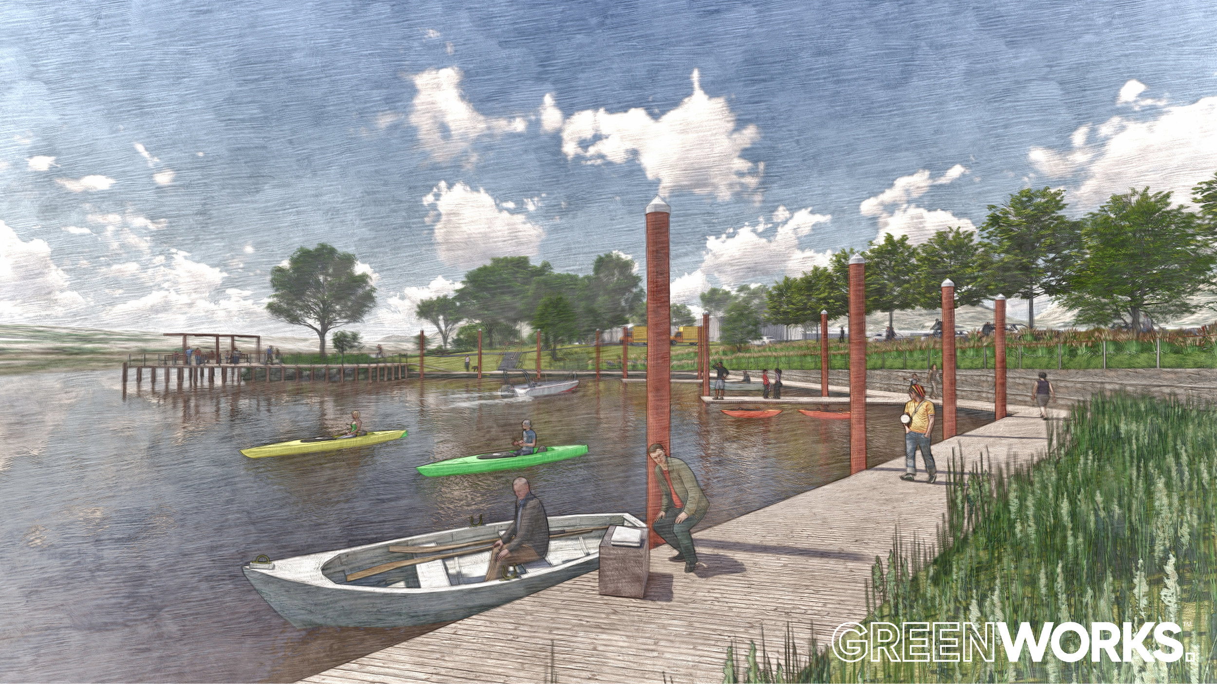
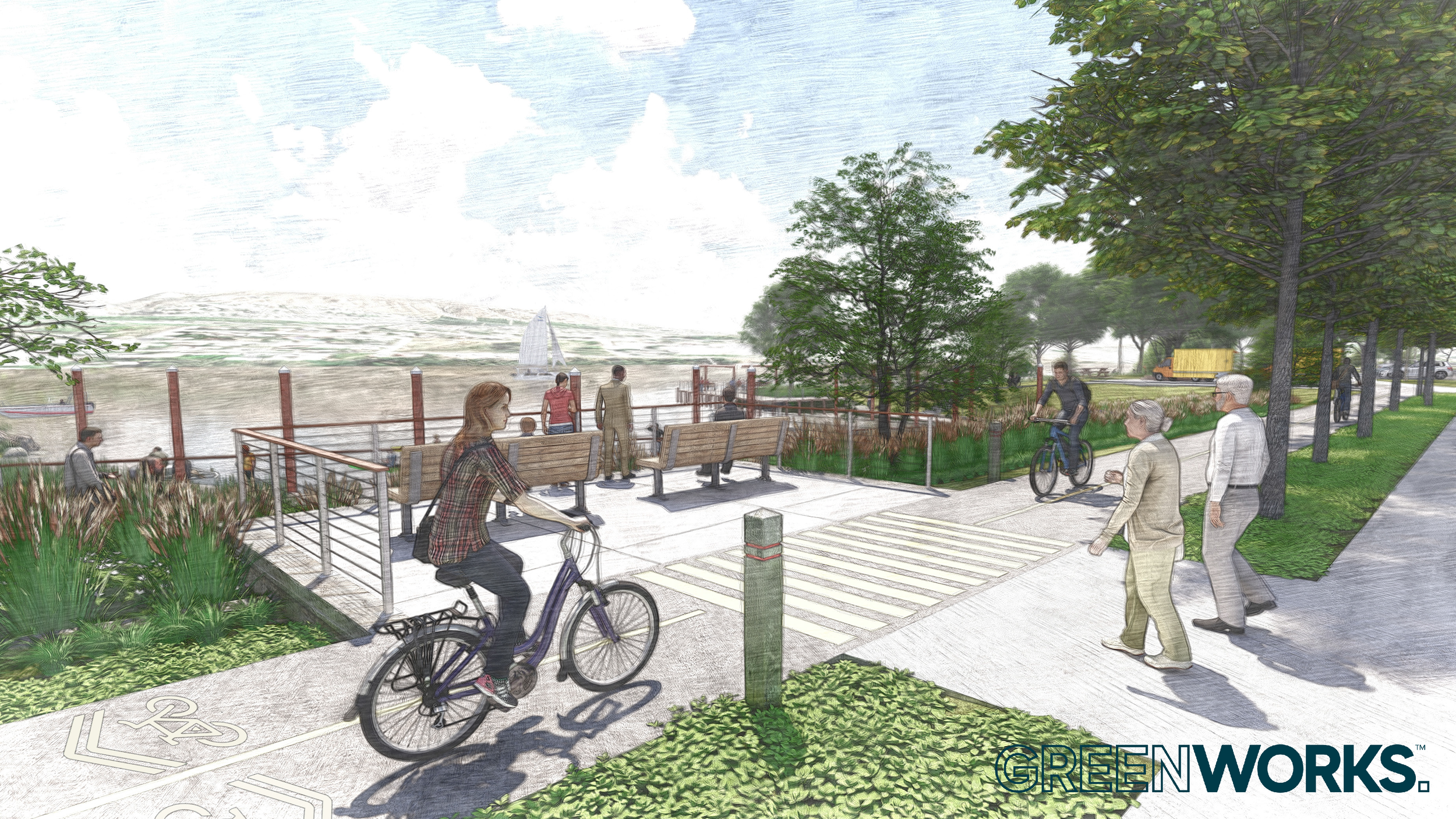
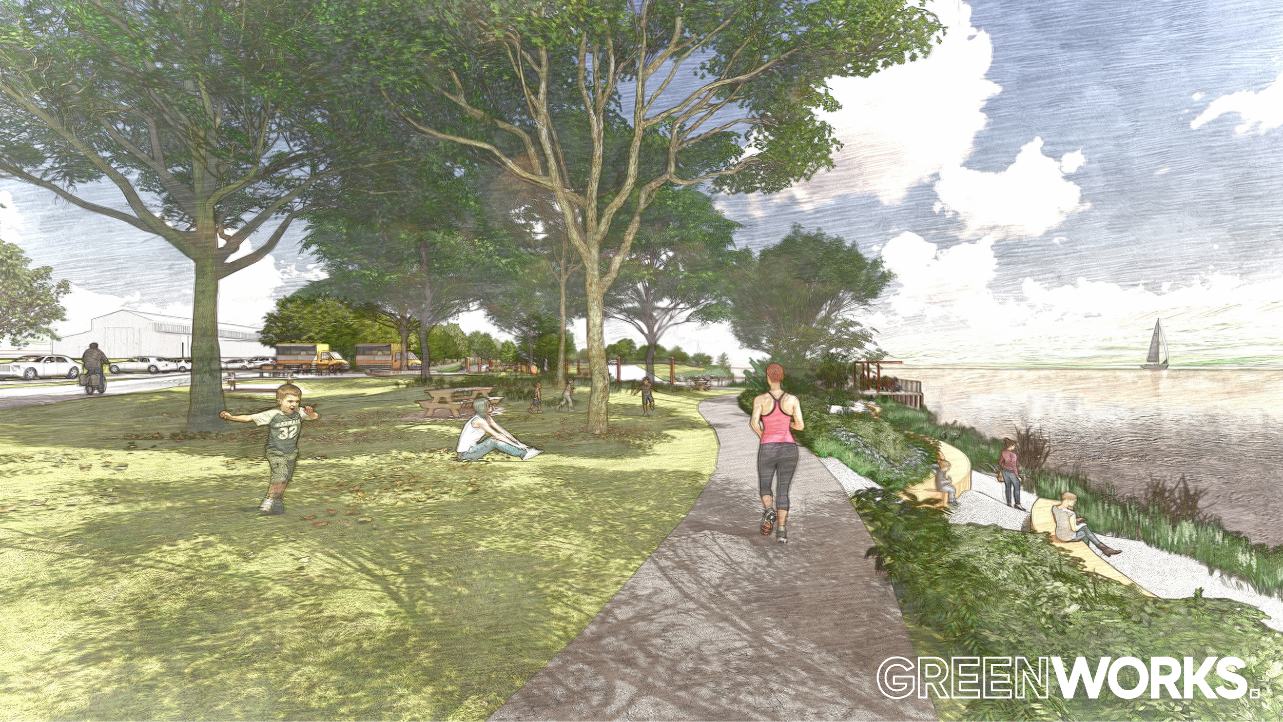
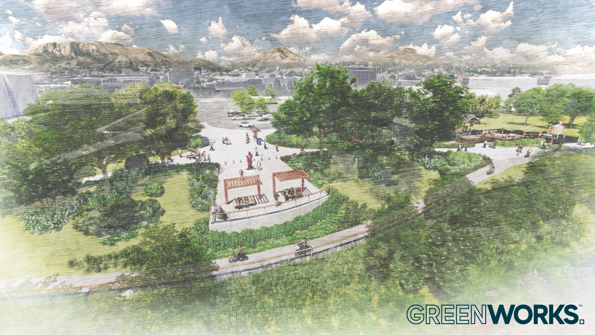
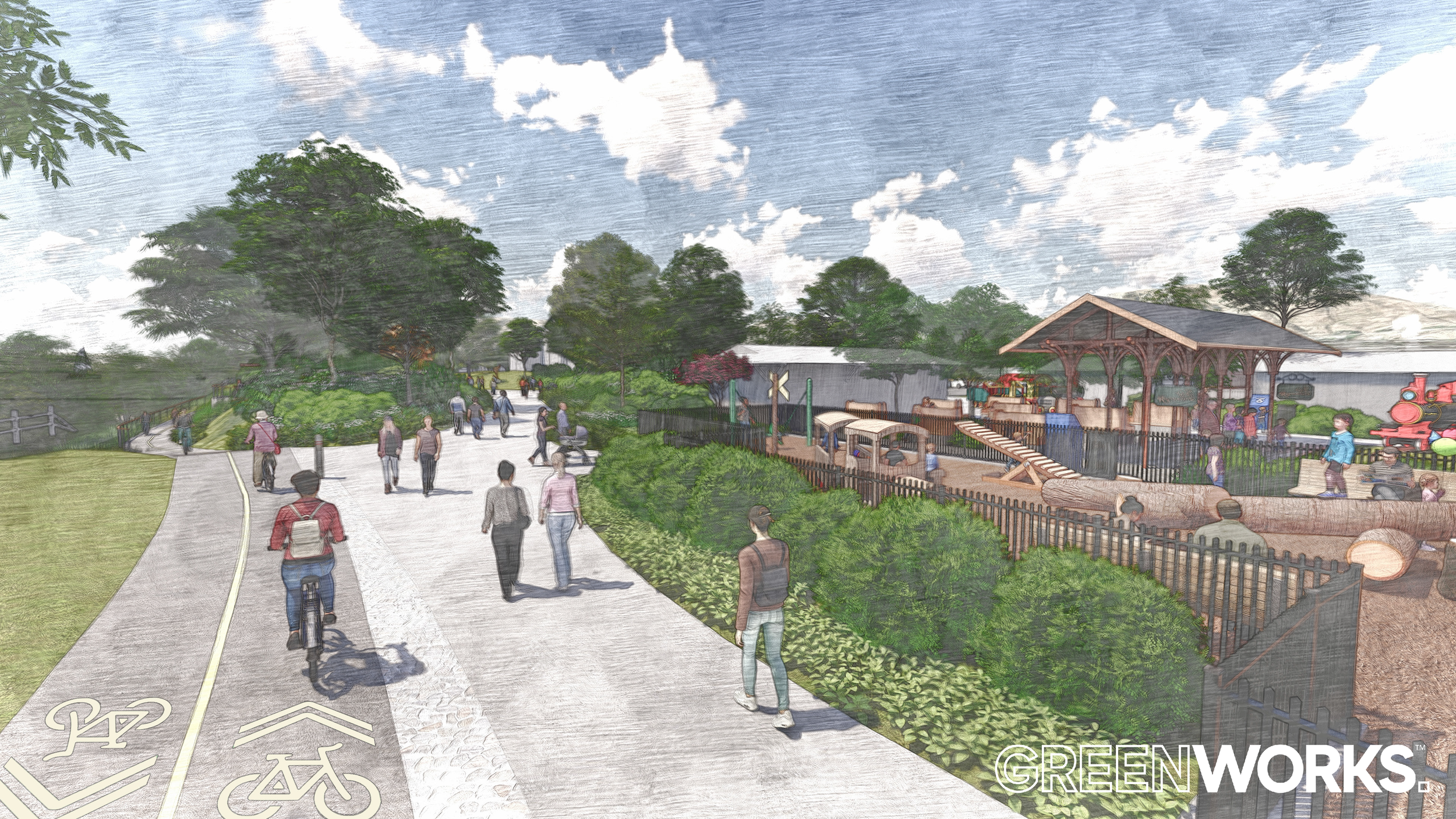
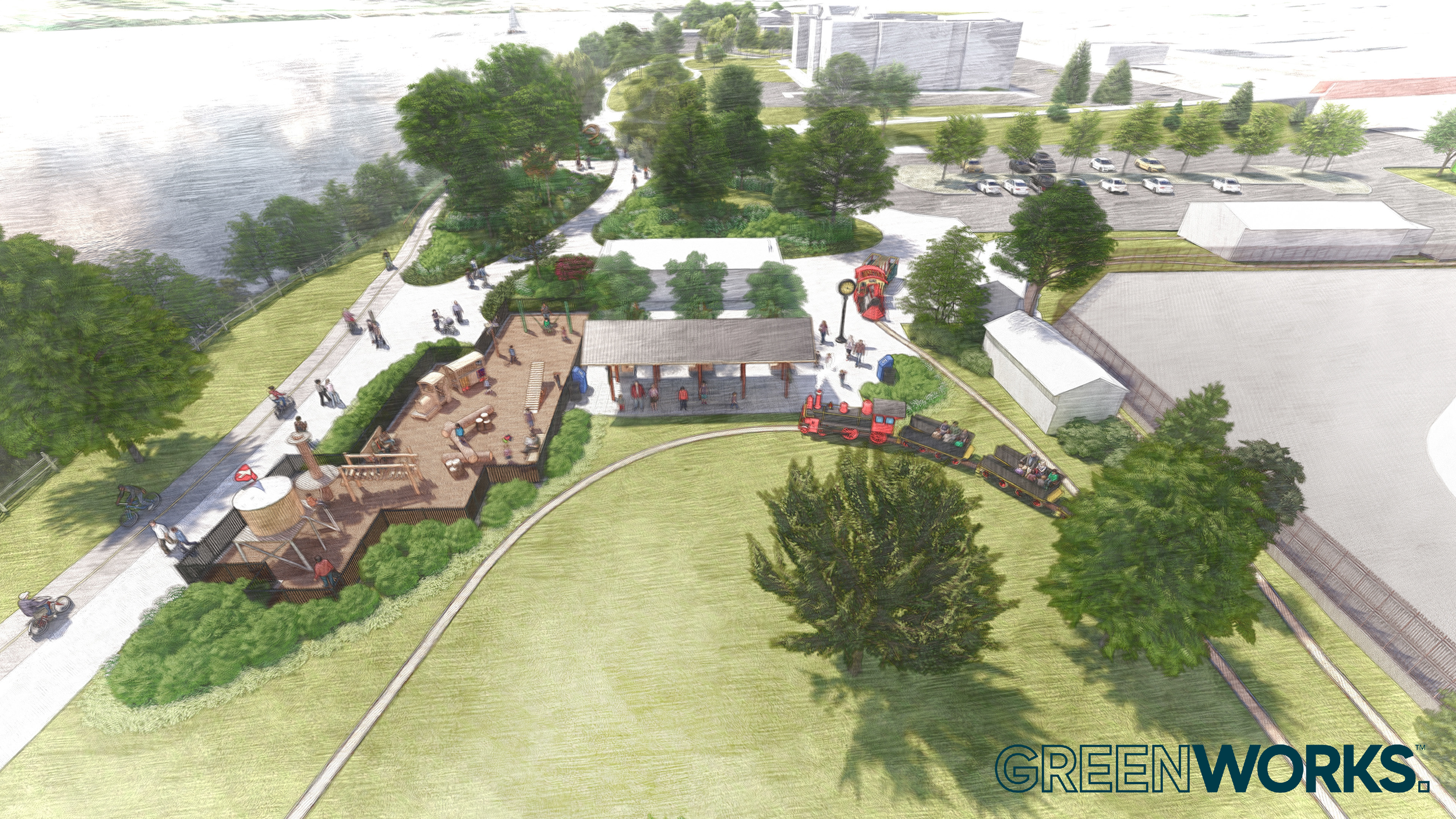
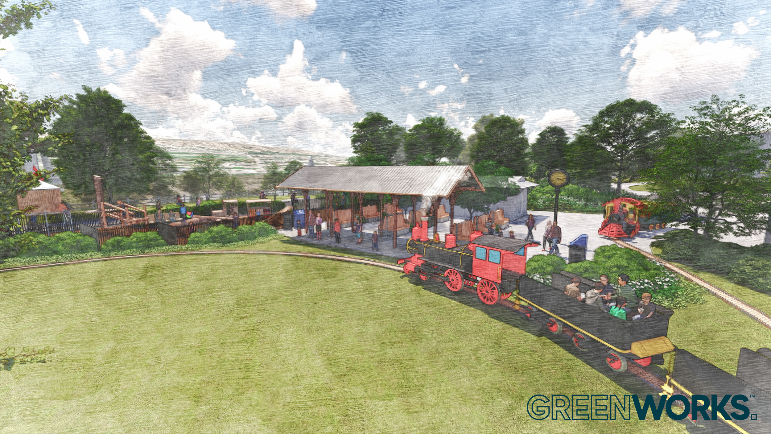
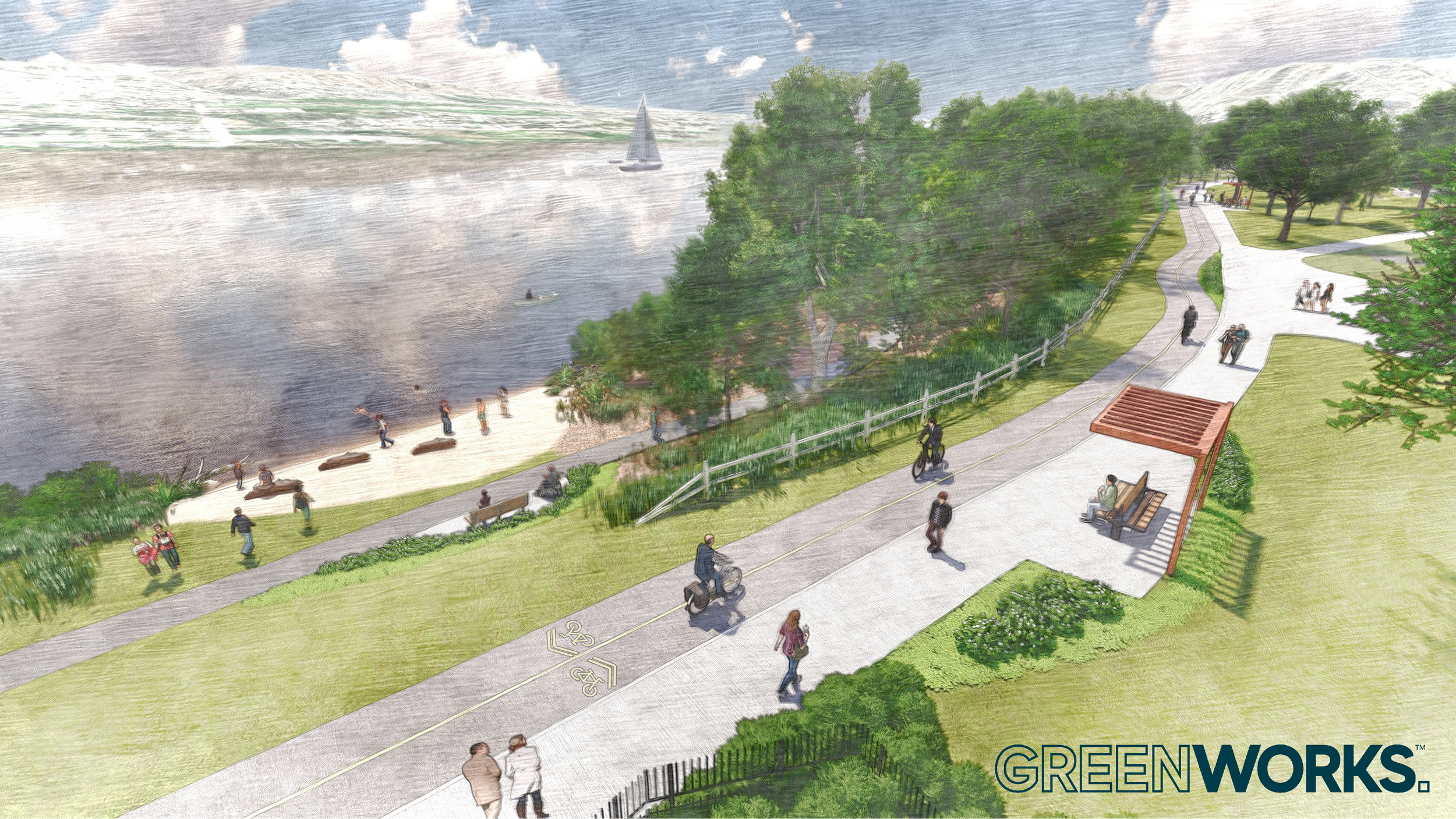
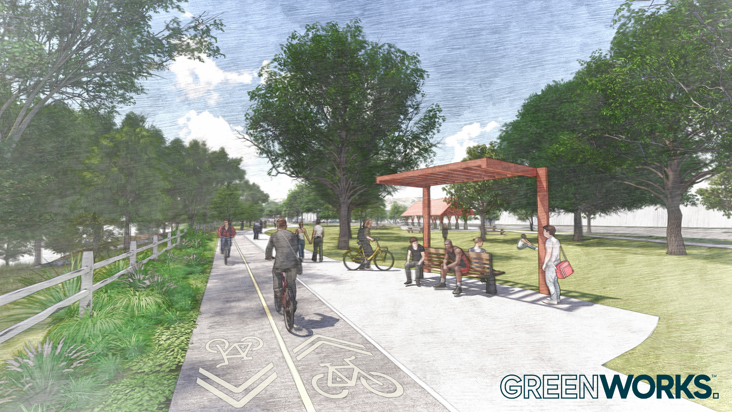
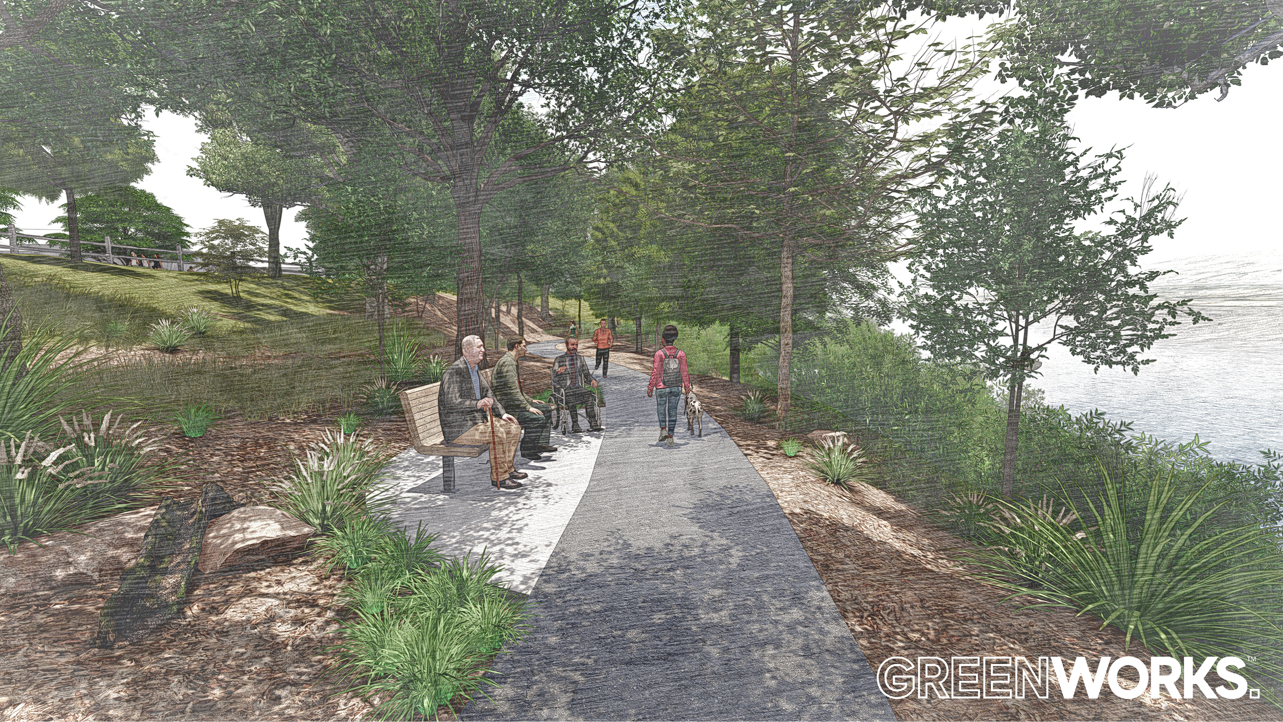
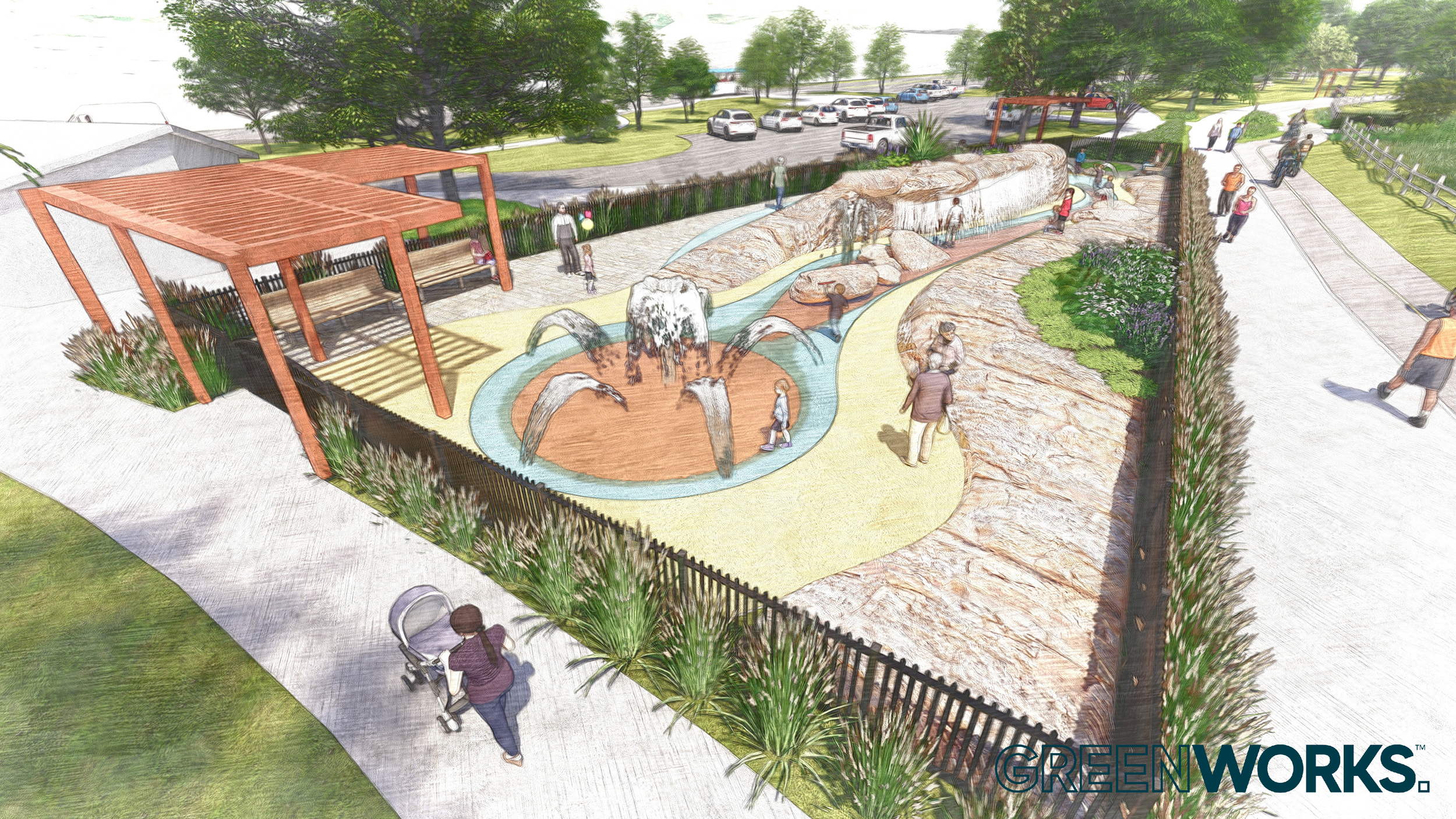
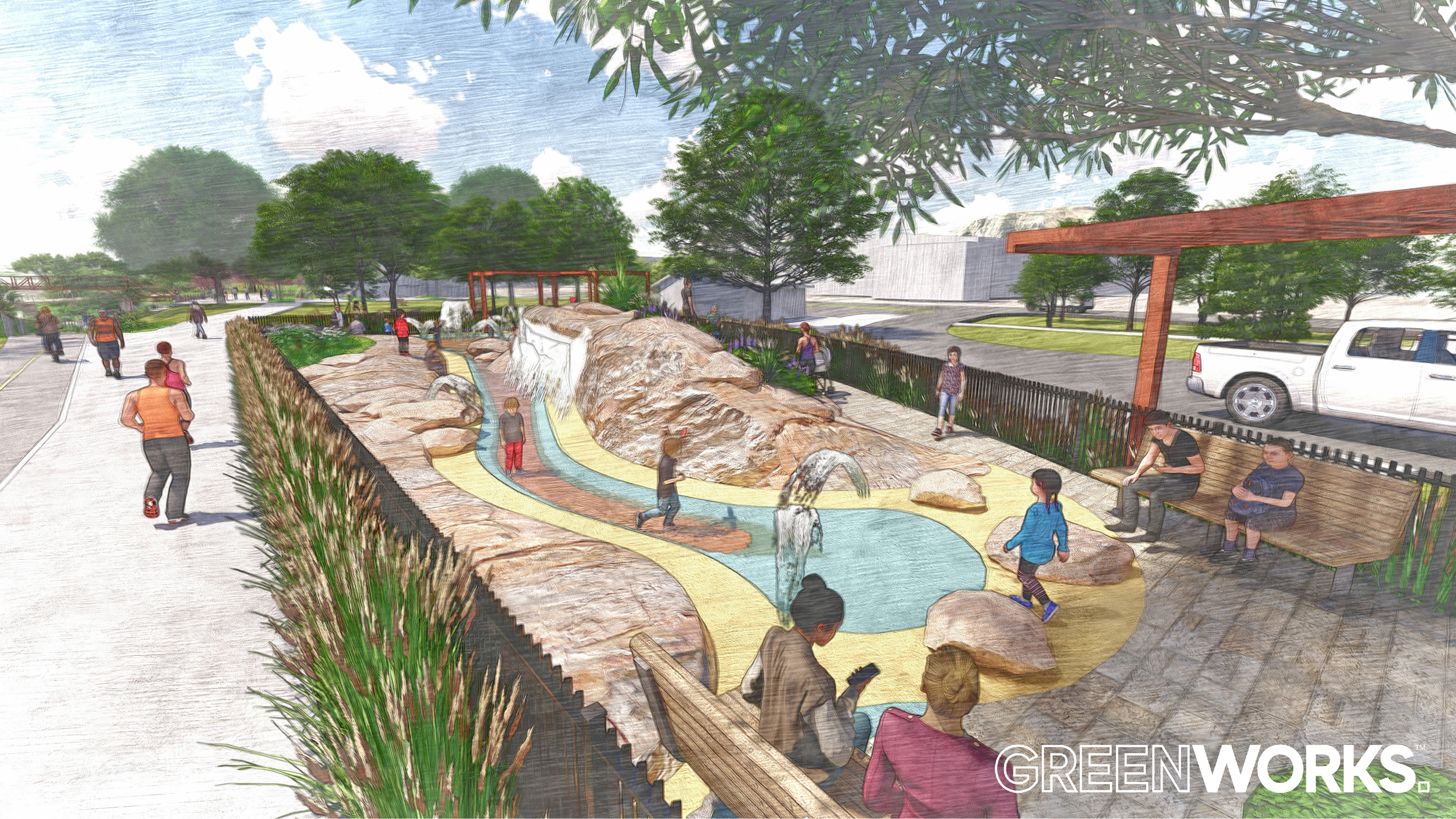
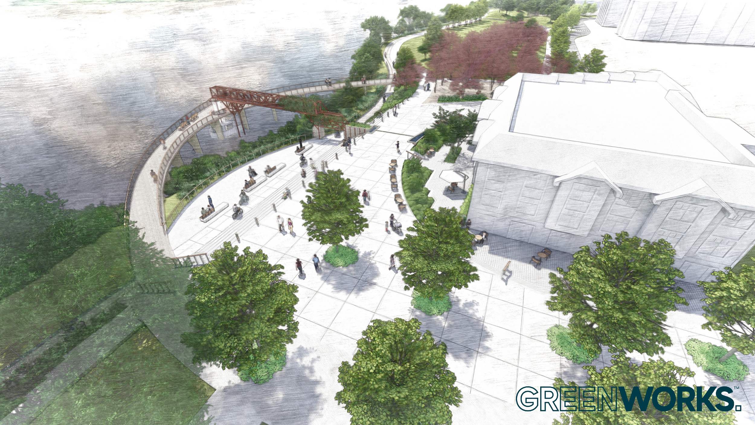
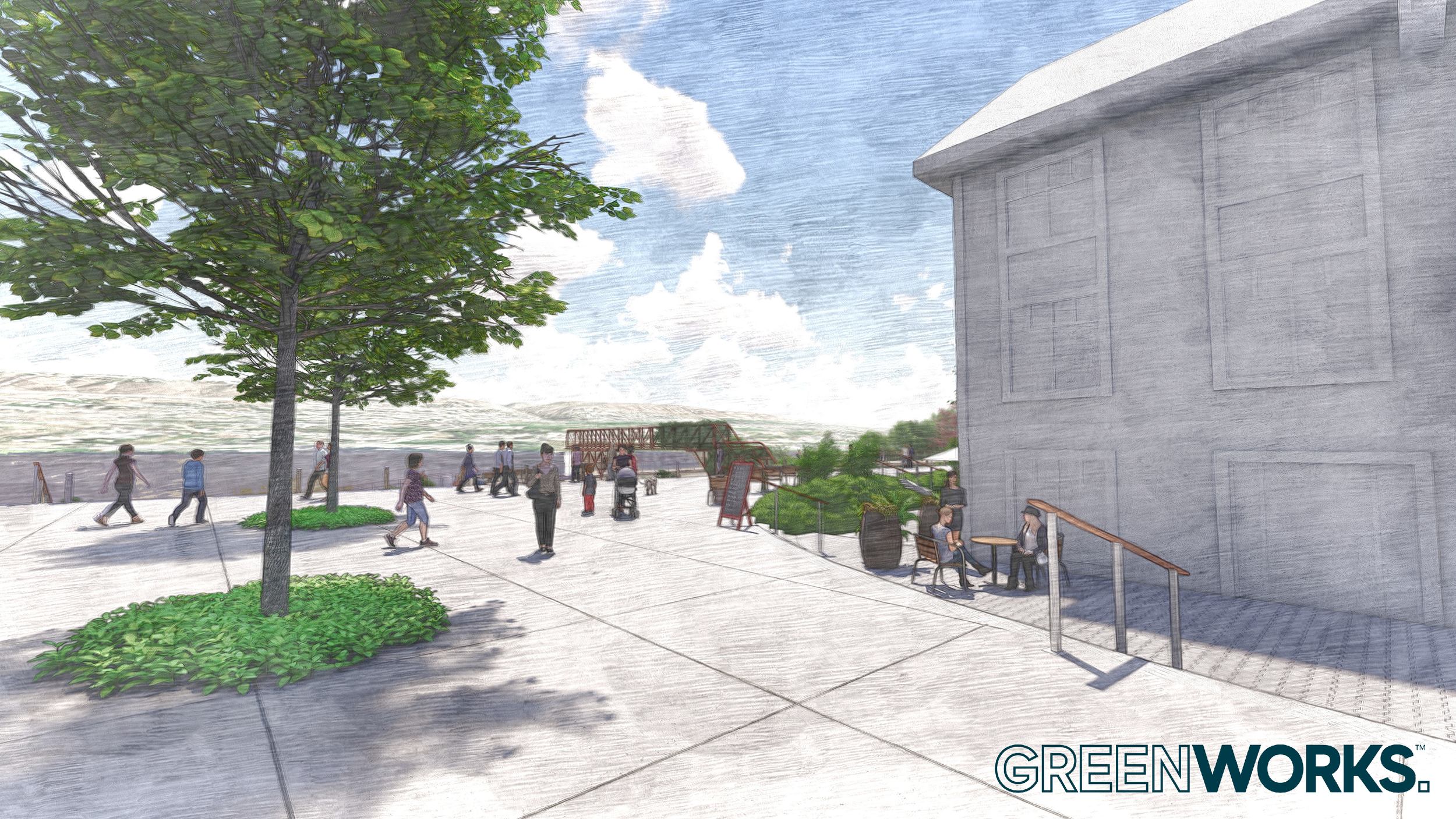
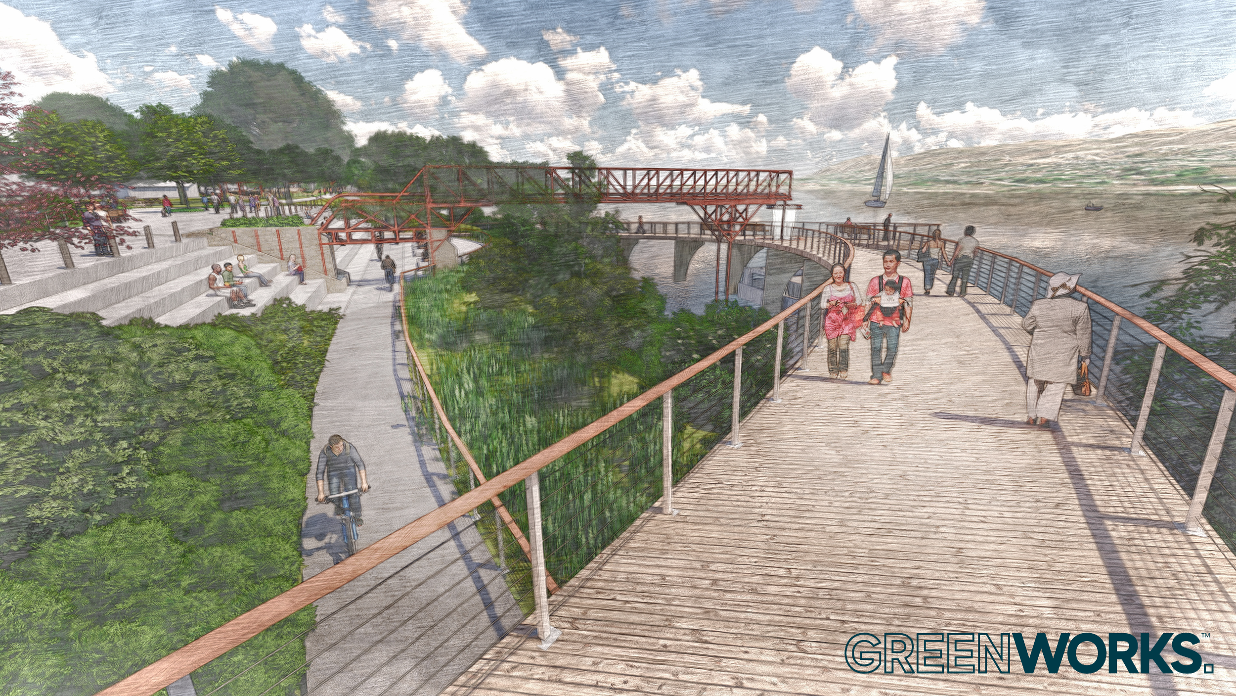
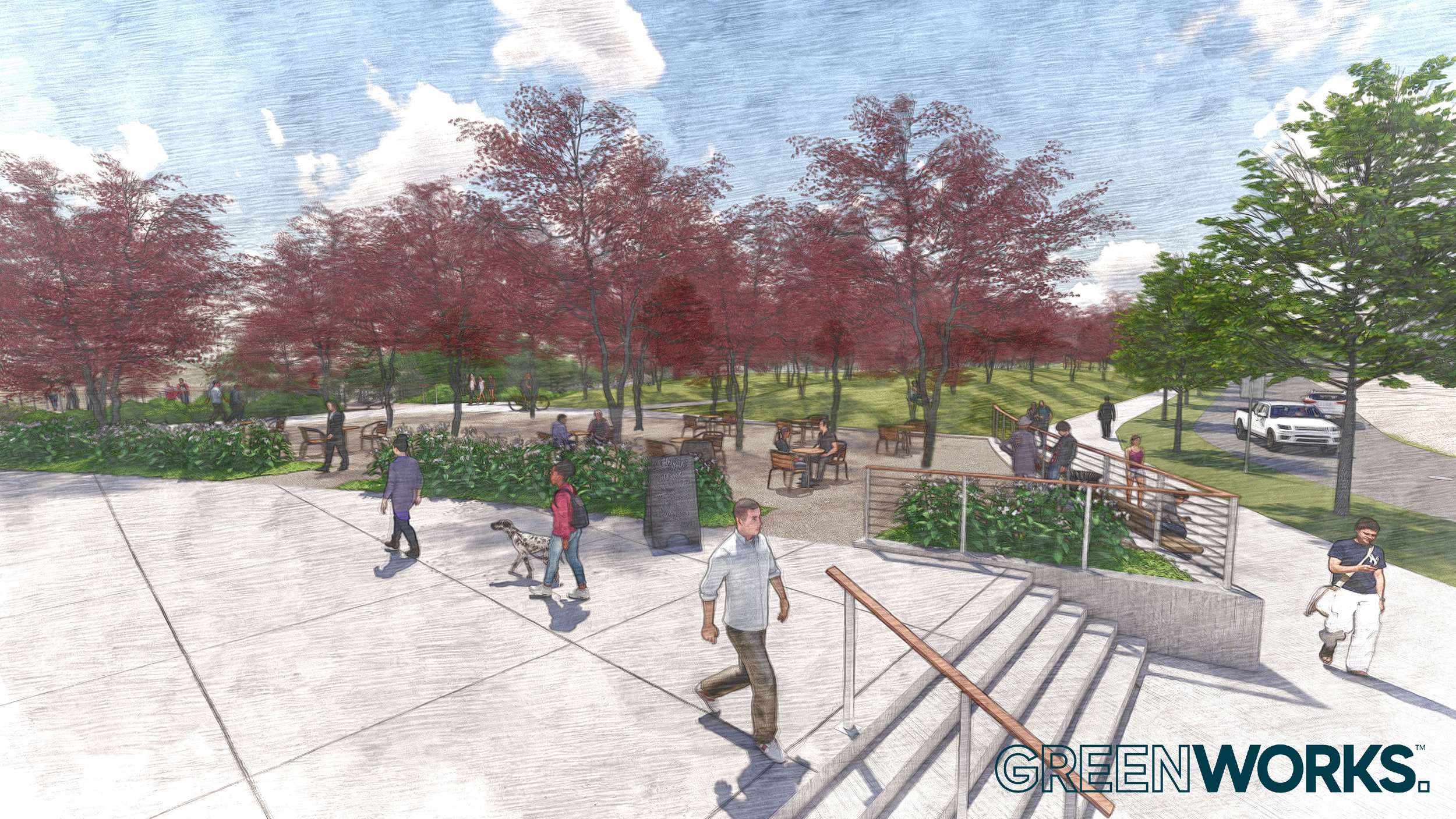
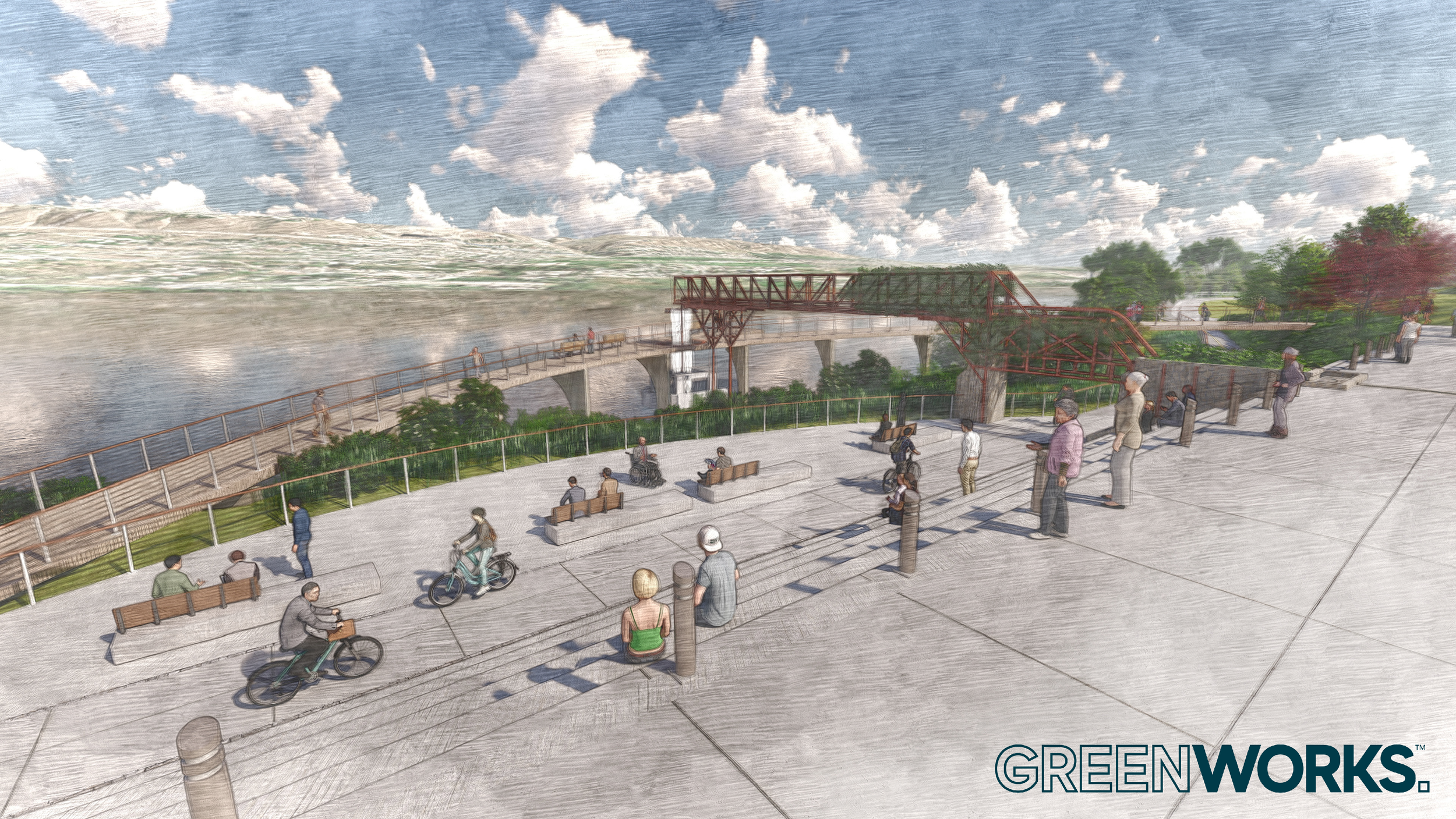
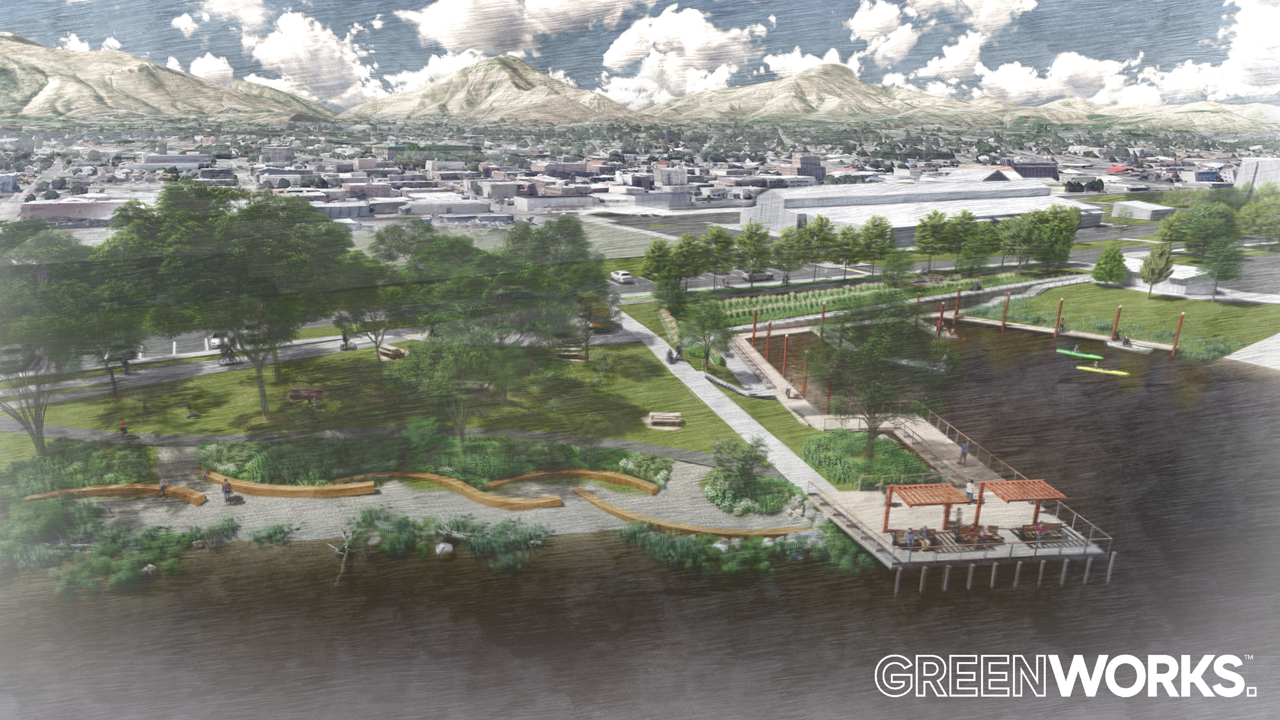
GreenWorks is working with Chelan County PUD on the design and development of a comprehensive Master Plan for a riverfront park along the Columbia River near downtown Wenatchee. Potential improvements include landscape and landscape architecture, water features, public gathering spaces, enhancements to trails and sidewalks, play areas, wayfinding, lighting, parking and park access, improved river viewpoints, and active and passive recreational amenities. The project began in 2021 and is currently in the initial Public Engagement phase.
Parker's Landing
/
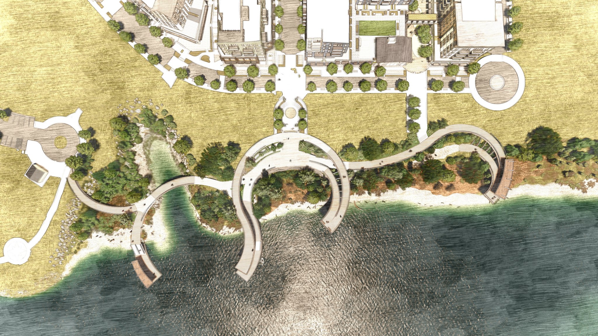
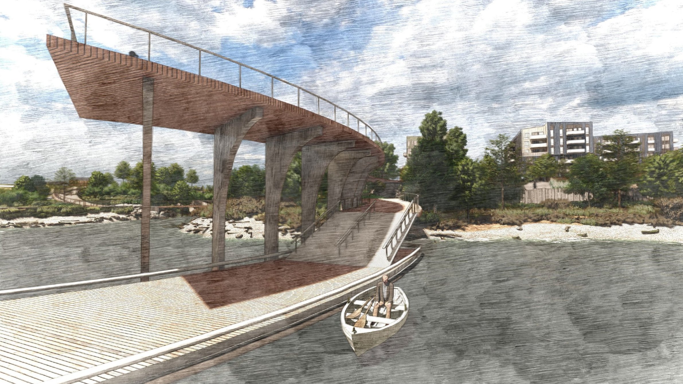
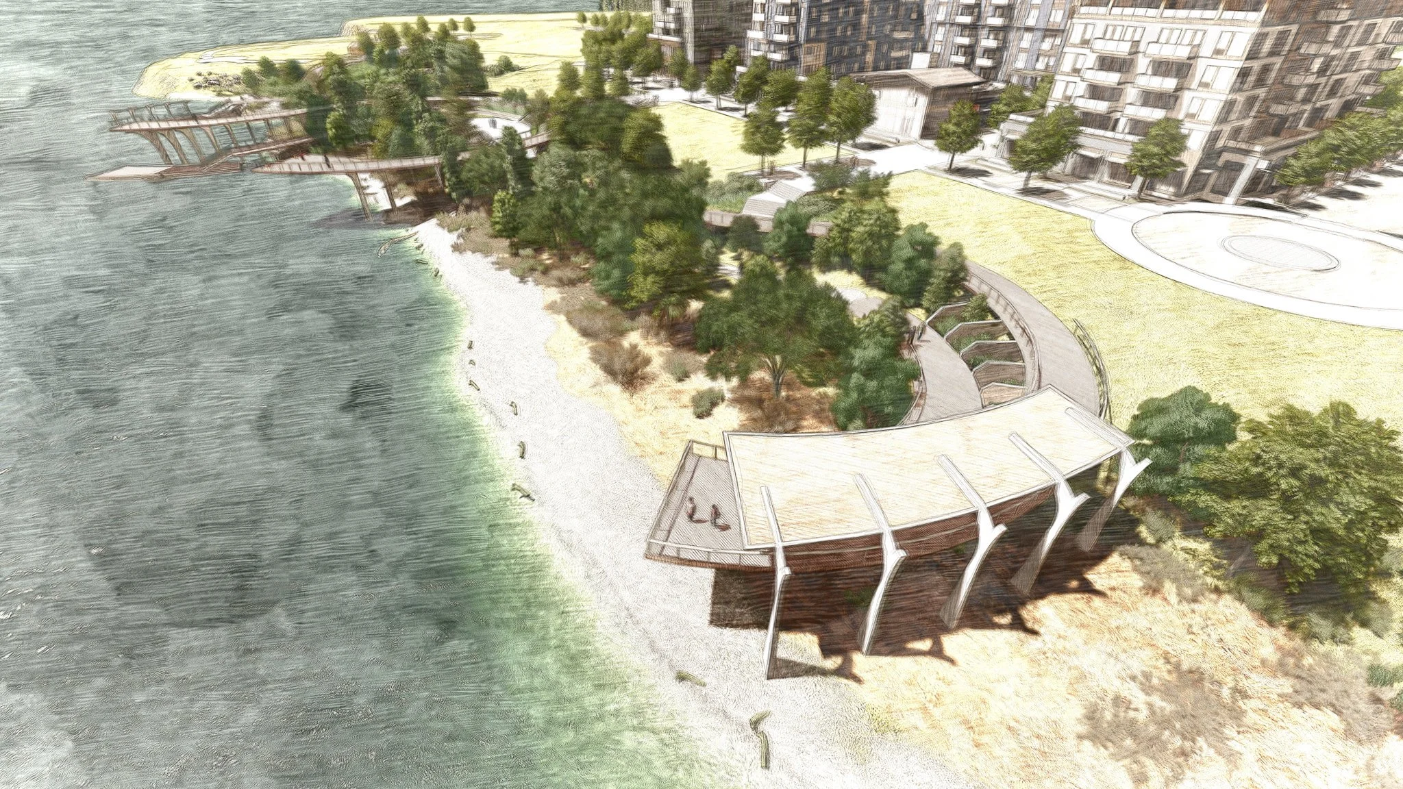
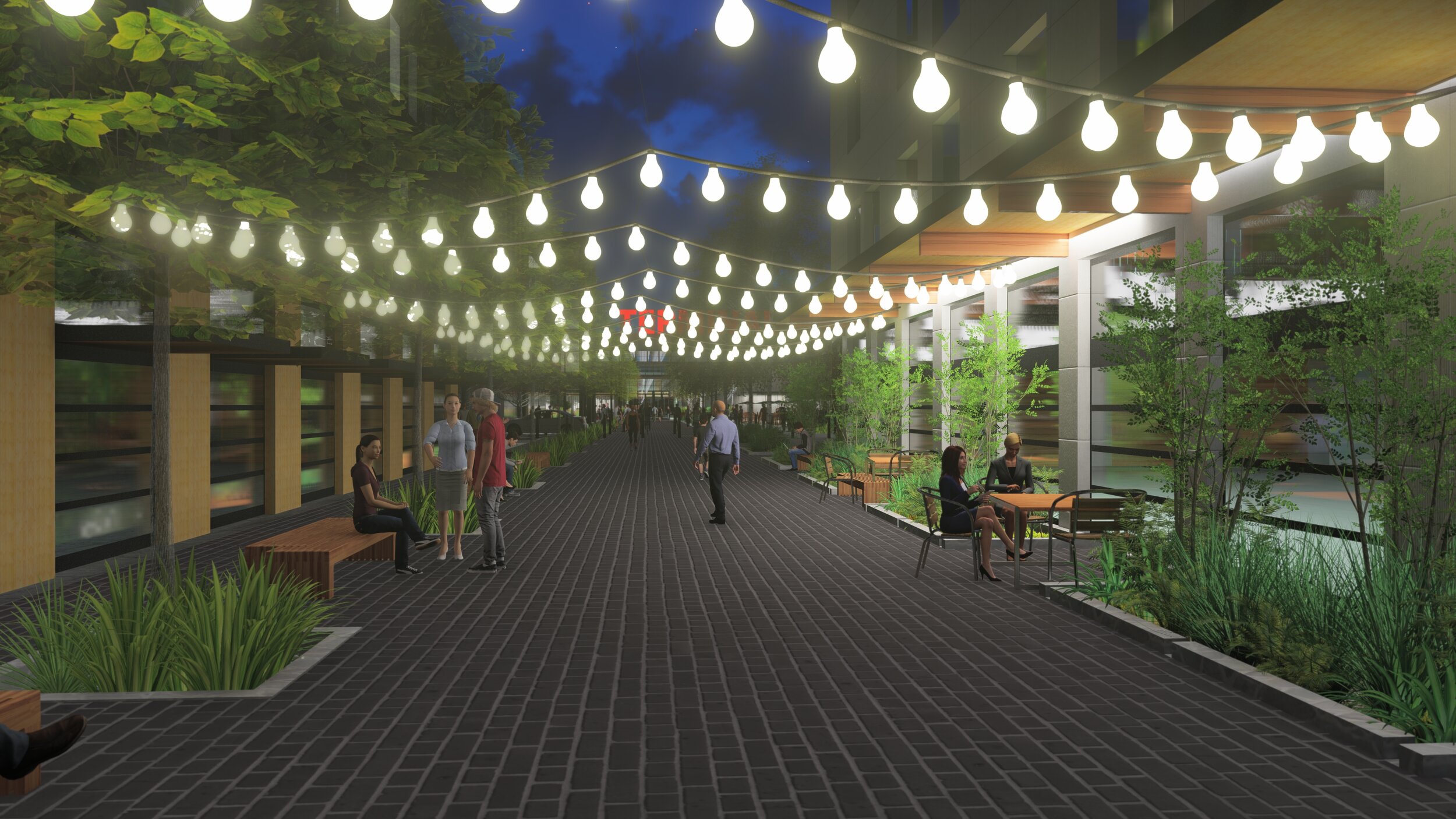
The Waterfront at Parker's Landing is a multi-phase mixed-use town center development located on the northern bank of the Columbia River in Washougal, Washington. It is located on the 21-acre remediated brownfield site that previously occupied by the Hambleton Lumber Company's main sawmill. The development has the advantage of approximately ¼ mile of naturally vegetated waterfront. Panoramic views up and down the Columbia and east to Mount Hood highlight the potential of this site.
GreenWorks is collaborating with RKm Development, YBA Architects, and the Port of Camas-Washougal to establish a vision for river access that reflects the sites rich natural and cultural history. The design explores penetrations in the riparian landscape to create diverse opportunities for both visual and physical access to the Columbia River Gorge and to the Columbia River. Utilizing graceful out and back circulation, the structures are reminiscent of fishing platforms historically found along the Columbia.
The design intends to connect people with the water and waterfront, integrating a carefully planned pedestrian esplanade, lined with shops and opportunities for dining and gathering. In addition, several public plazas and pedestrian passages are planned, each featuring a distinct scale and experience for visitors. Utilizing a simple material pallet of wood and native basalt, the design references the sites former use as a sawmill while paying homage to the basalt cliffs of the Columbia River Gorge.


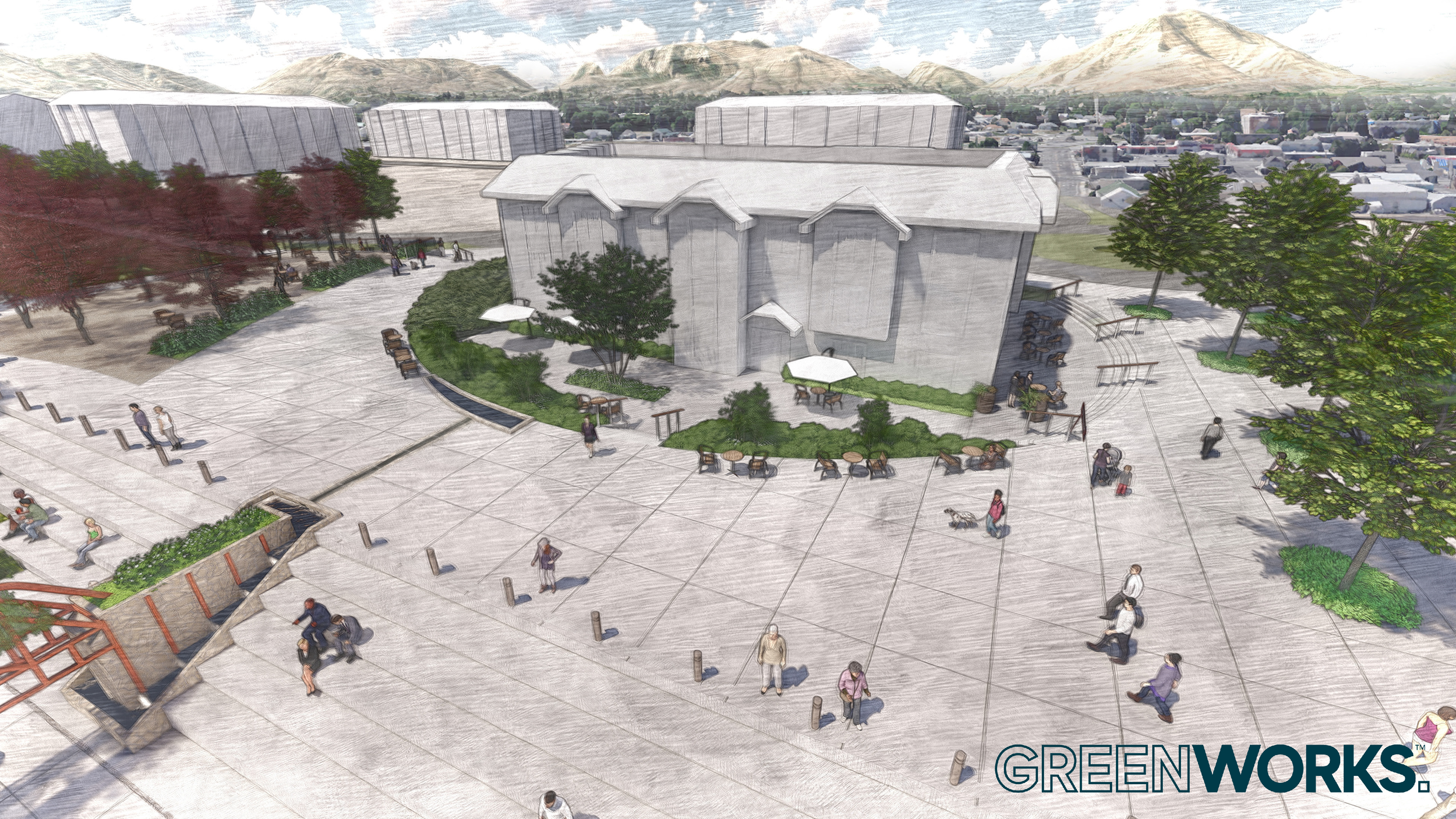
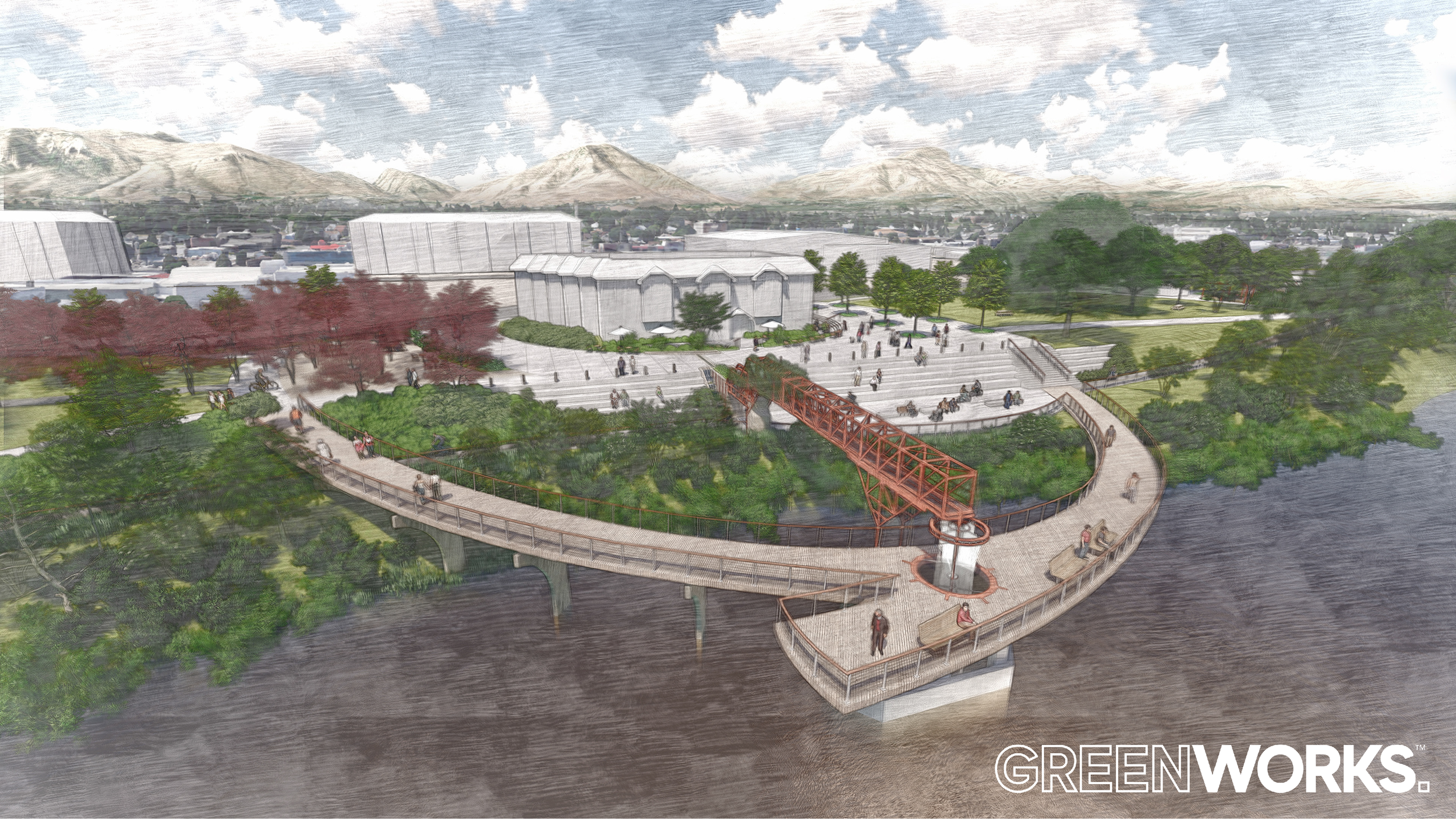
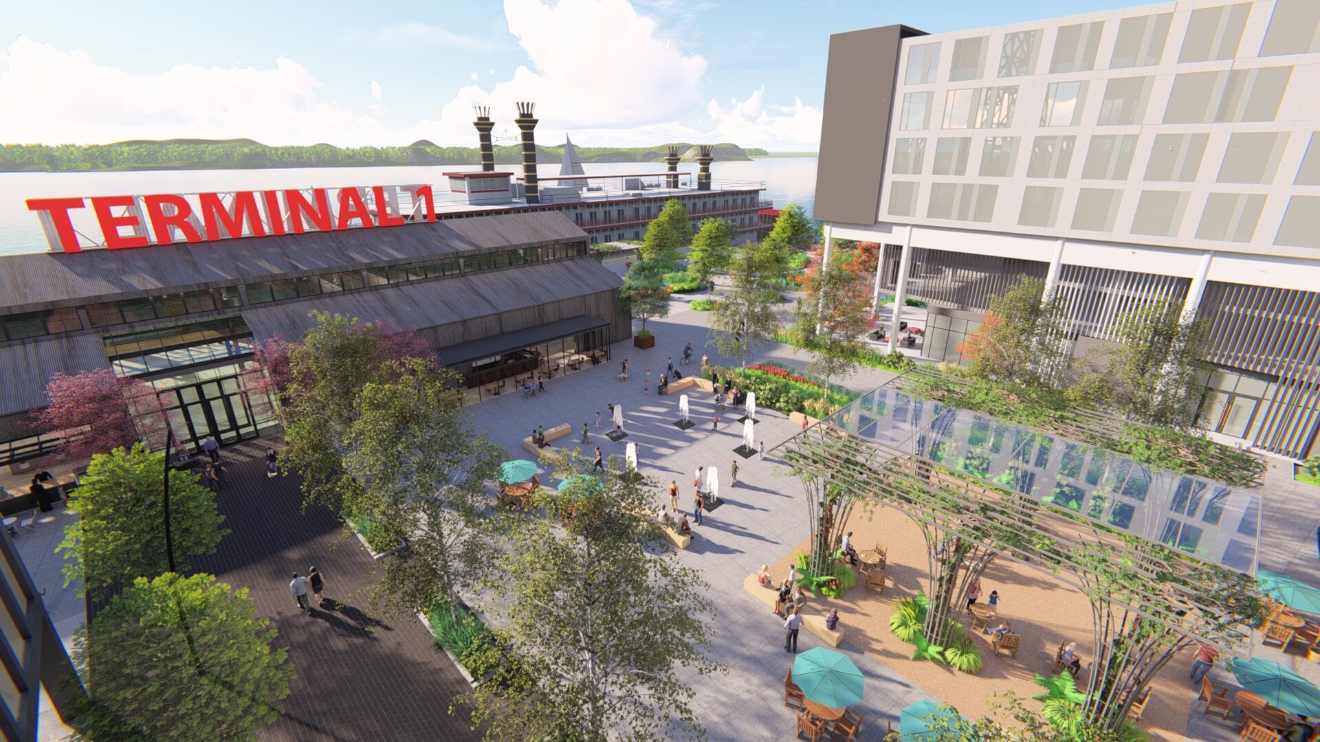
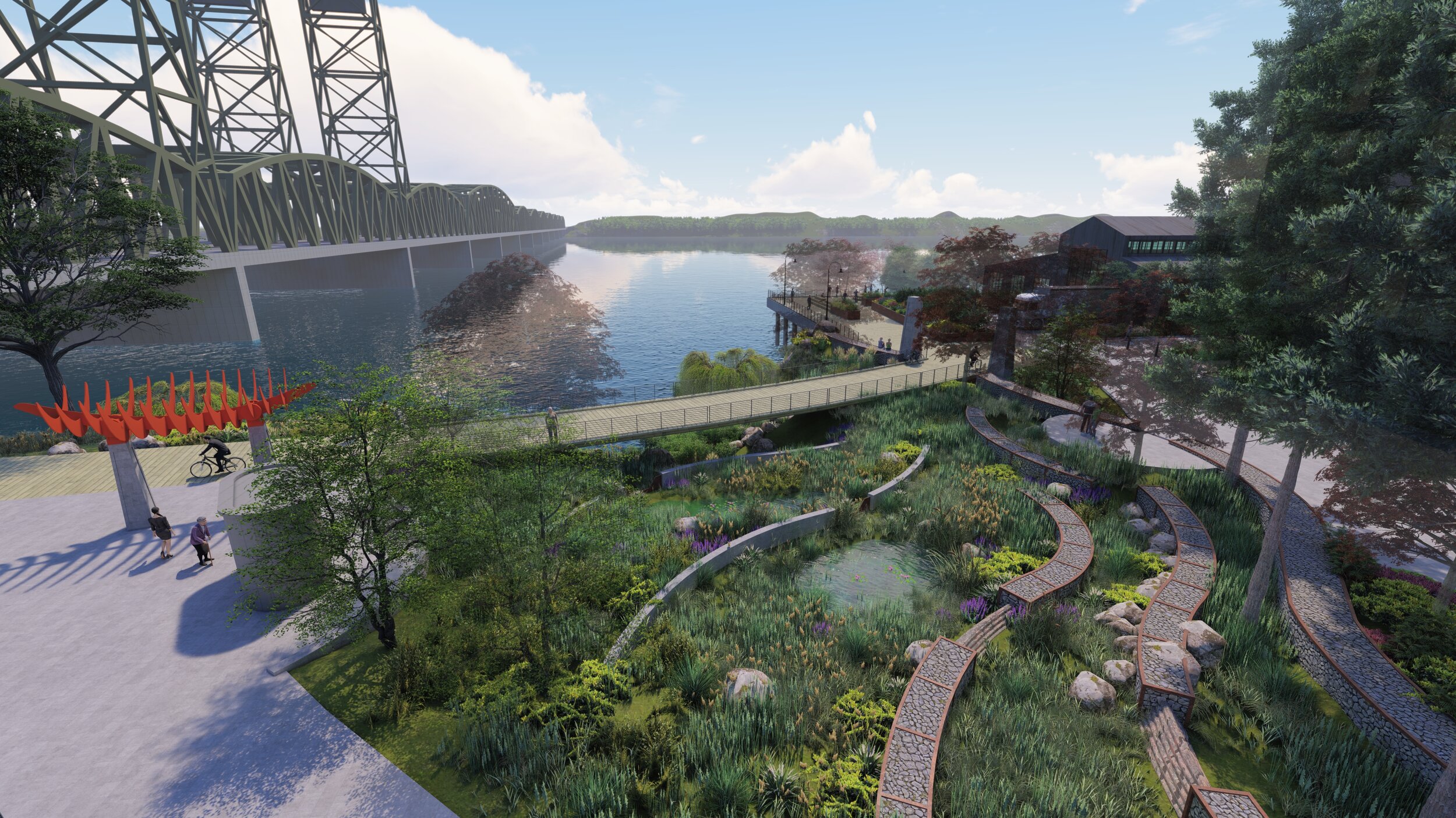
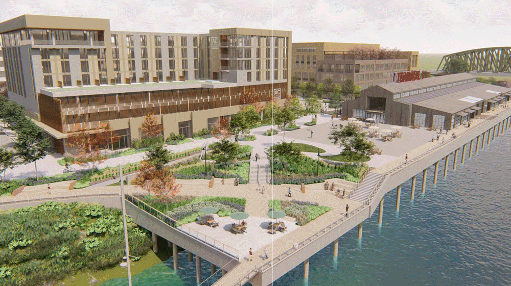
Vancouver Landing at Terminal 1
/
GreenWorks provided support to the Port of Vancouver for their Terminal 1 Vancouver Landing development. The 10.7 acre site was the site of their first shipping facility, with a rich history of supporting commerce and trade in Washington, as a site for shipbuilding during World War I, and in later years as a waterfront hotel and conference center. The iconic waterfront location offers visual and physical access to the Columbia River, and is directly adjacent to the Vancouver Waterfront development that has transformed the industrial areas and revitalized the district between Downtown Vancouver and the river with shops, housing, parklands, and the iconic Grant Street Pier.
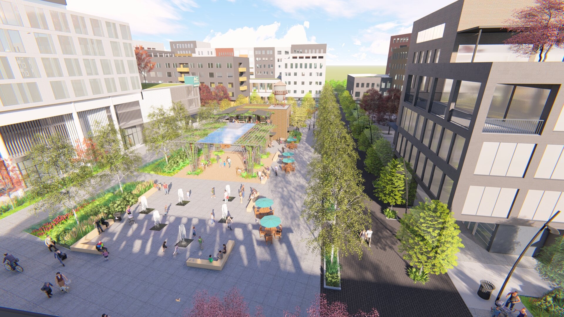
TERMINAL 1 MASTER PLAN
Our work at Terminal 1 began with the master planning process from 2018 to 2019 to set the vision for how the Port project would be developed to provide commercial and residential opportunities, along with open space amenities and the major attraction, a new Public Market Building.

Previous planning efforts laid the groundwork for the general project density and form. GreenWorks and team members developed a master plan that emphasized visual and physical connections to the river, new amenity spaces on the waterfront and to support new buildings, streetscape and pedestrian connections, including an important connection of the regional Renaissance trail.
A robust public process gathered feedback from stakeholders and the general public, with an end-point of evaluating multiple schemes to determine the specific conceptual design, types of amenities, and layouts of buildings. GreenWorks developed graphics and animations to support the public process, including workshops, press releases, and websites.
The project also achieved LEED Neighborhood Development Gold certification, showing the Port’s commitment to smart and ecologically sensitive design. The virtual environment, video walk-through, and fly-throughs were instrumental in public outreach, and helped with generating buzz for the project, ultimately resulting in the Port getting significant funding from the State of Washington to help make the project a reality.
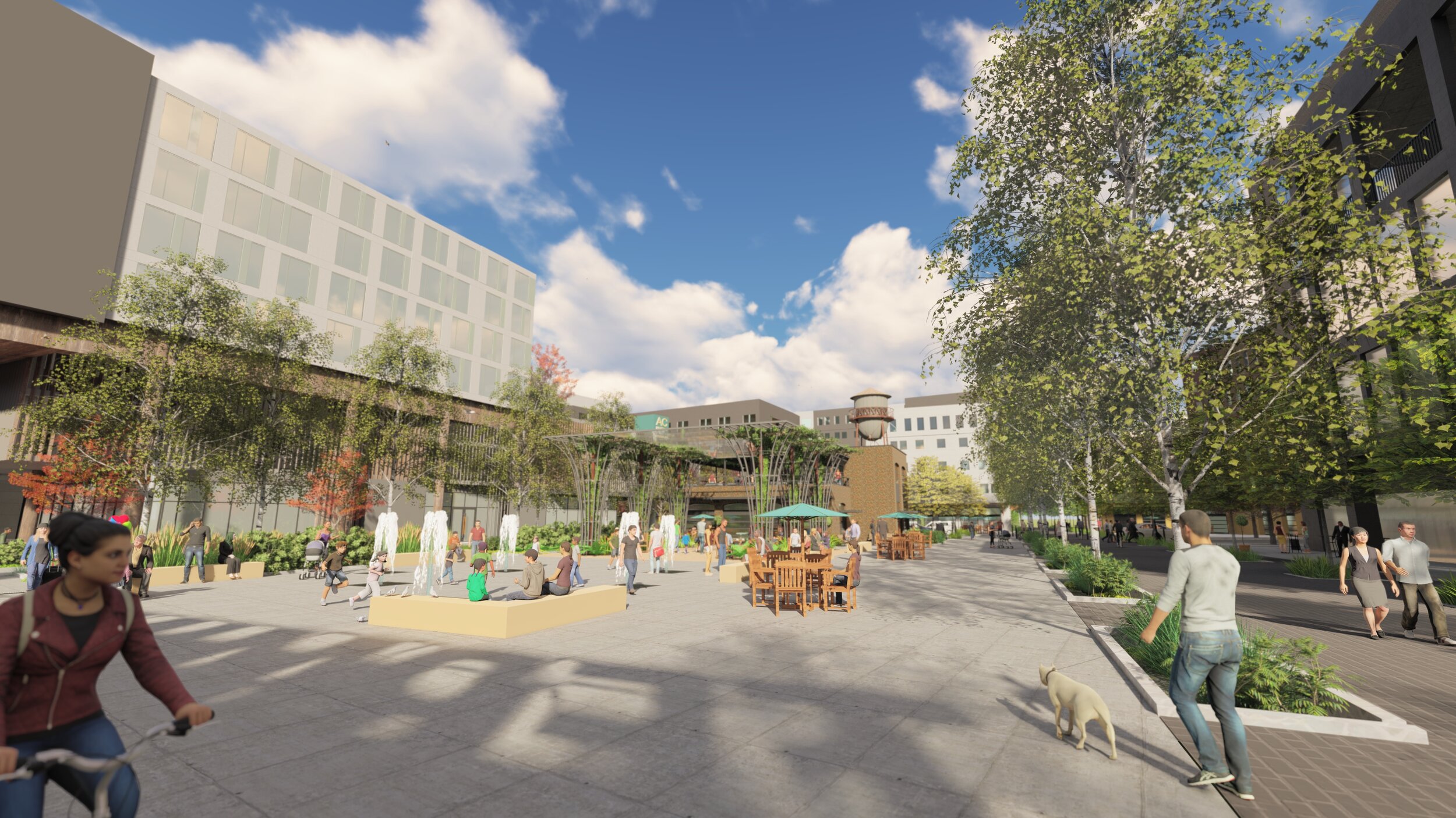
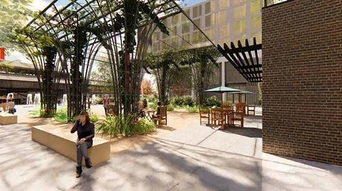
ROTARY WAY & RENAISSANCE TRAIL
The initial phases of development began with design and permitting in 2019, including the Vancouver Landing, and the first connection for the Renaissance Trail along the upper bank. This catalyst project aimed to set the stage for future work, and established a design concept that celebrated the industrial history of the site while greening the existing amphitheater, restoring the shoreline, and making vital connections to the adjacent Waterfront Park, and existing trail to the east.
Complexity at the Core
The location of the project on an existing structure, and along the shoreline of the Columbia River were factors that contributed to the complexity from a design, engineering, permitting, and construction perspective. The initial phase included seismic and structural upgrades to the pier, modifications of the existing structure to help with the new accessible route, bulkhead wall interface, and additional piles that allowed for the weight of future seating, decking, soil and site amenities.
GreenWorks working closely with Port staff and managed the team schedule and deliverables to ensure work and permitting was done to allow bidding and installation within the specific in-water work window. Team members at KPFF led the structural and seismic upgrades, including the addition of new seismic dolphins to stabilize the structure. WSP led permitting coordination for the local permitting along with state and federal compliance.
The need for adaptability is key with these types of projects, as the team continually learned new information and had to refine ideas, problem solve, and balance the needs of project budget, design goals, permitting requirements and schedule.
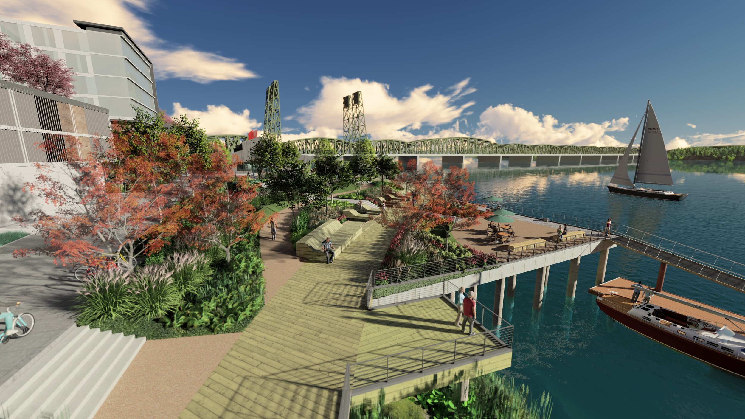
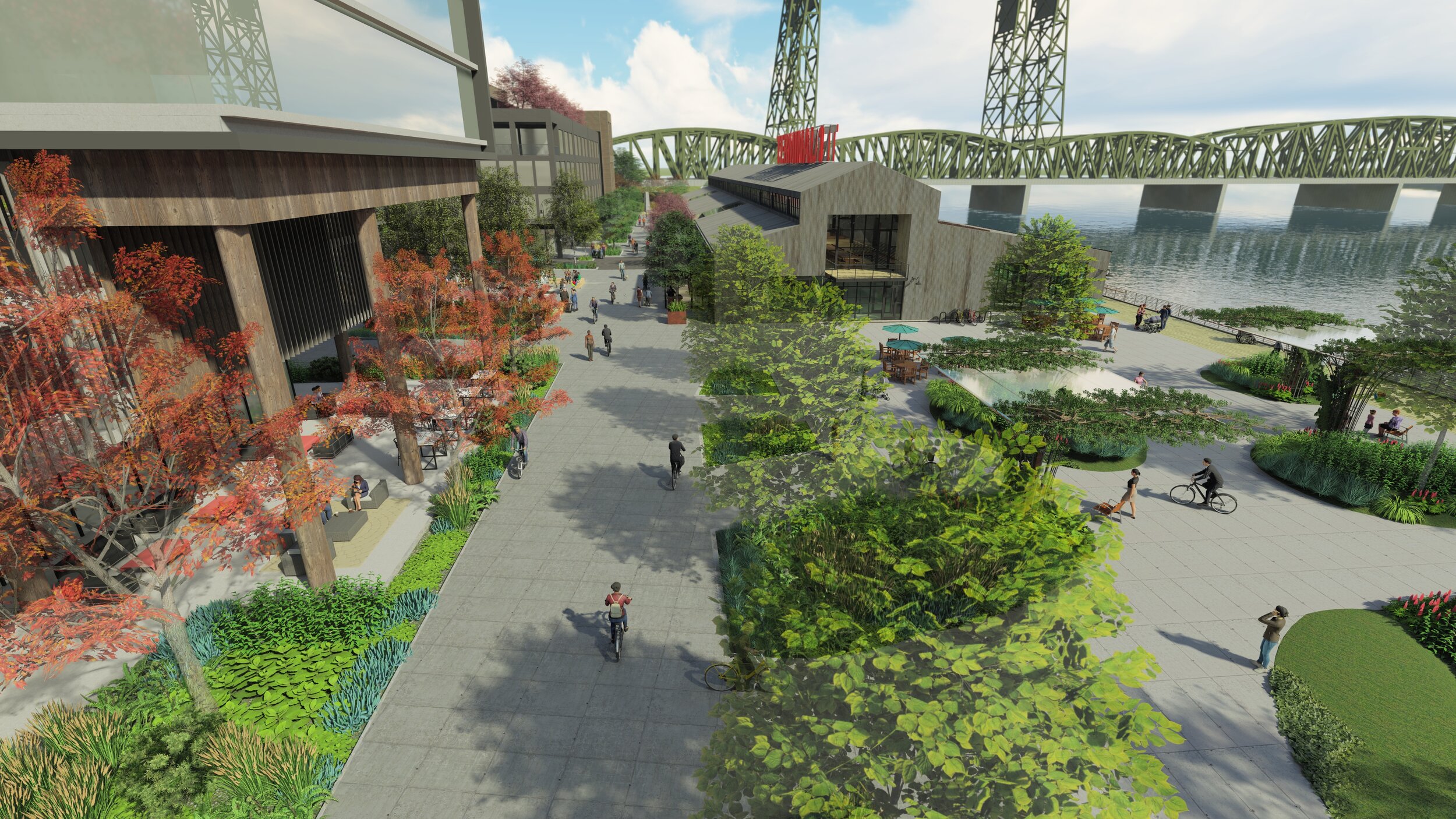
Completion of the structural work allowed for the Vancouver Landing project to move forward beginning in 2020. The design provided a seamless transition from the shoreline areas on the pier that provided seating, landscaping, and views to the river.
Pulling inspiration from the industrial materials with a modern context, the use of wood is prevalent, with boardwalk paths for access, and terraced seating elements, along with stacked timbers evoking the history of lumber shipping on the site. The plantings included shoreline restoration of the upland areas, and on-structure plantings of adapted, drought tolerant shrubs, grasses and groundcover that will soften the site and be activated with river breezes.
The team was also able to design the adjacent AC Hotel, the first project built as part of the master plan, integrating the site into the larger Terminal 1 plan while developing rooftop garden spaces, entries and patios for hotel guests.
A Celebration of Place
During the design process, the opportunity arose for the site to become a celebration of the 100th anniversary of the Clark County Rotary Club, who generously donated funds to the project, with a goal of tapping into the rich history of the site and region. Along with team member Chuck Lennox of Lennox InSites, we worked with the Port and stakeholders to develop an Interpretive plan that wove together the history of Clark County and Vancouver, Port of Vancouver and Terminal 1, the Rotary, and the natural landscape of the Columbia River and renamed Rotary Way.
Elements included interpretive panels that celebrated shipbuilding, agricultural heritage, tribal history, and transportation. Additional elements like timber stacks tied into the rich site history and whimsical connections to Vancouver history were included, such as the reference to local brew Lucky Lager.
A timeline of the regional history was etched along the pathway to celebrate significant cultural and natural historical events. Markers connected landscape elements to Vancouver’s sister city, and whimsical benches referenced the history of rail in the region and on the Terminal 1 site.
Visualizations from the Virtual Environment we Created

visualization of future terminal 1 development by greenworks
GreenWorks Commitment to Green Building
GreenWorks is defined by our commitment to green infrastructure and sustainability. Our design experience covers green roofs, green walls, innovative stormwater management, as well as implementing LEED certification on dozens of projects including RiverEast Center, The Encore Condominiums, Washougal Town Square, First and Main Office Building, Lake Oswego-Tigard Wastewater Treatment Plant, ODOT Headquarters, and Lane Community College. Our firm is proud to employ the only SITES AP certified landscape architect and designer in Oregon. SITES AP “establishes a common framework to define the profession of sustainable landscape design and development. It provides landscape professionals with the opportunity to demonstrate their knowledge, expertise and commitment to the profession.” In 2019, GreenWorks became the first Salmon-Safe Accredited landscape architecture firm, allowing us to facilitate Salmon Safe certification throughout the design process.
Explore our Other Work


Elwert Kruger Roundabout
/

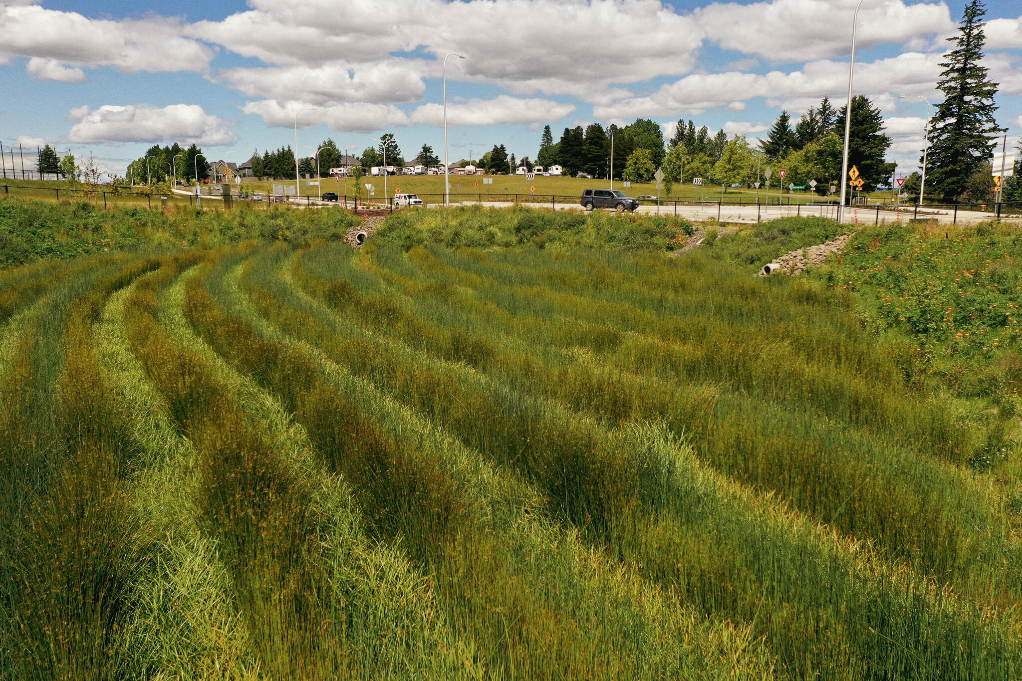

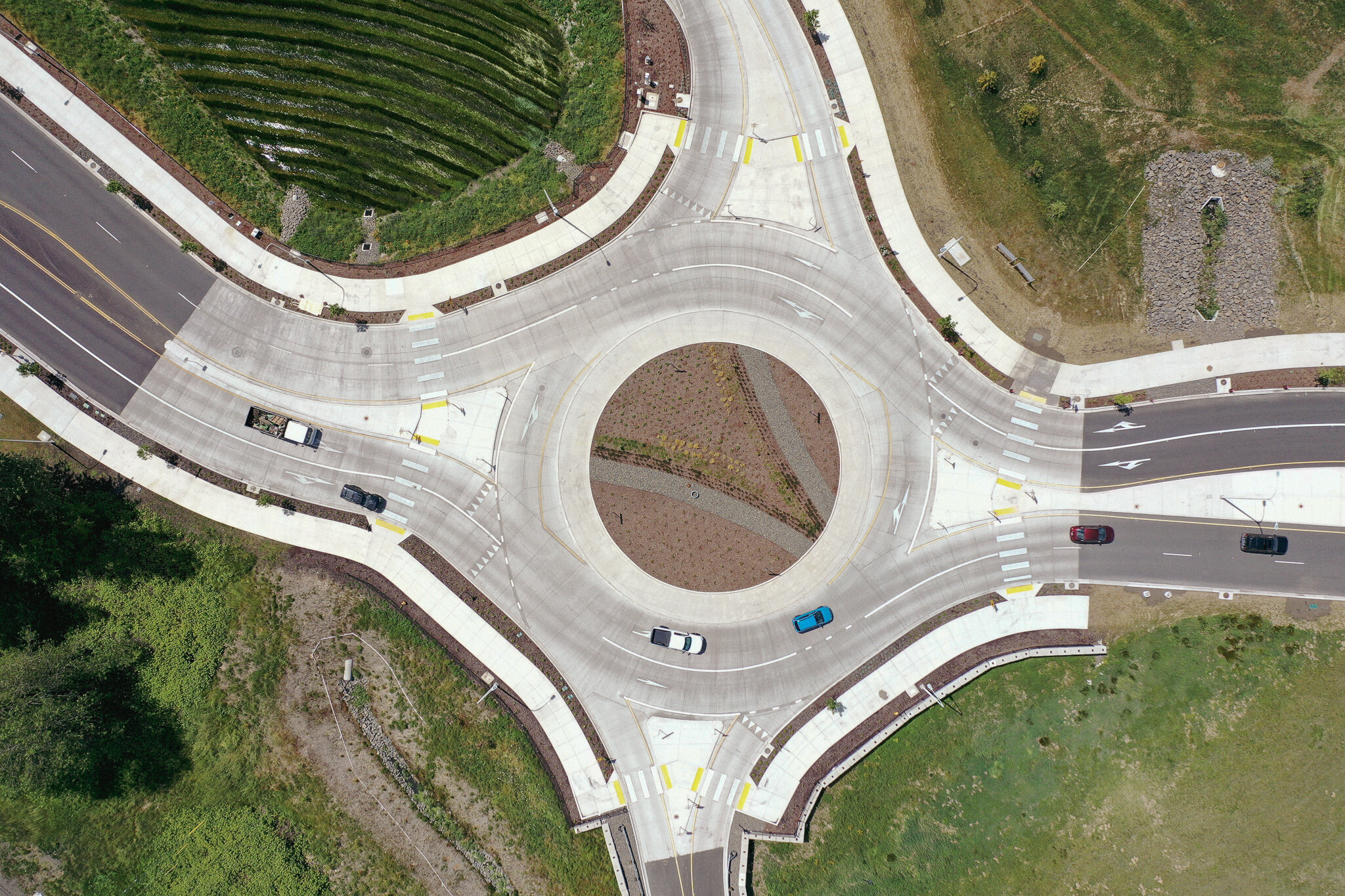
GreenWorks collaborated on a team with HDR on this intersection improvement project at Elwert Road and Kruger Road in Sherwood, OR, adjacent to the new Sherwood High School.
The roadway improvements are happening around the recently built High School and in conjunction with a large roundabout meant to help control traffic flow. GreenWorks' scope included planting and irrigation design for the streetscape, pond, and environmental areas along the intersection.
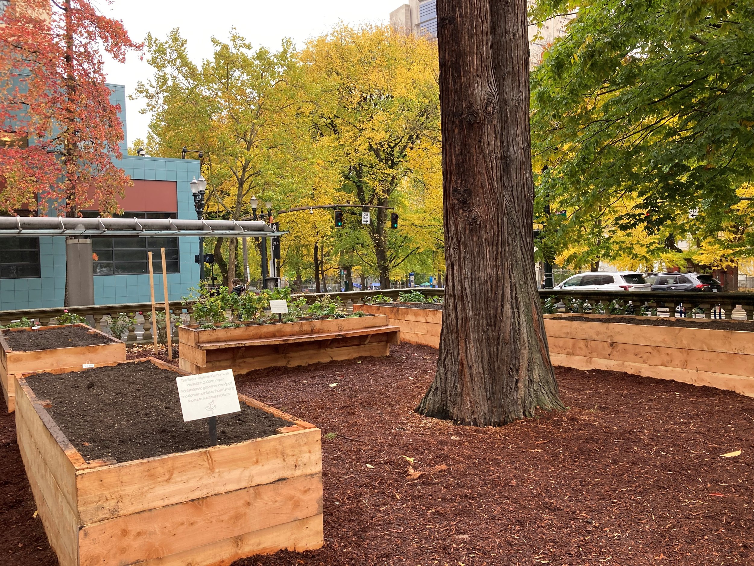
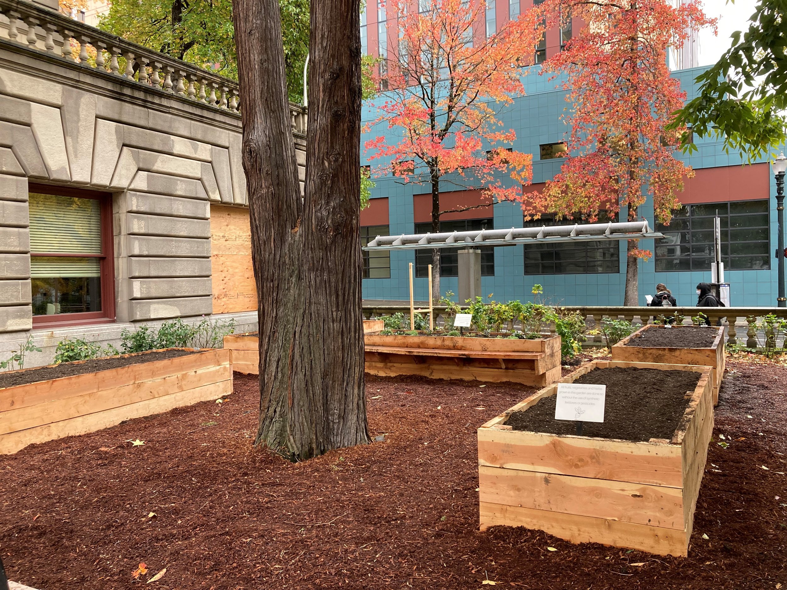
Portland City Hall's Better Together Garden
/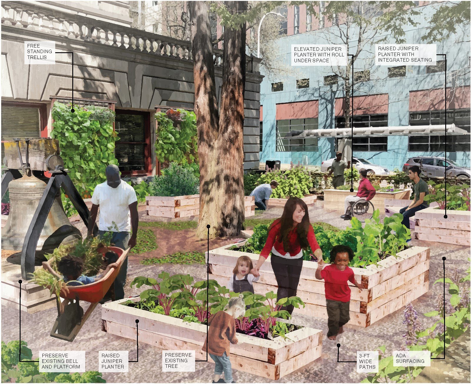
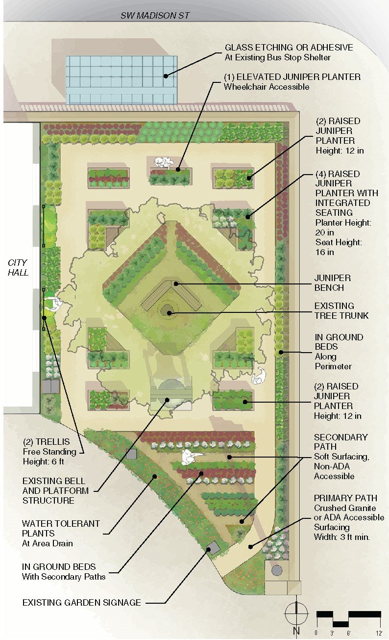
The GreenWorks team completed a preliminary re-design of Portland’s “Better Together Garden” at City Hall. GreenWorks Landscape Designer Vivian Schoung explained, “The next evolution of the garden is to make it more welcoming to people of all abilities and to increase its visibility.”
The next step in improving the garden, which GreenWorks was tasked to address in this project from the City, is installing walking paths that are friendlier to people of all abilities. New surfacing on the pathways will allow water to soak into the ground, but it will also mean the garden will become more ADA accessible, with 4-foot-wide paths. It will also include raised plant beds of varying heights so people can more comfortably work in the garden.
In spite of its prominent location, the garden can be surprisingly difficult to find if you aren’t looking for it. “Oftentimes people don’t see the garden because it’s raised above the surrounding sidewalk and behind the low wall that surrounds the courtyard,” GreenWorks designer Schoung said. Future iterations of the garden’s design will seek to address this issue.
“The opportunity to give back to the community through our pro-bono services at The Better Together garden was a special opportunity for Greenworks,” GreenWorks Associate Principal Jason King said. “While a small space, the impact is immense as an example of how community landscapes can address food insecurity through thoughtful design while being accessible to all. This reflects our firm’s aspirations for design to contribute to the overall livability of the Portland metropolitan area.”
Corvallis Wetlands TMDL
/
The City of Corvallis investigated options to treat its wastewater using constructed wetlands. The Orleans Natural Area site was chosen as the preferred location for this facility. GreenWorks collaborated with Kennedy Jenks to design a facility of approximately 30 acres, consisting of emergent/scrub-shrub wetlands, ash forests, and infiltration ponds. The purpose of these wetland areas is to reduce the temperature of the wastewater as well as remove nutrients before the water is released back to the Willamette River. Interpretive elements and park features like pathways and plazas are also being proposed.

A Total Maximum Daily Load (TMDL) is a regulatory term in the U.S. Clean Water Act (CWA), describing a value of the maximum amount of a pollutant that a body of water can receive while still meeting water quality standards.

Centennial Mills
/
Located on the west bank of the Willamette River, Centennial Mills consists of 12 industrial flour mill structures built between 1910 and 1940. The derelict waterfront mill site provides the one of the last urban sites in Portland for its residents to re-connect to the Willamette River. This important and historic riverfront site demanded a creative, unifying vision that recreated Centennials Mills as a compelling part of Portland and its future while preserving a unique piece of the city's history. GreenWorks assisted Harsch Investments and PDC in creating a schematic design vision for this complex brownfield site. In partnership with Olin Studio, the project creates a new civic space on the Willamette River with public open spaces and programming. Ecologically-based technologies were interwoven with unique historic structures inviting residents and visitors to see regenerative systems at work amongst industrial artifacts. The public realm of this private venture with the Portland Development Commission took several forms: a bridge from the Pearl District crossing Naito Parkway, an expanded wharf with carefully edited mill structures, an extended greenway along the river through multiple levels of the wharf, and a daylighted outfall of Tanner Creek at a restored cove that signals the public/private commitment to the health of the river.


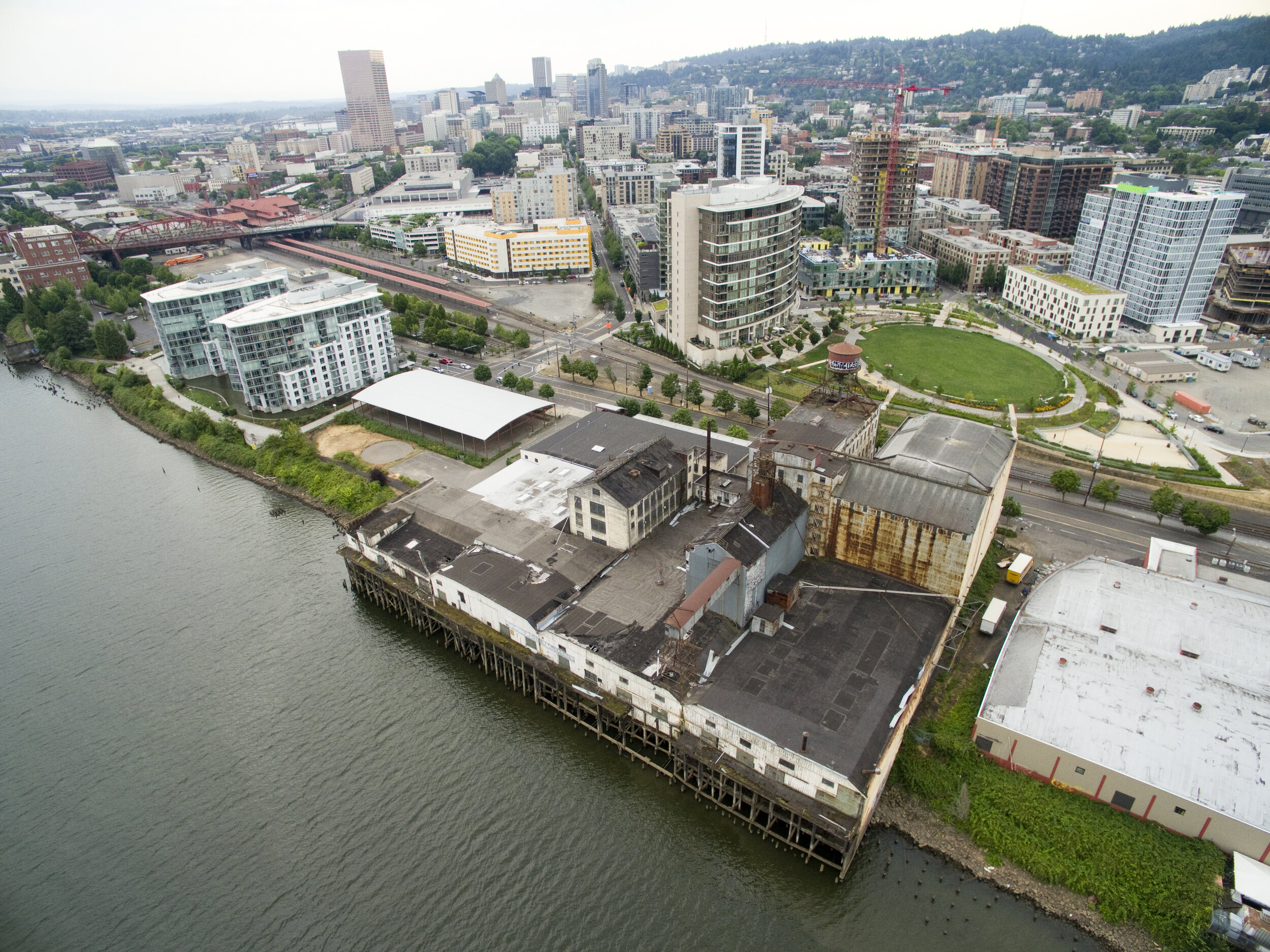
Centennial Mills in 2015
Northeast 7th Avenue Green Street Capacity Improvements
/
Portland’s Bureau of Transportation is planning a new pedestrian and bike bridge, the Congressman Earl Blumenauer Bicycle and Pedestrian Bridge, over Interstate 84 to connect the Lloyd District with the Kerns neighborhood in a rapidly changing inner NE industrial neighborhood. GreenWorks assisted in diverting stormwater from the area the bridge will be built.
Because the area around the bridgeheads was developed with impervious surfaces, GreenWorks was hired to provide green street improvements to adjacent streets Flanders, Davis, and NE 7th Ave. This work will alleviate some storm pipe capacity issues from aging infrastructure within the bridge's catchment area. In total, we did five stormwater facilities that included inclusion citing, laying out, and construction documentation.


Bush's Pasture Park Cultural Landscape Plan
/
GreenWorks lead a Cultural Landscape Management Plan for a 96-acre park with historic buildings and gardens, natural resources, ornamental gardens, and active recreation facilities.
Working closely with Salem Parks staff, a subconsultant team, and a large stakeholder group, GreenWorks identified key management concerns and developed policies and procedures for consistent management to protect contributing features of the park.
The project included three virtual open houses for public participation to contribute to the CLMP and vision plan.
The Confluence Project: Celilo Falls Site
/
There is no more significant place that shaped the early culture of the Pacific Northwest than where the Columbia once thundered at Celilo Falls. It was one of North America's largest waterfalls and was a life-sustaining salmon fishery and gathering place for Native Americans over the course of 10,000 years. As a tribute to this lost place, the last of the Confluence Project sites was designed collaboratively by Maya Lin and GreenWorks.
About the Confluence Project
The Confluence Project is a series of seven public art installations at significant points along the Columbia River system. The project stretches 438 miles from the mouth of the Columbia River in the west to the gateway to Hell's Canyon in the east, with sites in both Oregon and Washington. Each references a passage from the Lewis and Clark journals, while comparing it with the deeper story of the local Native American Tribes that inhabited this region. Envisioning the river and its tributaries not just as singular points along the way but as a connected and integrated ecological system, it encompasses work in over 15,000 acres of state and federal land that is now being restored as an integral part of the project.
Collaborating with the artist Maya Lin, GreenWorks has provided landscape architectural services for the Confluence Project for the landmark development of six sites since 2001. GreenWorks led project teams for schematic design, design development, permitting, construction documentation, cost estimating and construction administration of the multiple sites. GreenWorks provided coordination with multiple federal, state, and local agencies and with the many of the tribes of this region, including the Chinook, Umatilla, and the Nez Perce tribes. Strong interpretive and education elements tell the story of Lewis and Clark, and also preserve the history and celebrate the cultural significance of the native tribes.
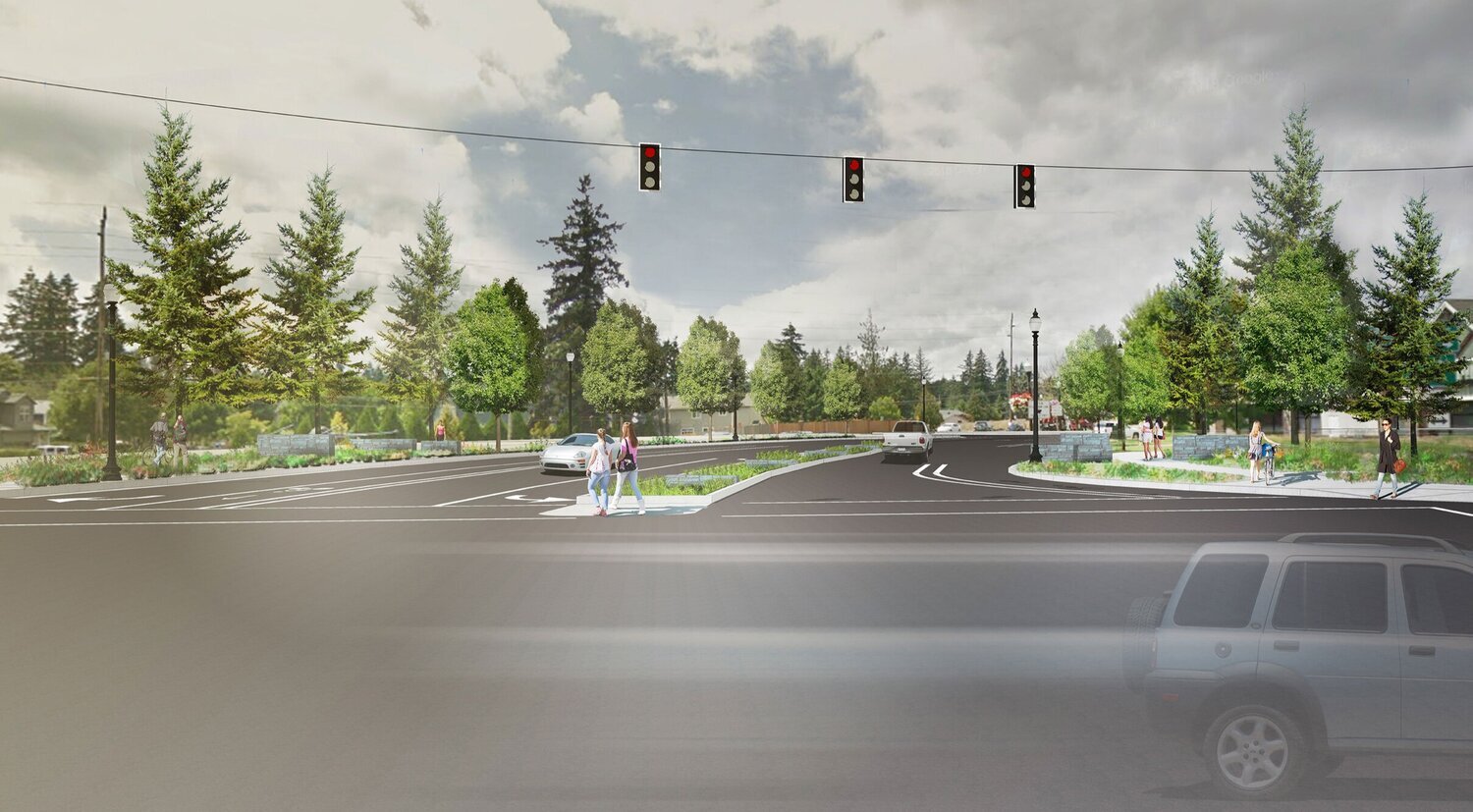
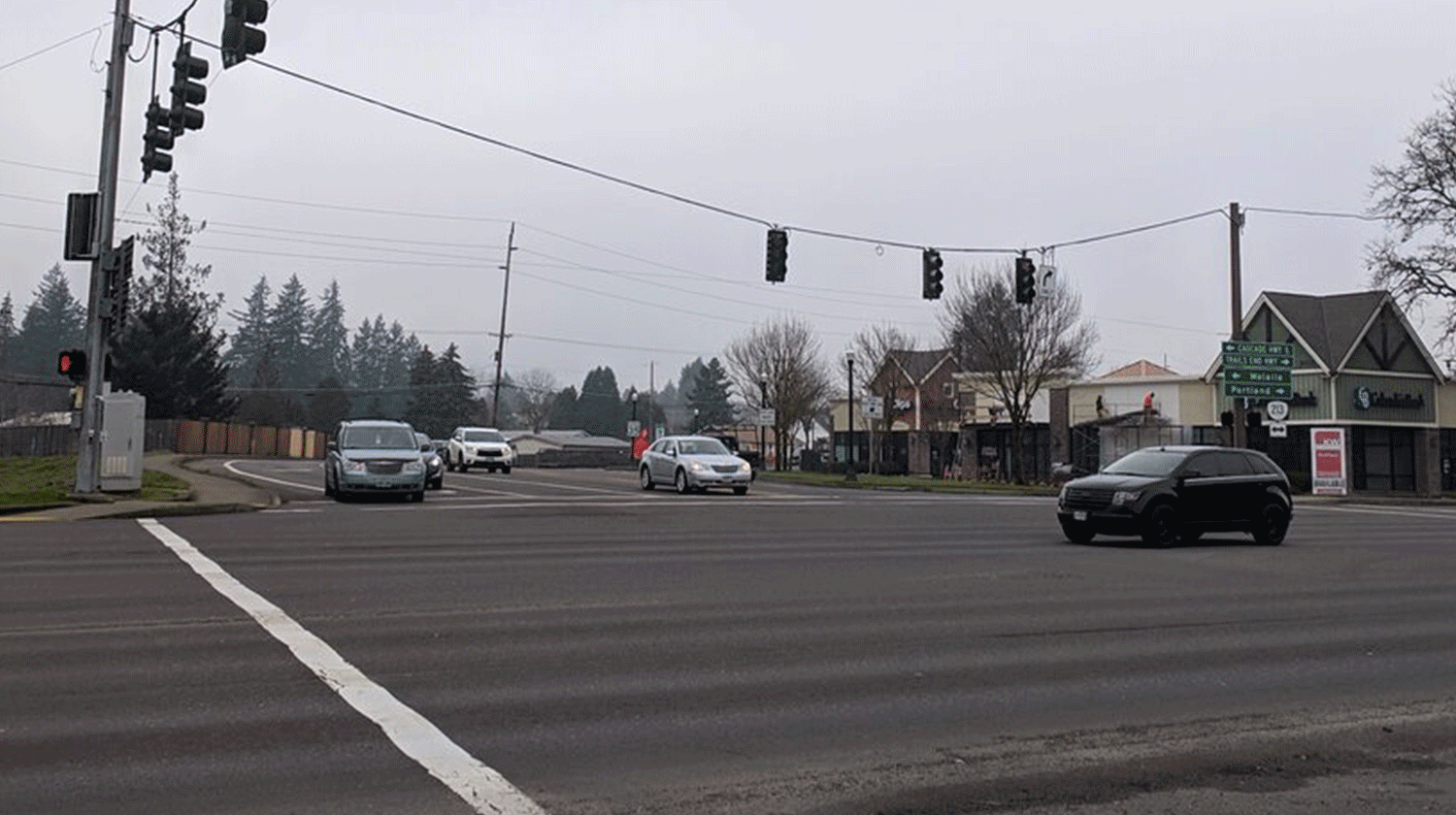
St. Helens Street and South 1st Street Intersection Improvements
/

GreenWorks partnered with Kittelson & Associates, Inc. to create an intersection design that could be a model for future improvements City-wide. A Kittleson-led traffic study in the spring of 2019 found low traffic volumes with minimal congestion that did not warrant an all-way stop but did find concerns for pedestrian safety and vehicle sight distance. Improvements the team designed included enhanced pedestrian safety, improved vehicle sight distance, bicycle transportation facilities, and easy access to nearby businesses with parking.
Designing Livable Streets and Trails Guide
/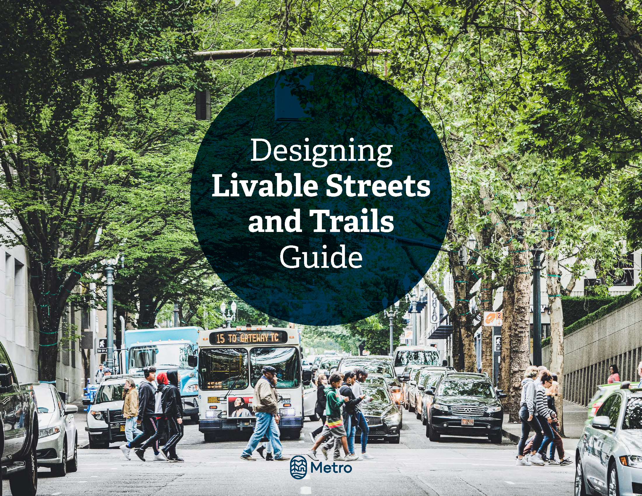
Photo courtesy of Metro
On October 24th, 2019, Metro, our Portland metropolitan area regional government, released an updated version of their “Designing Livable Streets and Trails Guide.” GreenWorks was part of the team that contributed updates to it.
“Metro’s Designing Livable Streets and Trails Guide provides design guidance for our regional streets and trails. The guidelines were developed to help implement the 2040 Growth Concept and the Regional Transportation Plan.”
— Metro
It’s a set of design guidelines that require transportation infrastructure to be designed to serve the people and environments they’re built in, not just the vehicles that use it. The updates refresh the well-known guide and provide some important updates, prioritizing livability, safety, and reducing our greenhouse gas emissions.
We’re particularly proud of our work because Metro will be requesting money from voters through a transportation bond this November that will use these guidelines if funded.
Metro hired Kittelson & Associates to partner with GreenWorks, sparks+sullivan, and KLik Concepts to develop graphics, write new guidance for innovative stormwater infrastructure, and update information about integrating trails. That means our input may have a big impact on our region’s future.
“The guide acknowledges the negative impacts transportation can have on water,” said Lake McTighe, senior transportation planner at Metro. “It highlights how important green streets can be to solving this.”
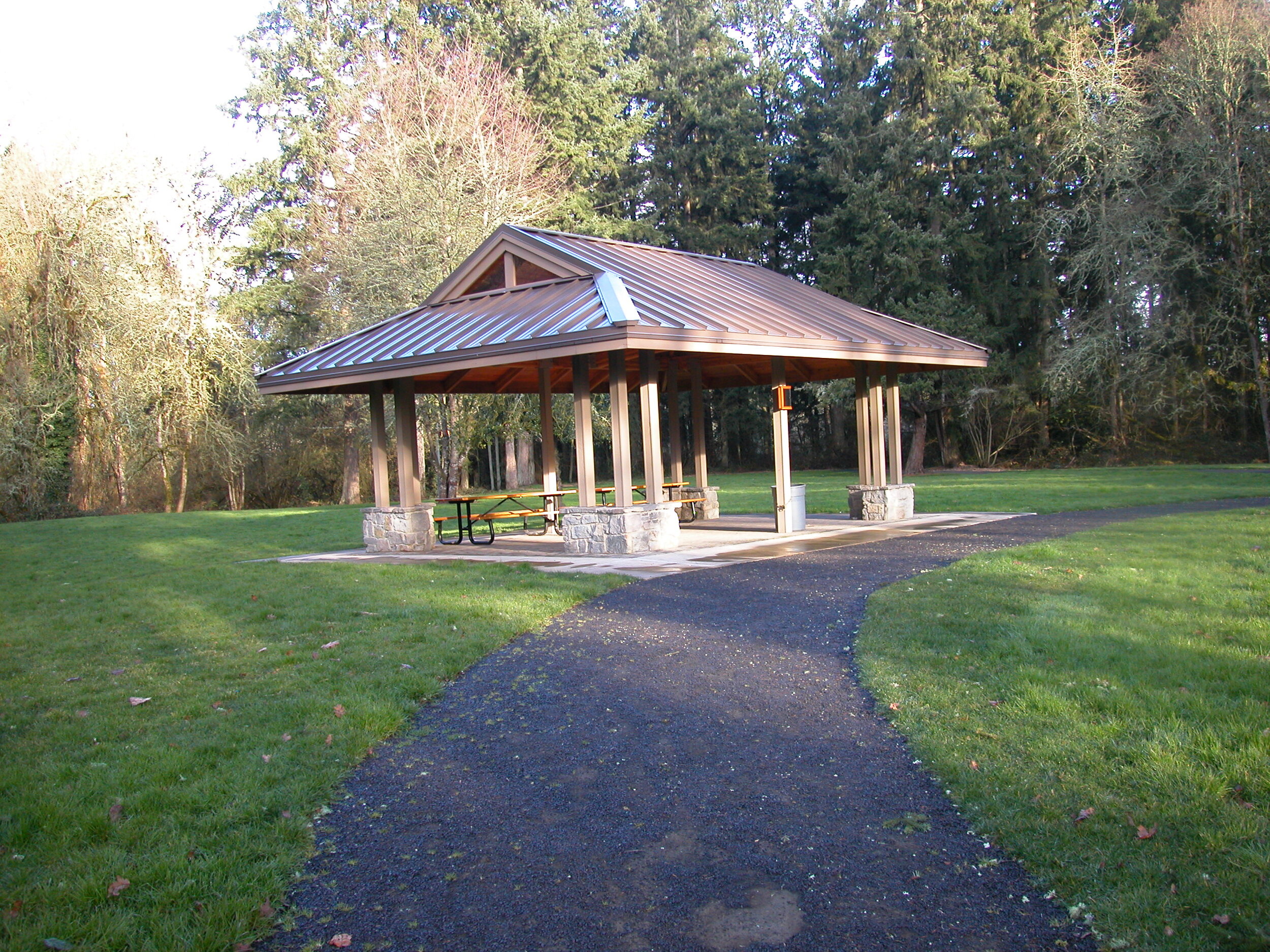
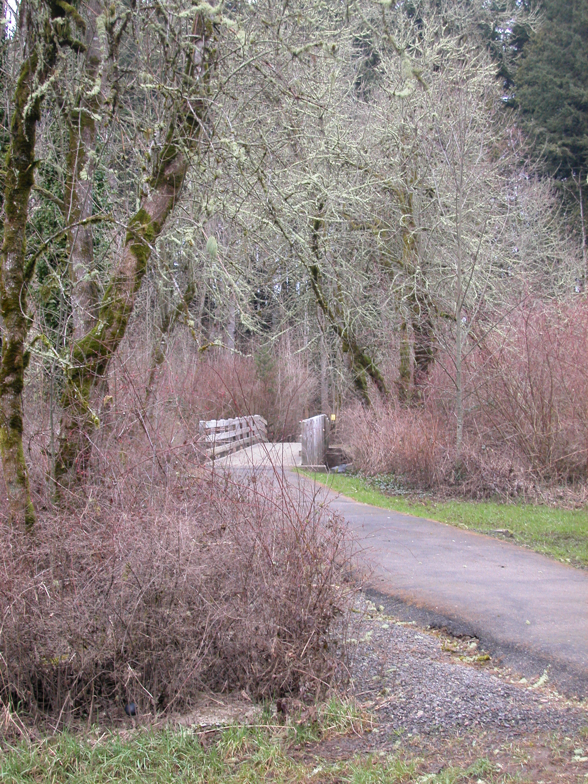
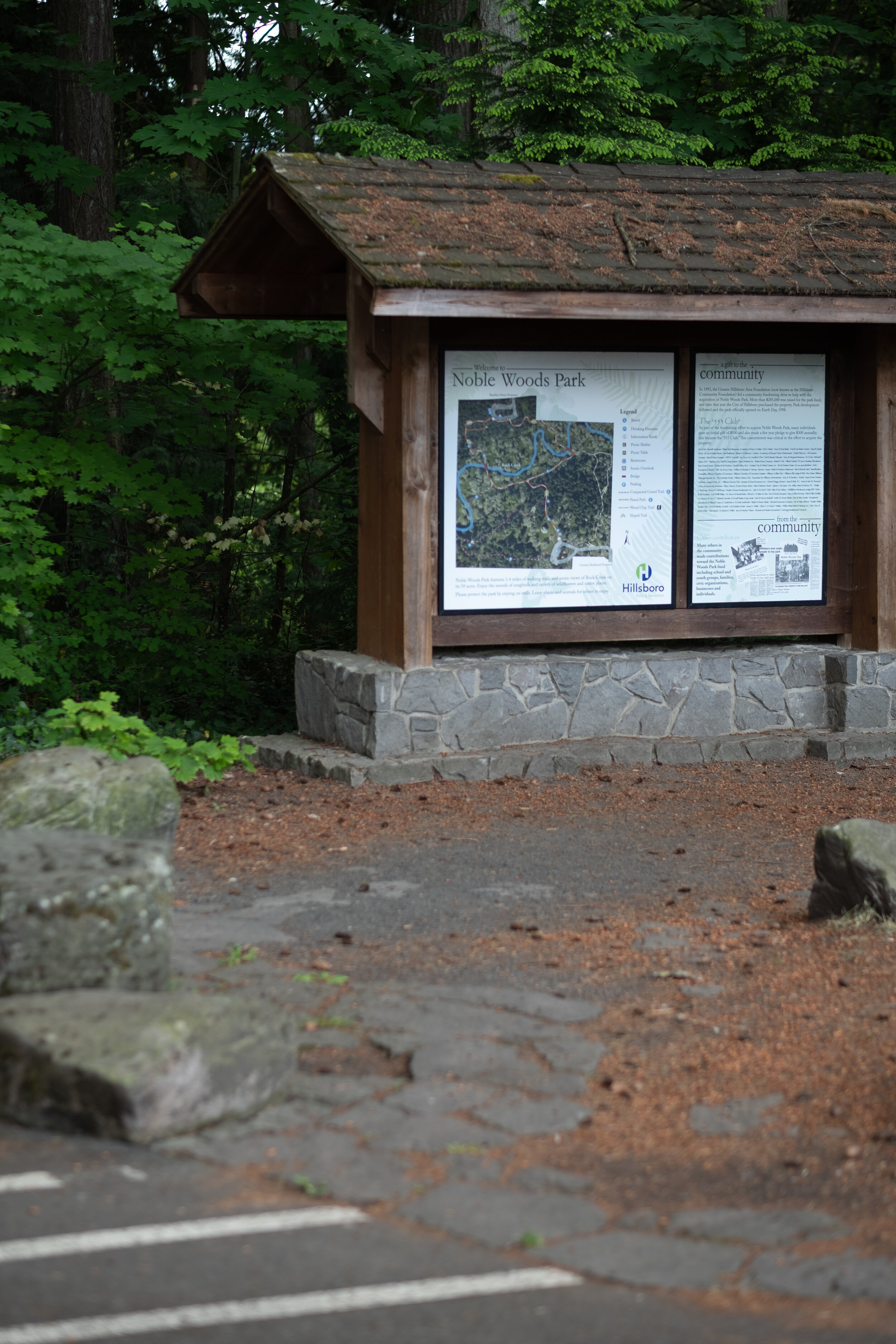
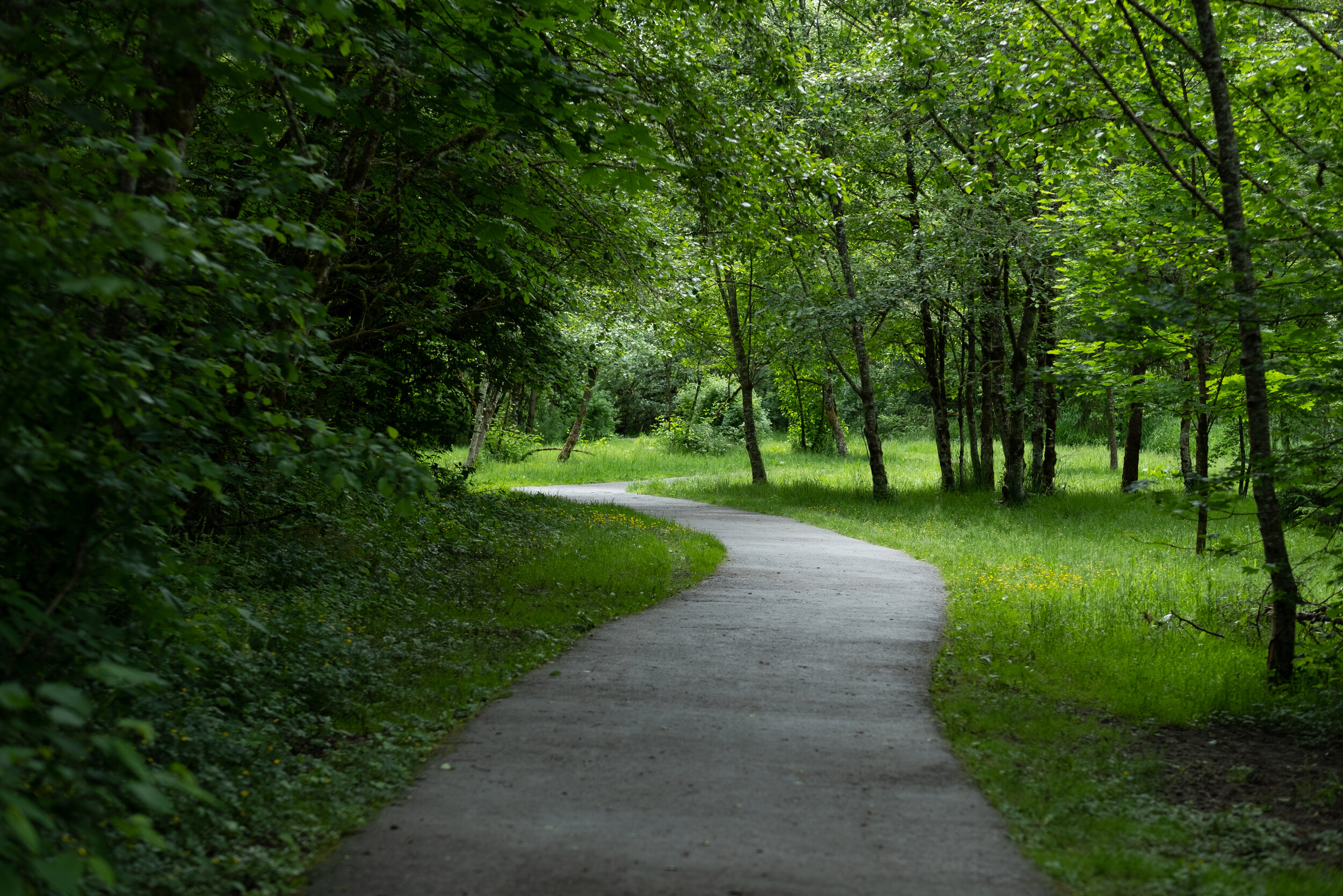
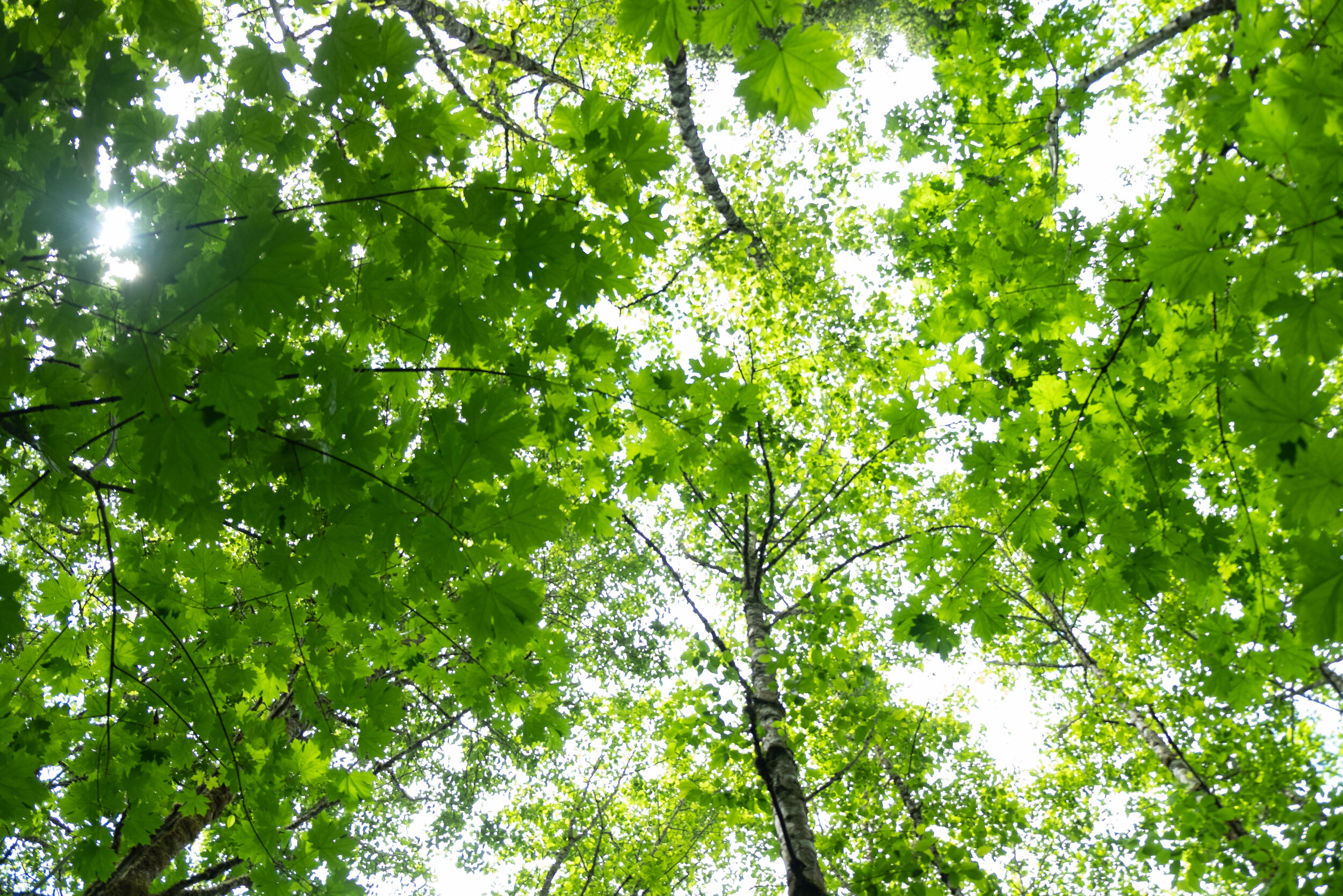
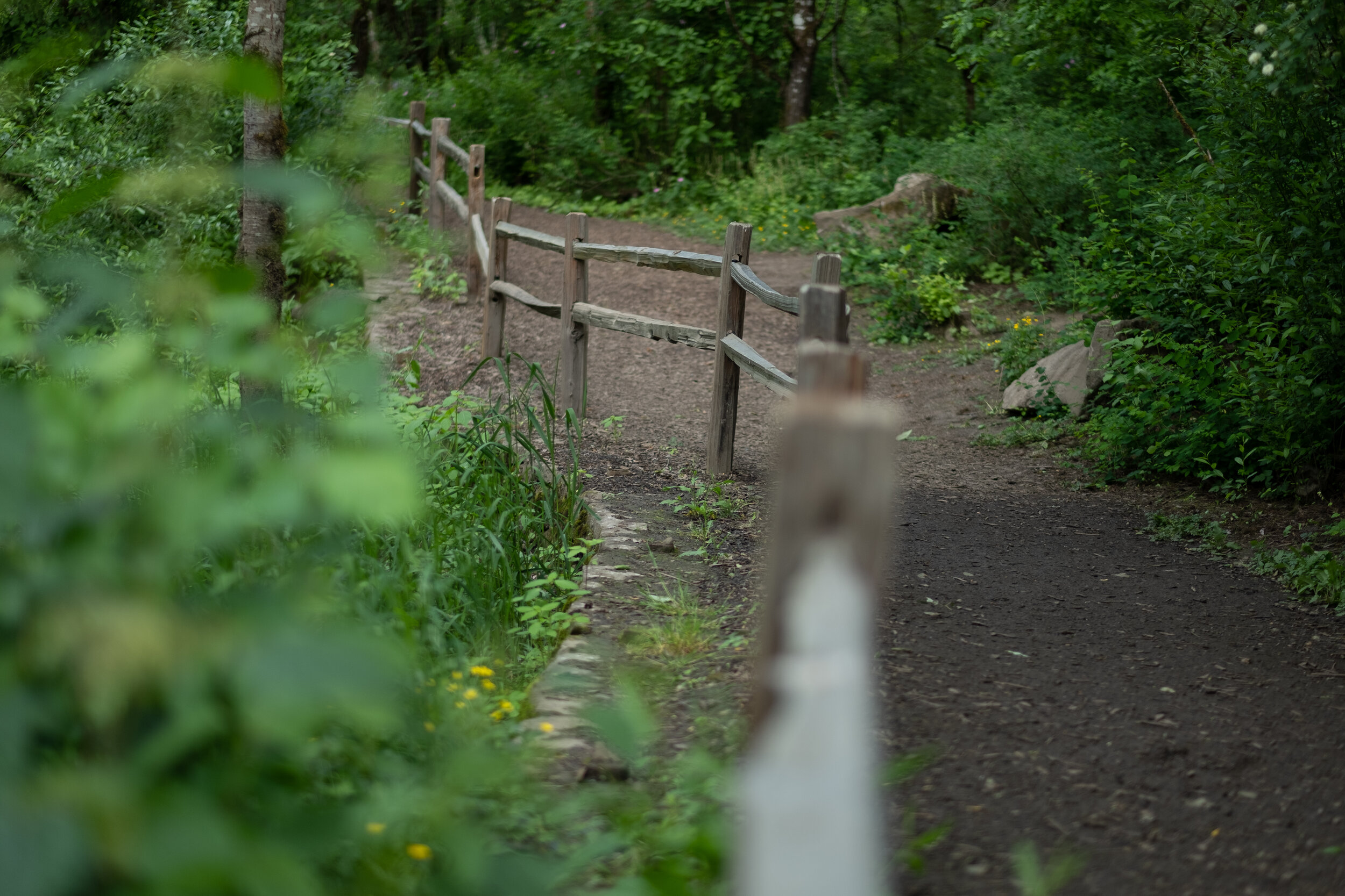
Noble Woods Park
/
GreenWorks completed concept design, permit acquisition, construction documents, bid phase assistance and other services during construction at Noble Woods Park. We helped the City of Hillsboro create a park with recreational trails, a scenic overlook, trailhead parking and access roads, boardwalks, stream crossings, and riparian corridor enhancement. GreenWorks obtained permits from the Oregon Division of State Lands for riparian corridor improvements, and worked with city staff coordinating volunteer activity.
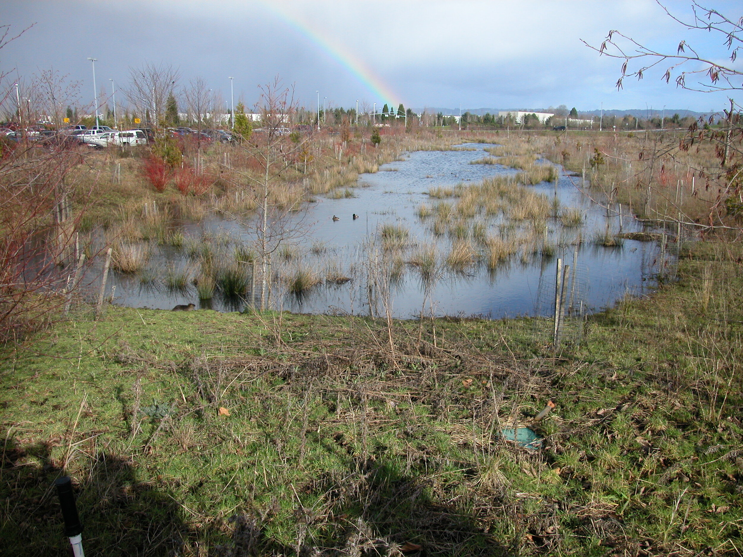
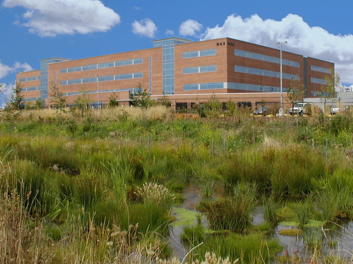
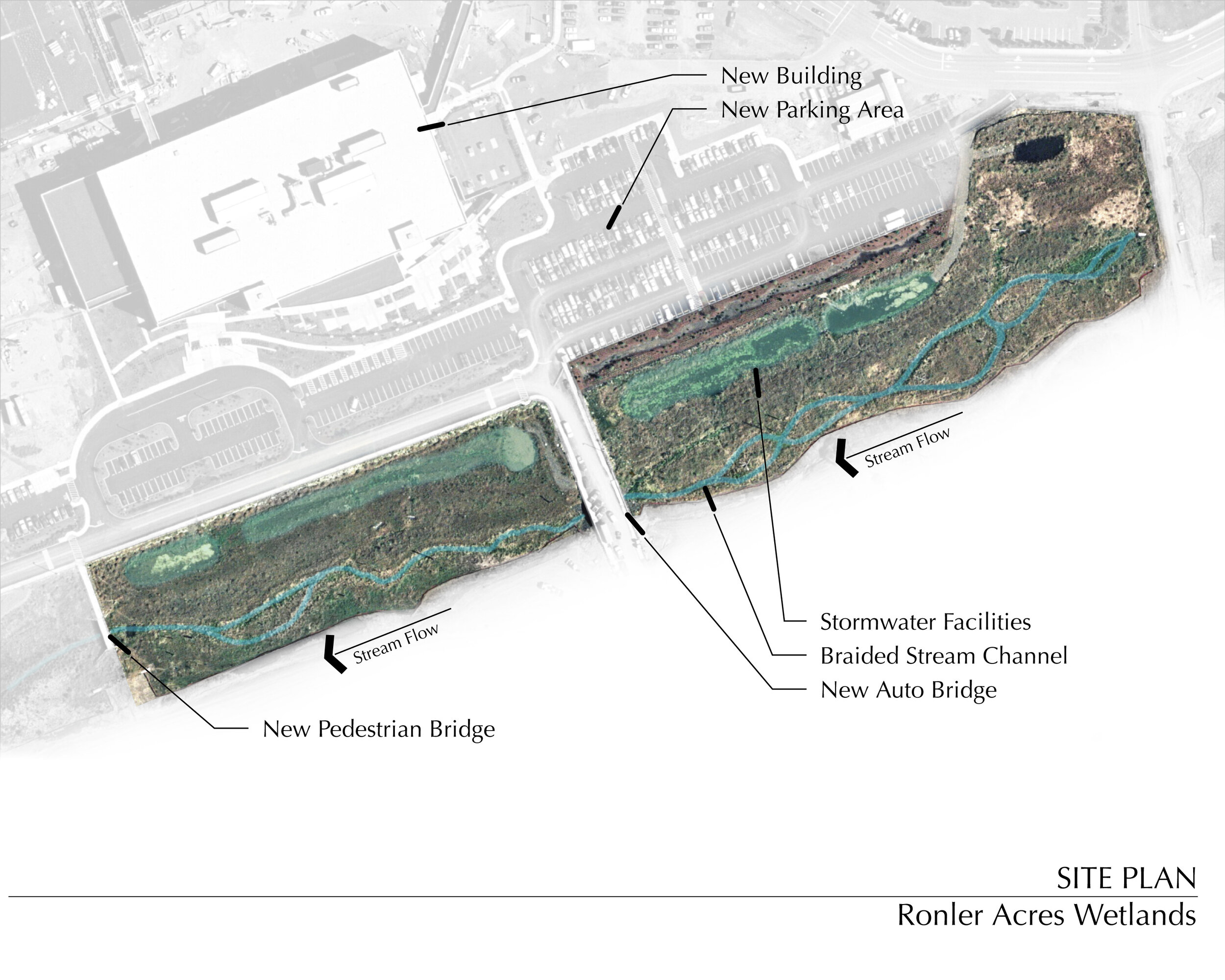
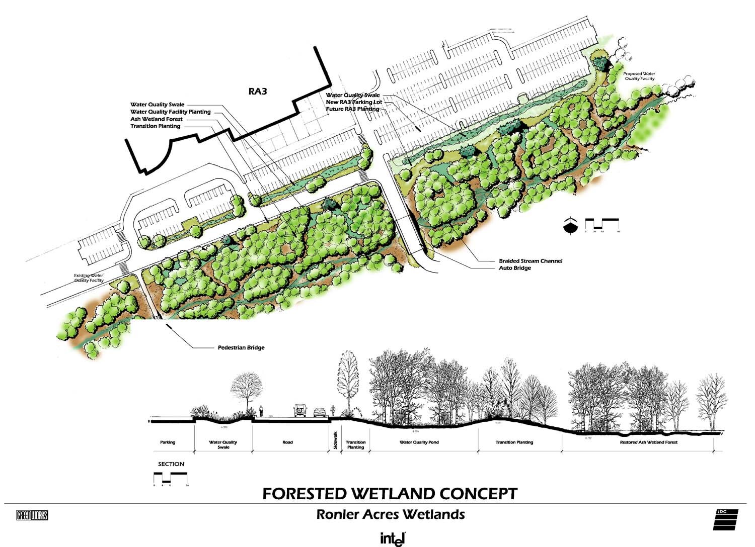
Intel Ronler Acres
/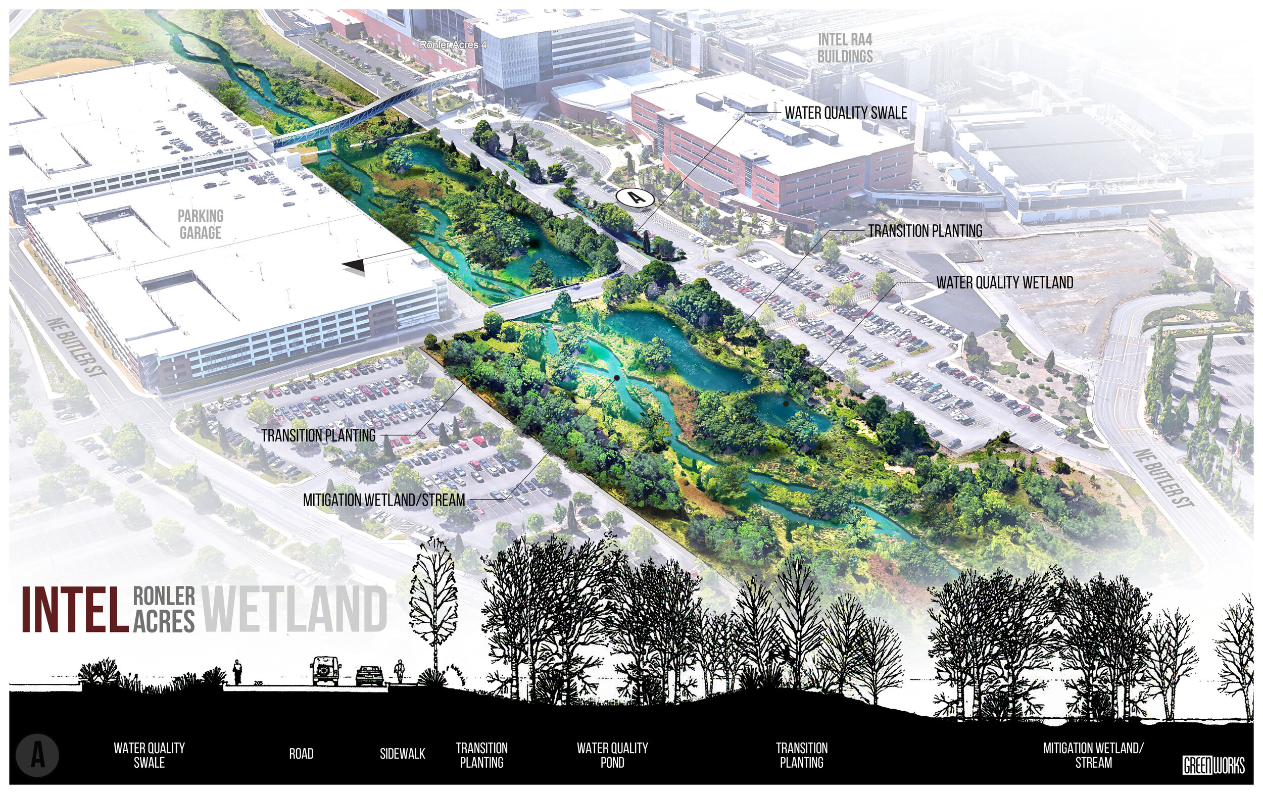
The Industrial facility expansion at the Ronler Acres Campus required an existing stream to be destroyed. GreenWorks collaborated with a team of planners, engineers, biologists, and hydrologists to design a new path for the stream, creating and restoring a natural Ash Forest wetland to meet state and federal permit requirements.
The project also required the design of stormwater treatment facilities between the developed portion of the site and the newly created Ash Forest wetland area. GreenWorks developed a site concept plan that incorporated the wetland area and stormwater facilities into the overall campus layout and provided conceptual design information for a pedestrian bridge crossing of the new wetland area. GreenWorks also provided construction documents and construction observation for the improvements.
Molalla Avenue
/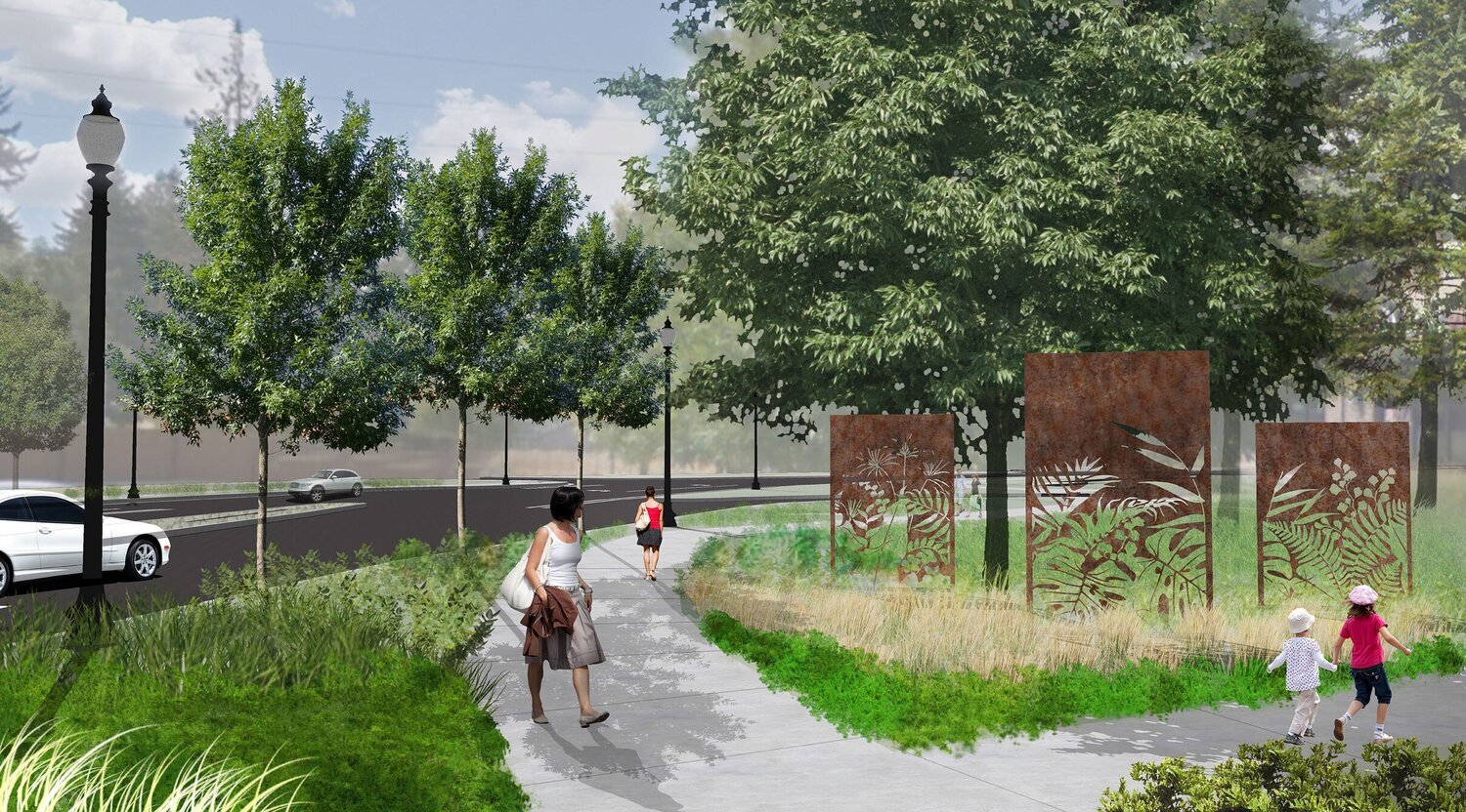
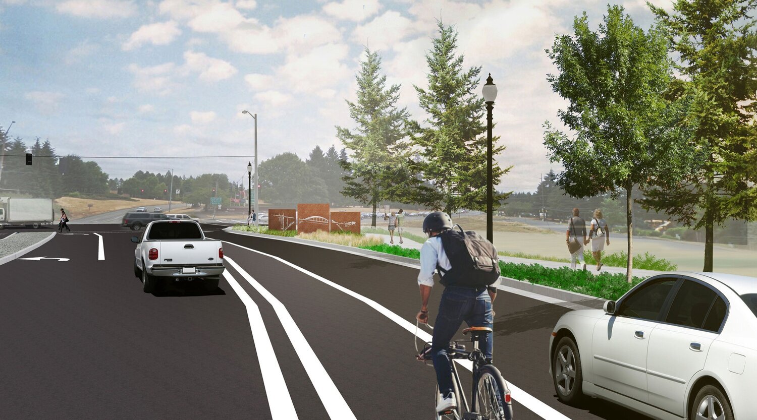
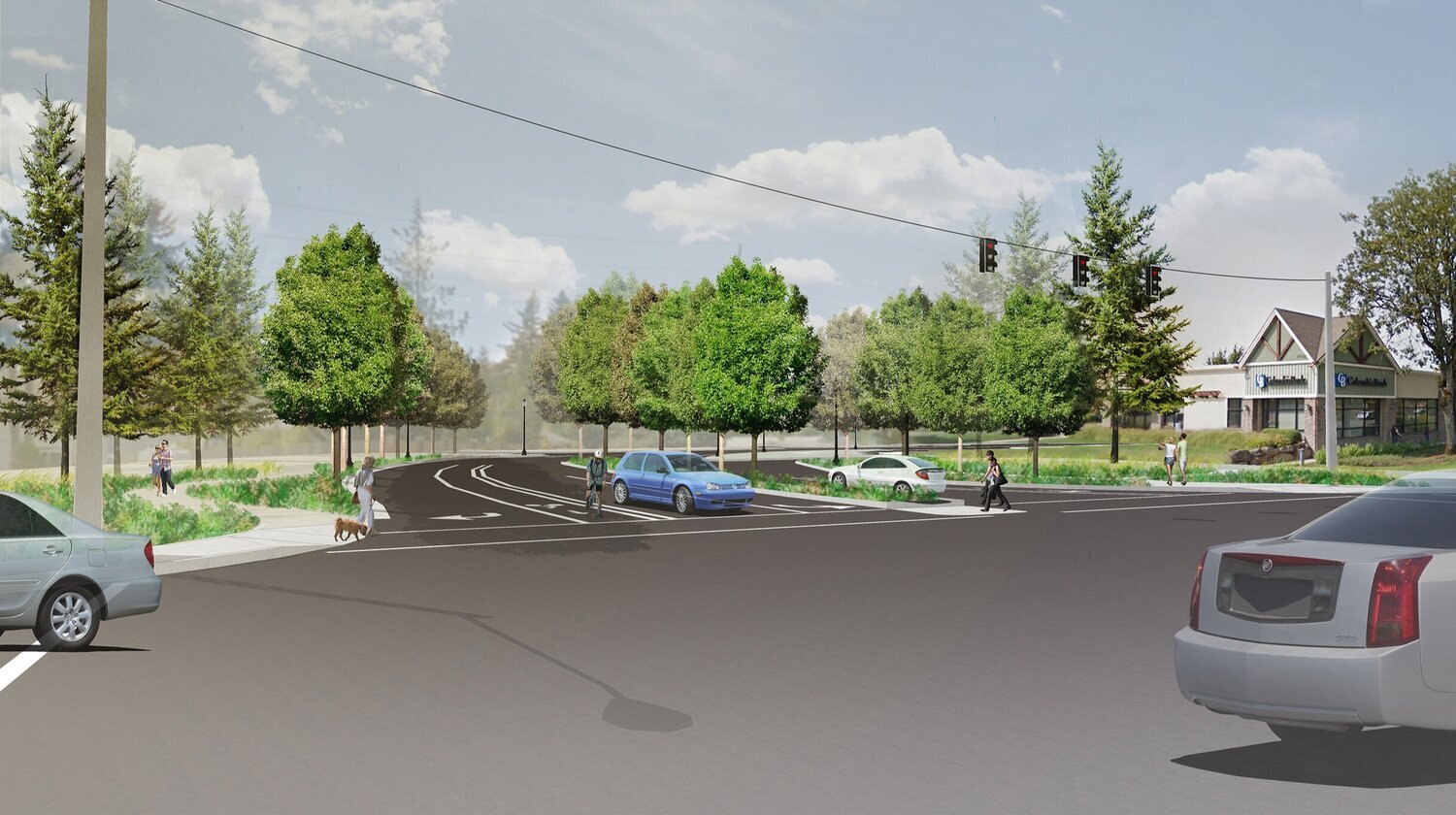
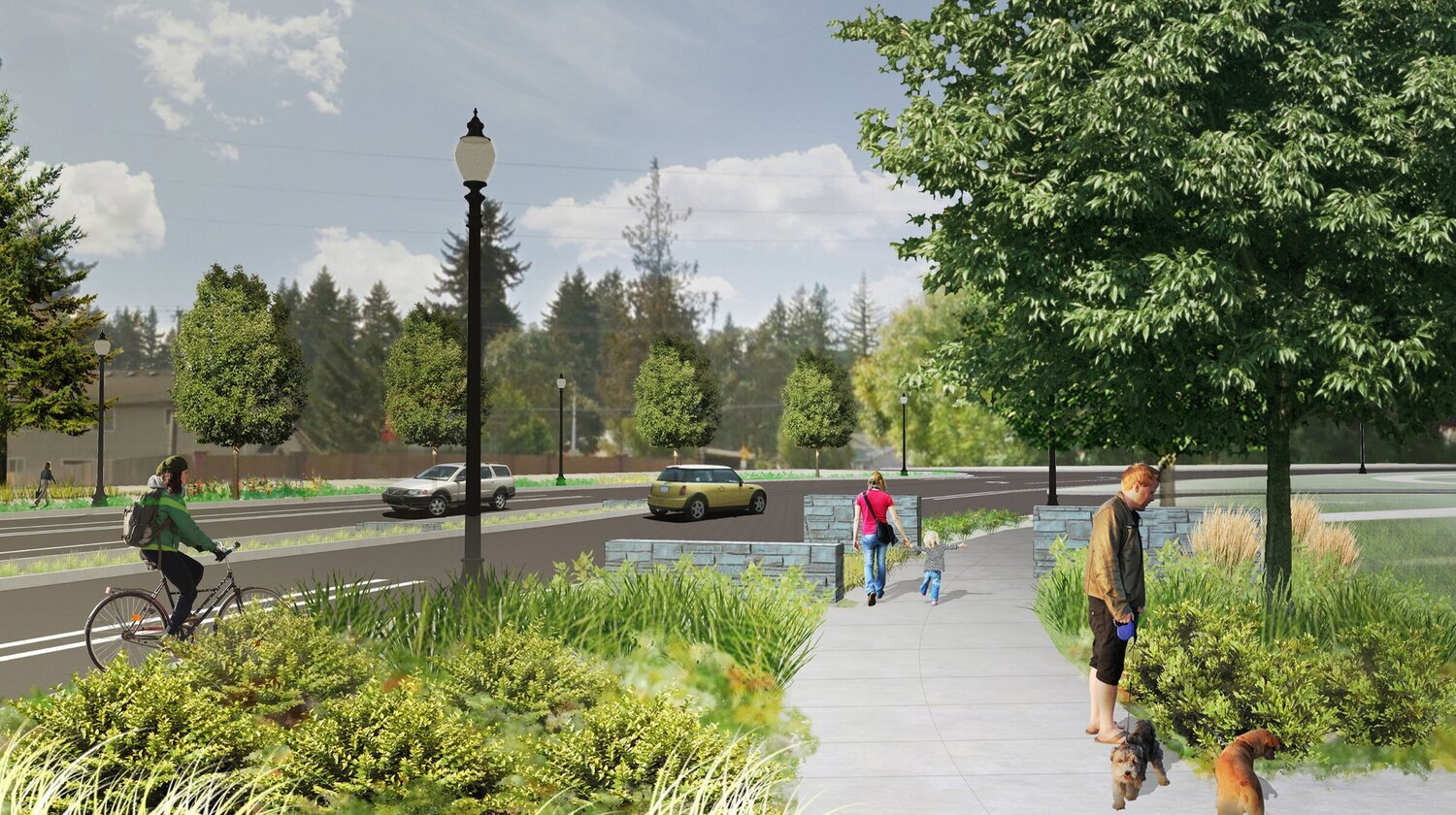
Greenworks is working with a consultant team led by OBEC to create a ‘complete street’ and upgrade a key corridor from one only designed for cars, to a safe and comfortable way for cycling, walking, and public transit along Molalla Avenue.
The existing route is an important pathway for all types of travel connecting the Oregon City Downtown and Regional Center with Clackamas Community College and Clackamas County Red Soils Business Park Campus, as well as the residential areas on the west side, and the commercial areas on the north and east side of Molalla Ave.
This project also includes the development of a welcome/gateway feature at the SE end of Molalla Avenue to introduce visitors to the district.
Fanno Creek Restoration and Recreation Enhancements
/
GreenWorks has been providing landscape architectural services on Tigard’s Fanno Creek watershed since 2002, when a team including GreenWorks was hired by the City of Tigard to site the city’s new library and community center—an area bordered by a virtually untouched segment of Fanno Creek.
Since then, GreenWorks has worked on the Fanno Creek Remeander, where a multidisciplinary design team devised an approach to restore a segment of Fanno Creek to its natural, meandering alignment to improve hydrologic function of the creek and the adjacent floodplain. GreenWorks’ focus included the design of Fanno Creek Trail, which now mimics the new creek alignment, drawing pedestrians and bikers further into the park to experience the natural environment. During the project, GreenWorks participated in Camas Days at Dirksen Nature Park, where visitors could vote on priorities for potential projects and amenities along the Fanno Creek Trail including additional parking, enhanced trailheads, public art, interpretation, overlooks, and more. The design team created a map of the entire trail in Tigard and highlighted potential projects and amenities to help people visualize and provide input on what they felt would enhance their experience on the trail.
GreenWorks also provided services through a Local Agency Liaison contract with ODOT on four segments of the Fanno Creek Trail. The alignment passes through natural areas and triggered wetland mitigation as well as vegetated corridor mitigation through CWS. The evaluation of trail alignments included criteria such as cost, environmental impact, and user experience. Trail design included about 1.7 miles of new shared-use path to be designed and constructed in accordance with regional, state and national standards. To aid with public outreach, GreenWorks created illustrative graphics covering four new segments of trail along the Fanno Creek Trail and participated in a public open house at Tigard Library.
