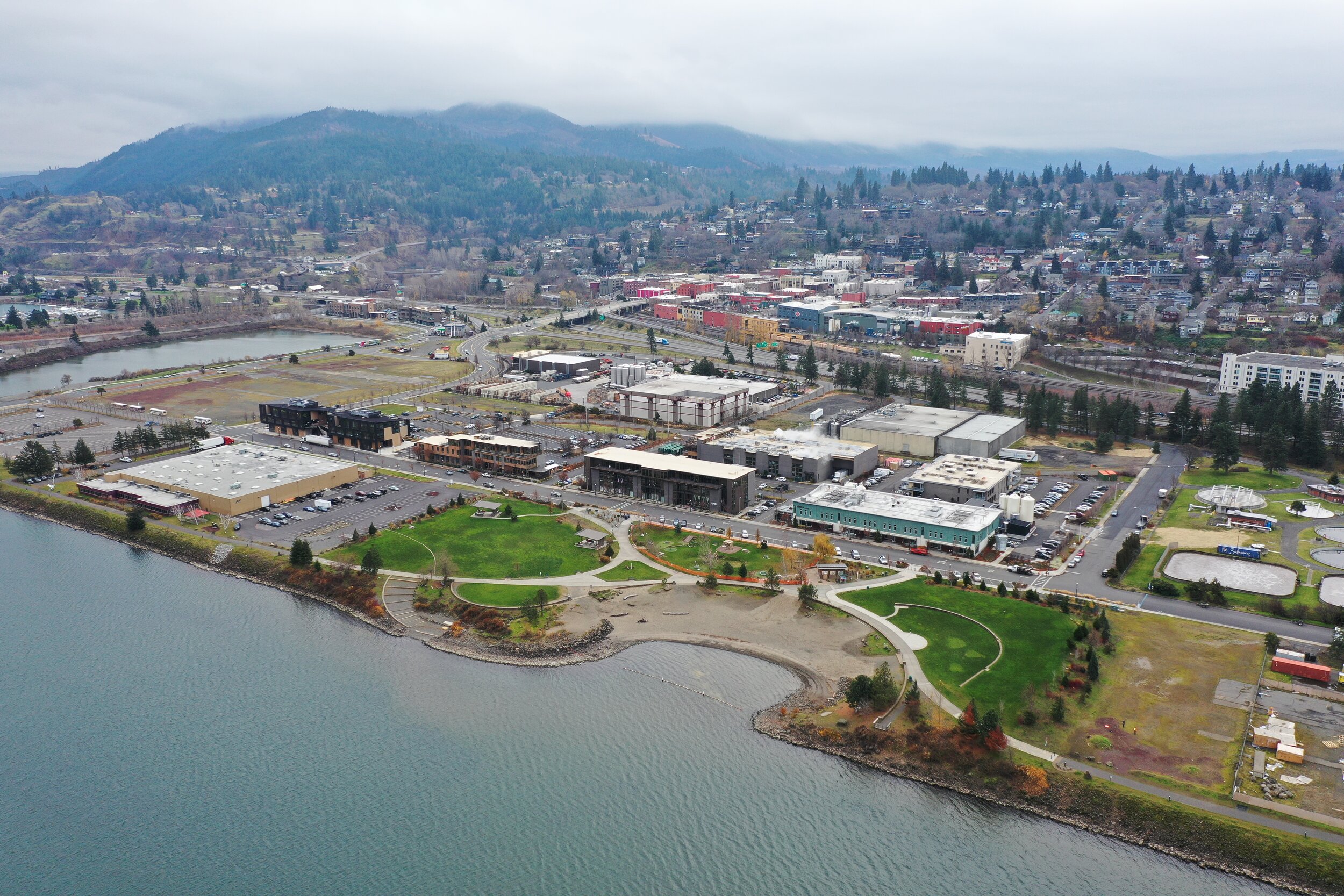
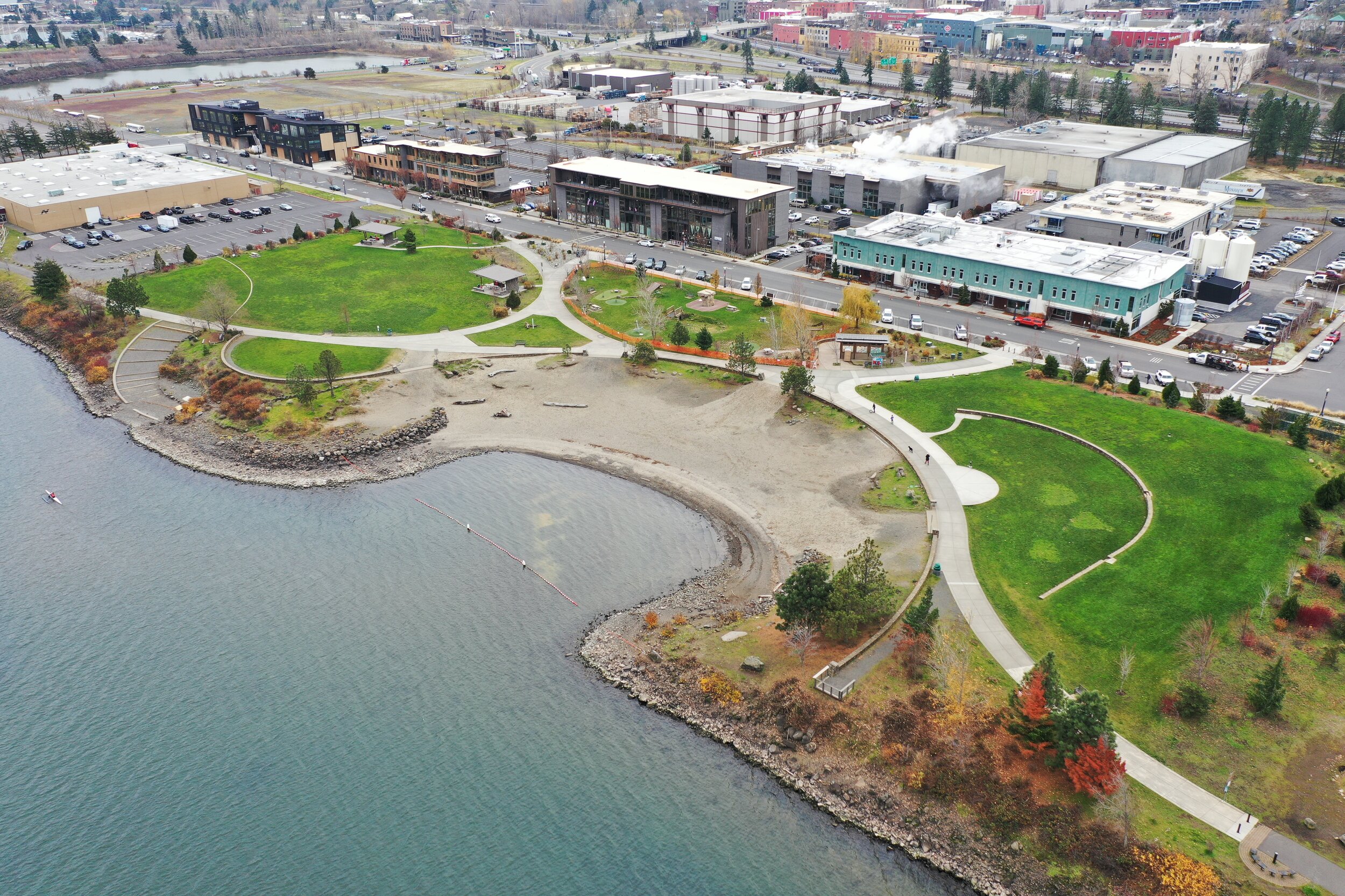
Battle Creek Wetland Park

Battle_Creek_Park_Visualization_Birdseye_west facing.jpg

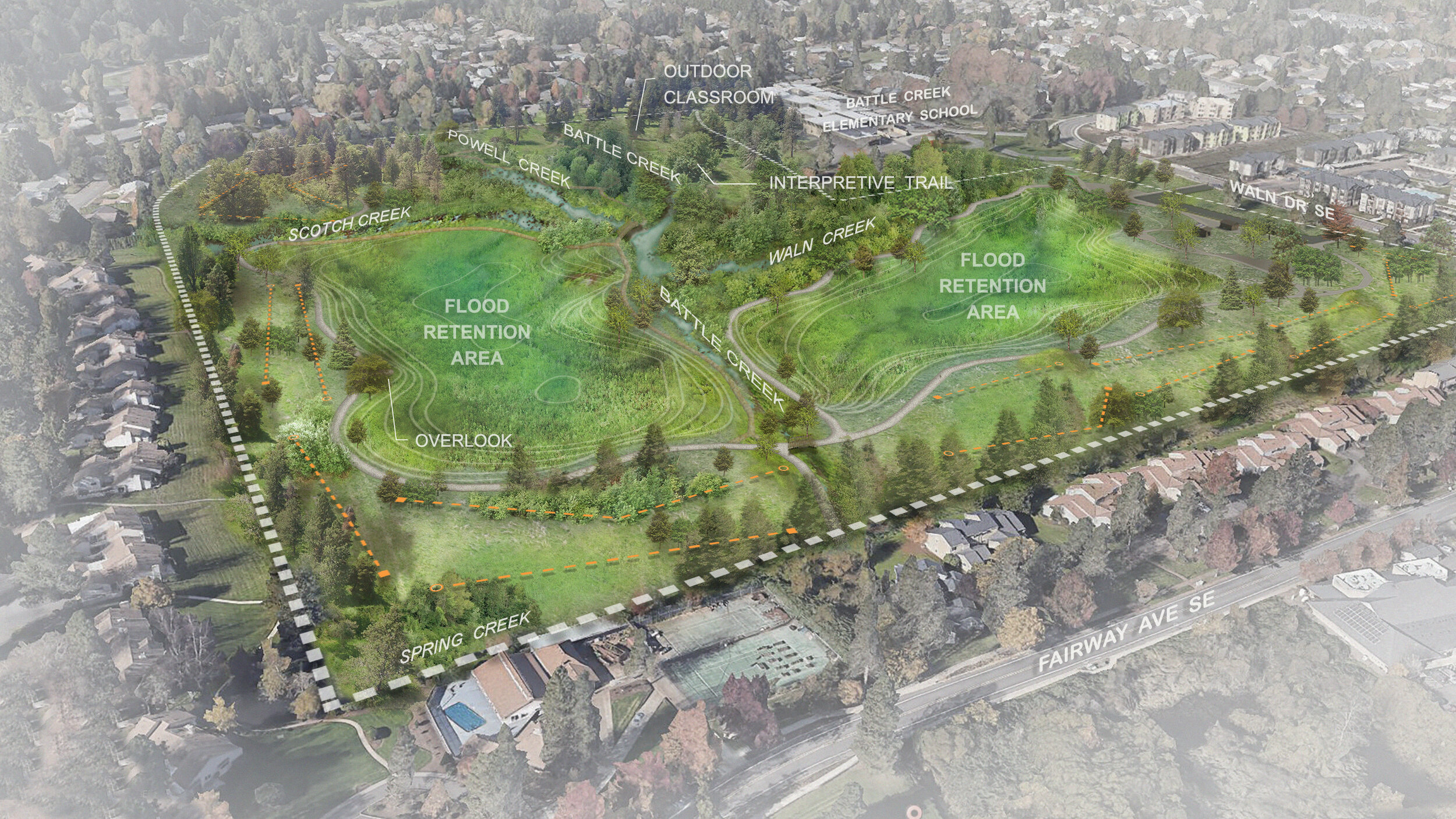
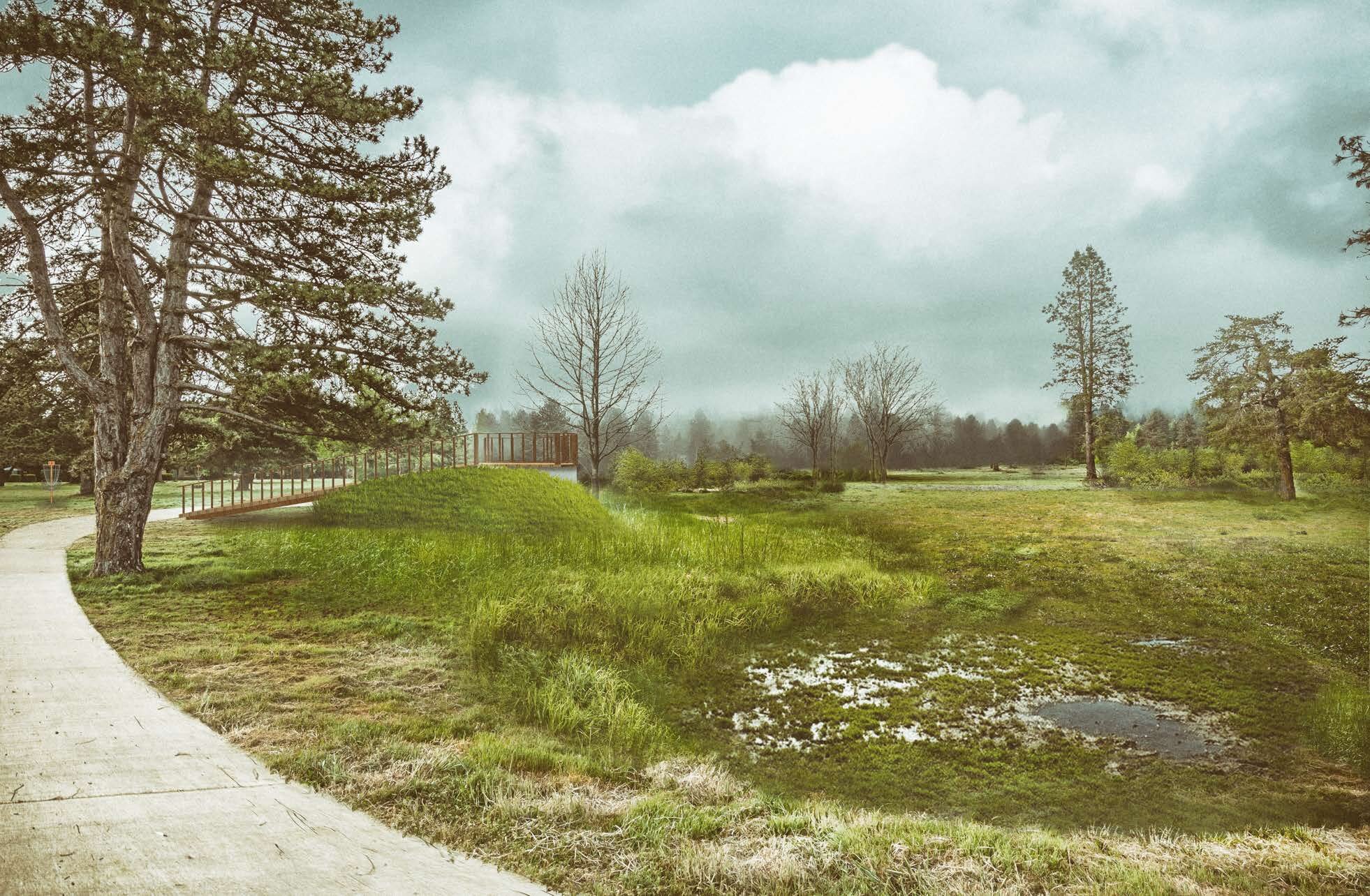
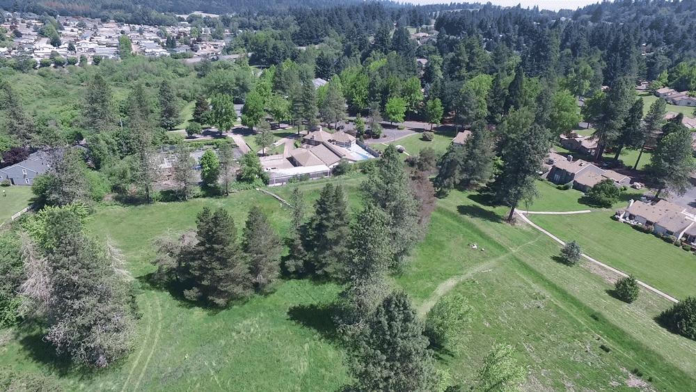
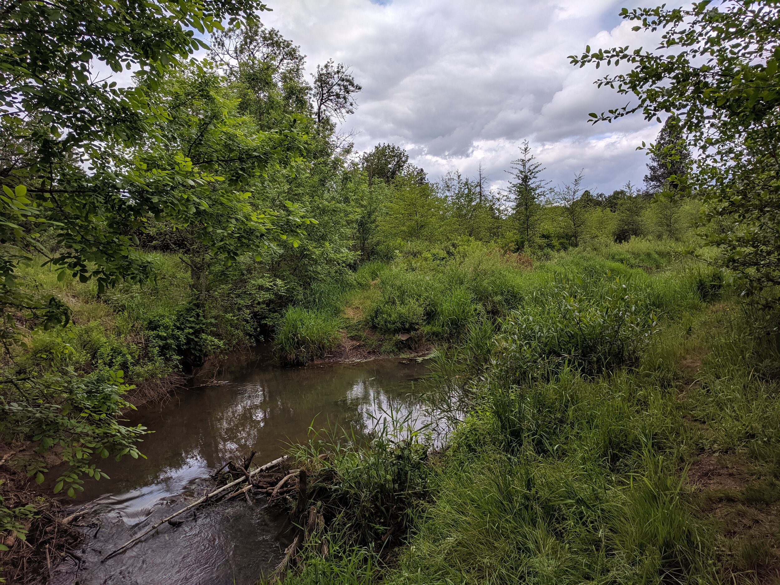
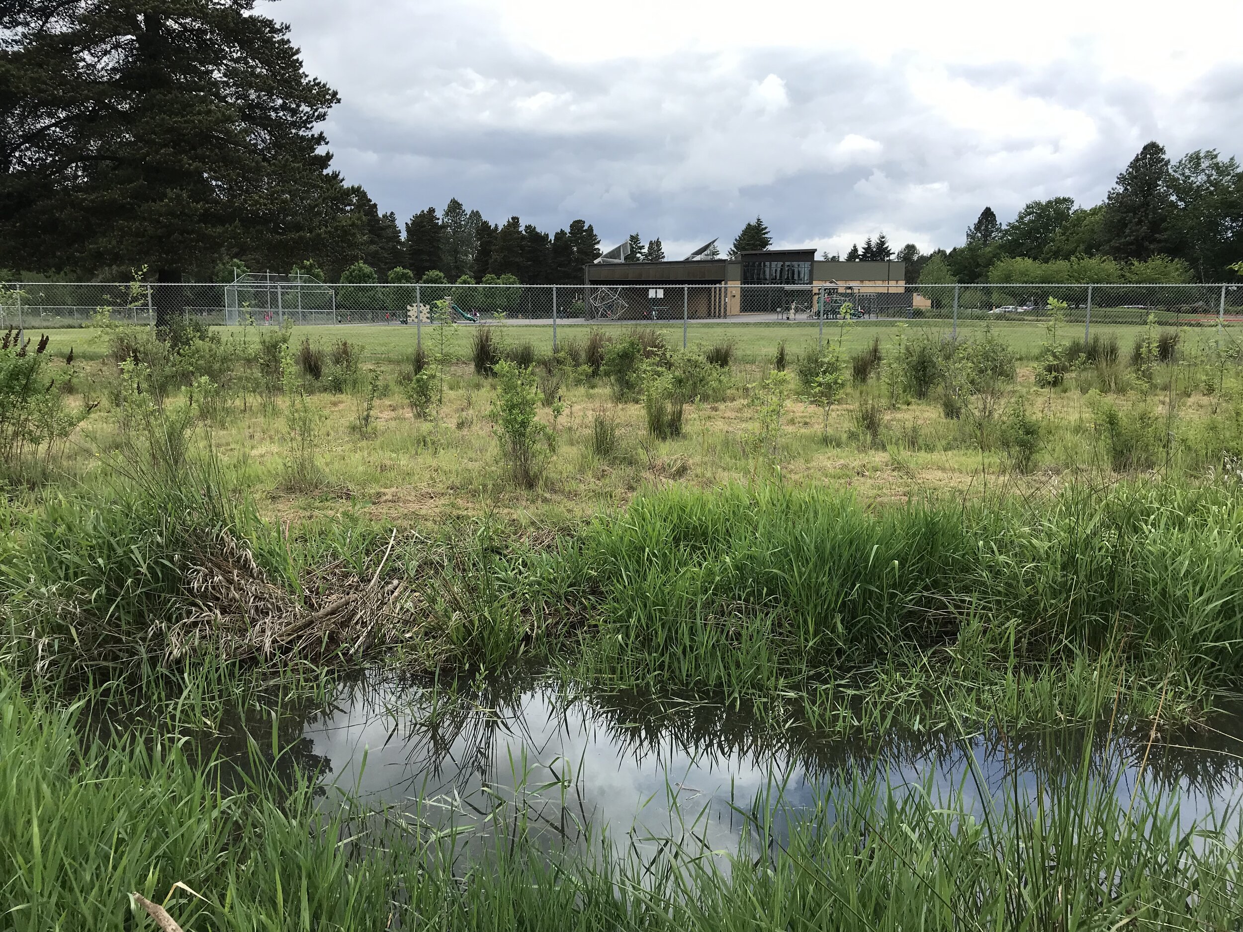
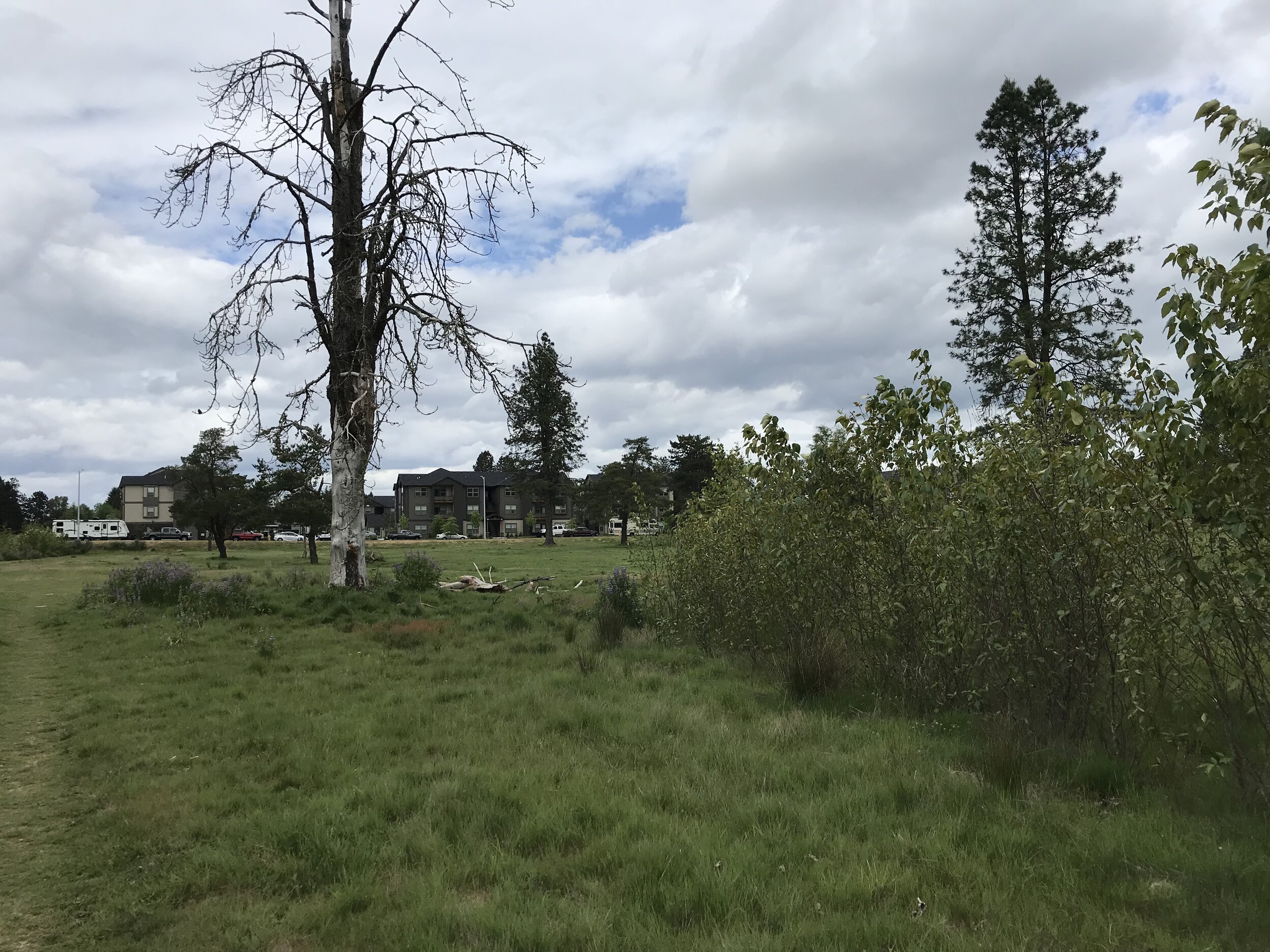
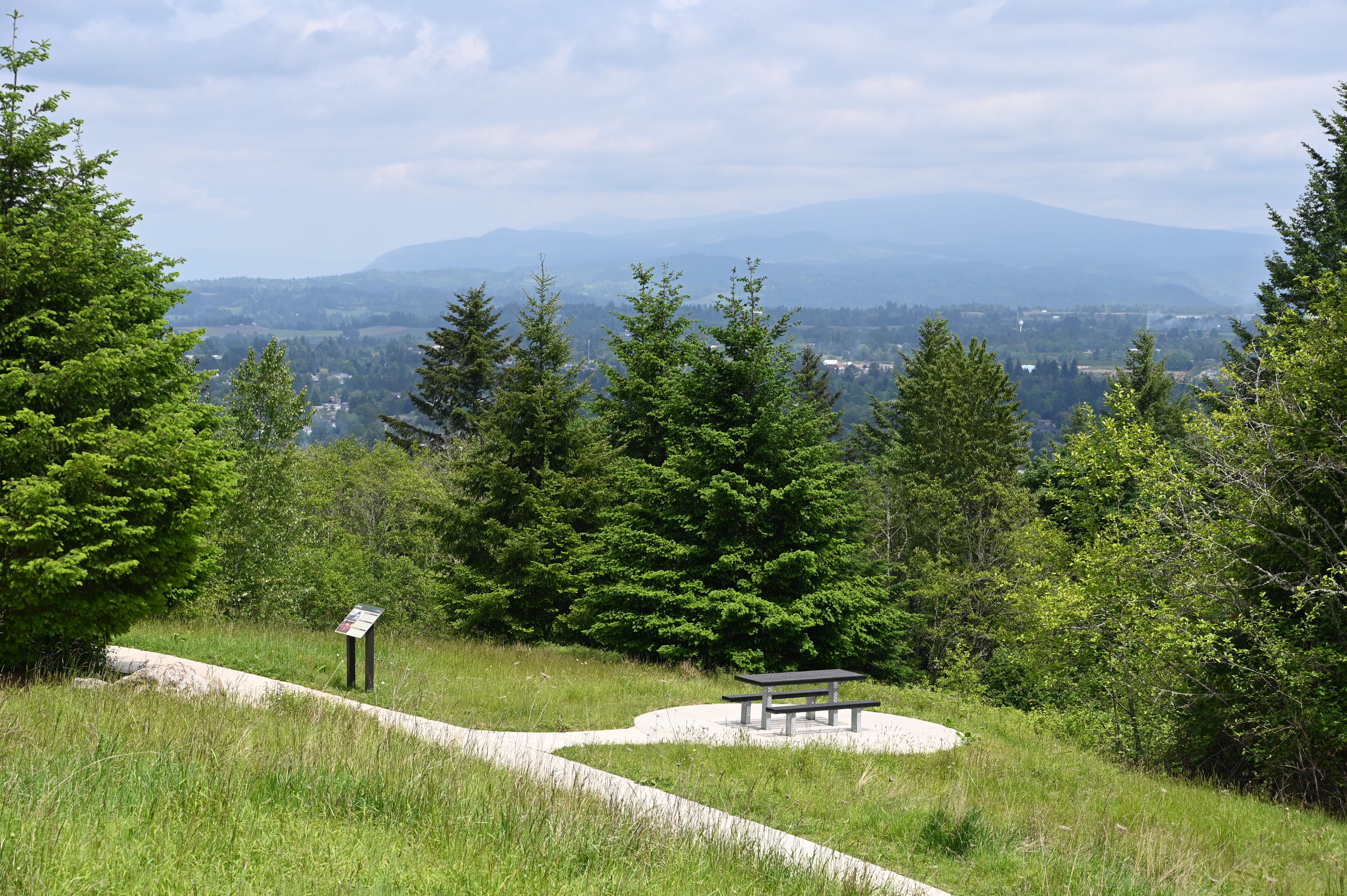
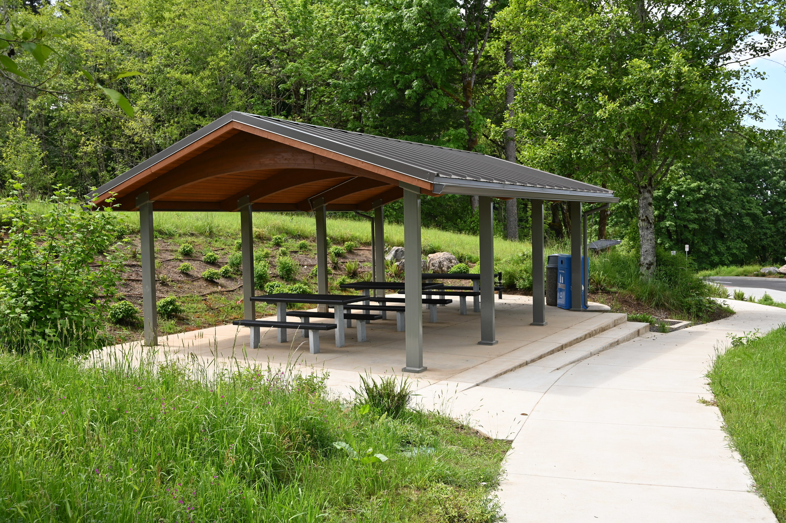
GreenWorks is currently working with the City of Salem, preparing a master plan for Battle Creek Park, a large 56-acre undeveloped park property in South Salem.  The site, a former golf course, is currently undeveloped, with creeks, wetlands, trees and open space. Urban growth in South Salem has created flooding issues in the adjacent neighborhoods and downstream from the park, thus the property was purchased for both park and flood mitigation functions.

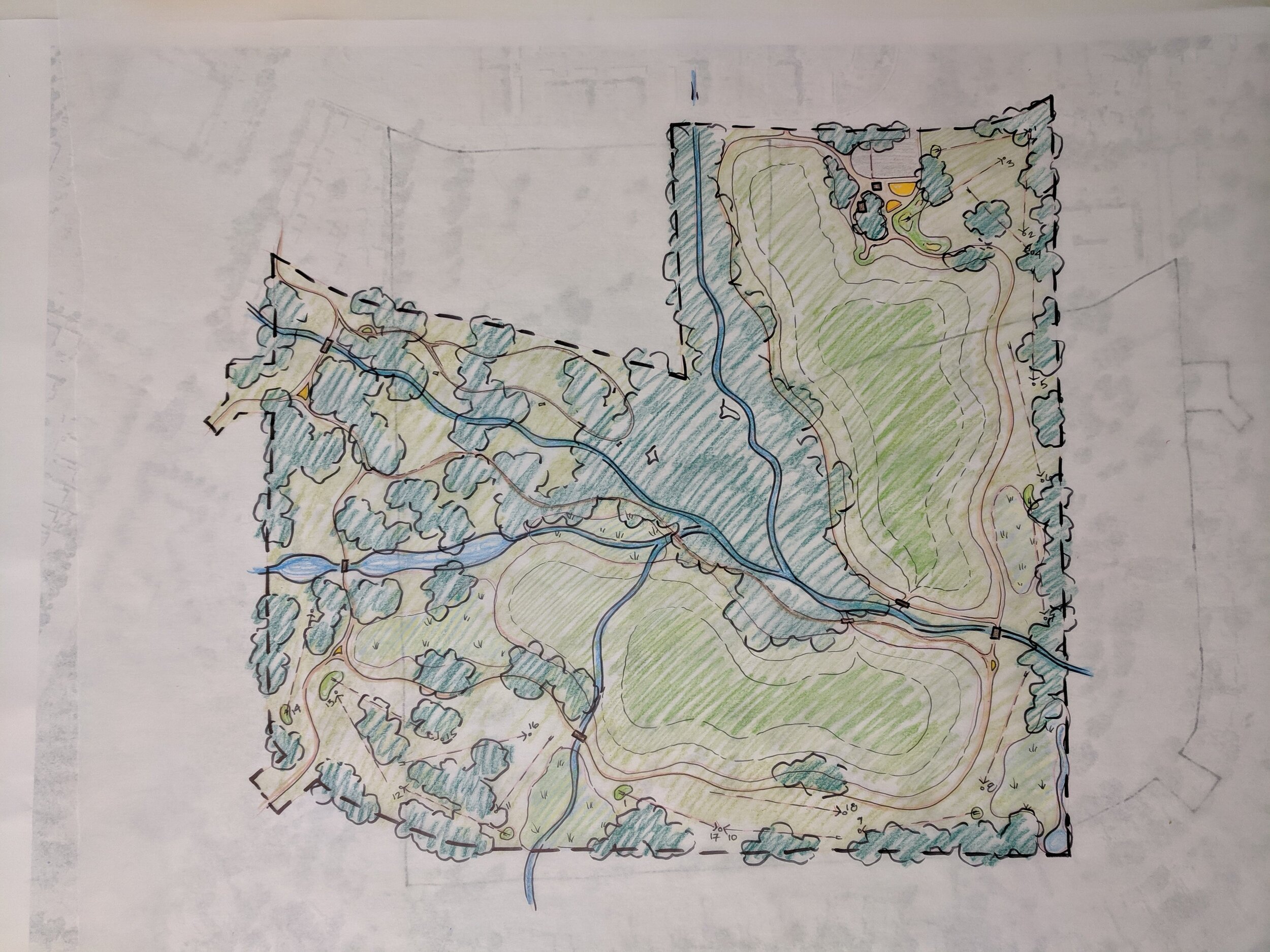
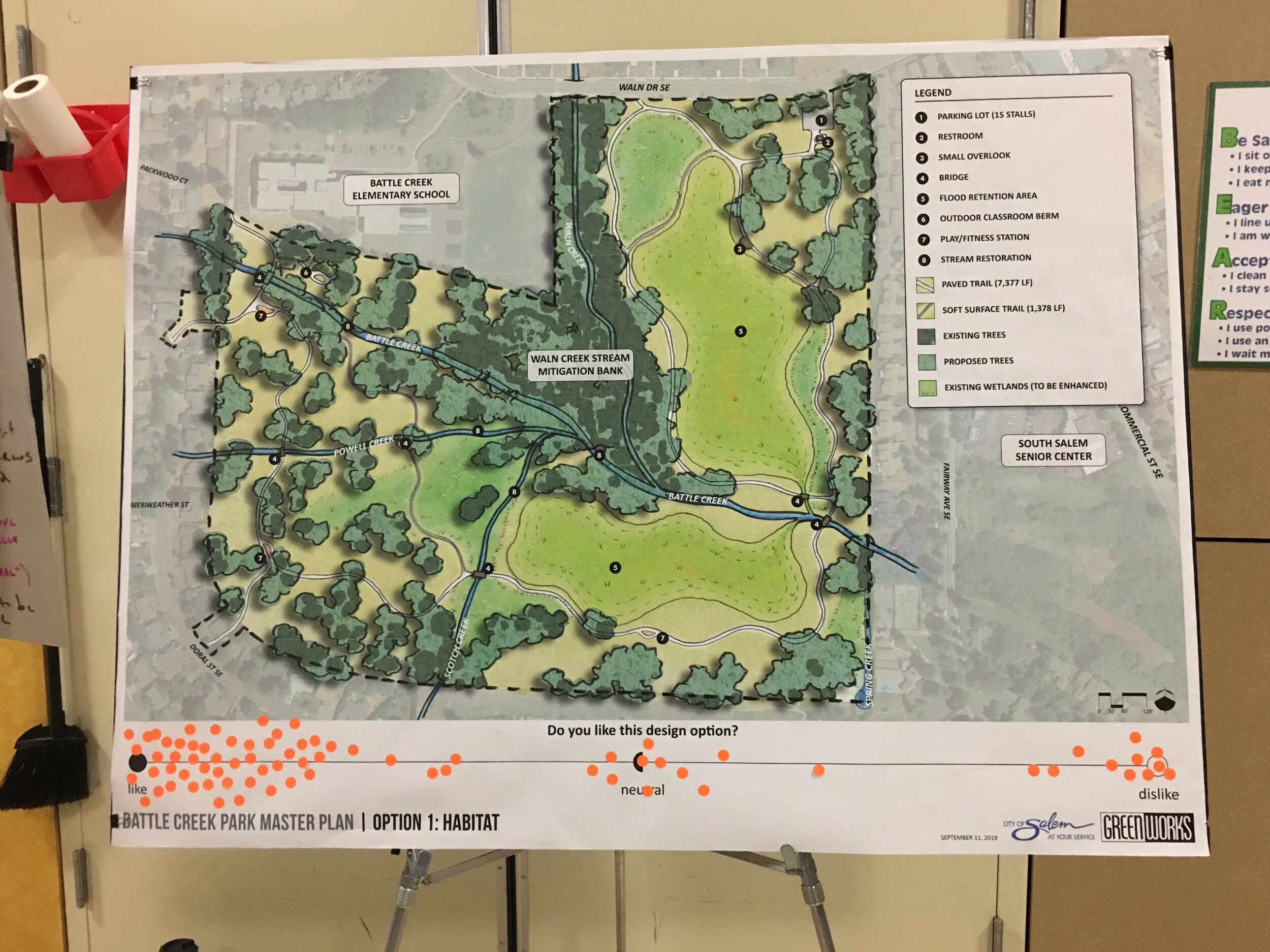
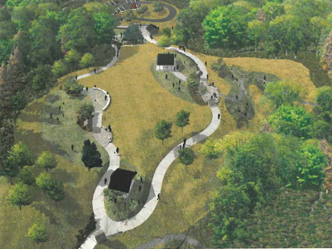
The goal for the Battle Creek Park master plan is to develop a multi-use park that balances recreational use with flood mitigation. GreenWorks is exploring ways to integrate flood plain mitigation so that the park looks and feels natural versus looking like a large, engineered detention facility.

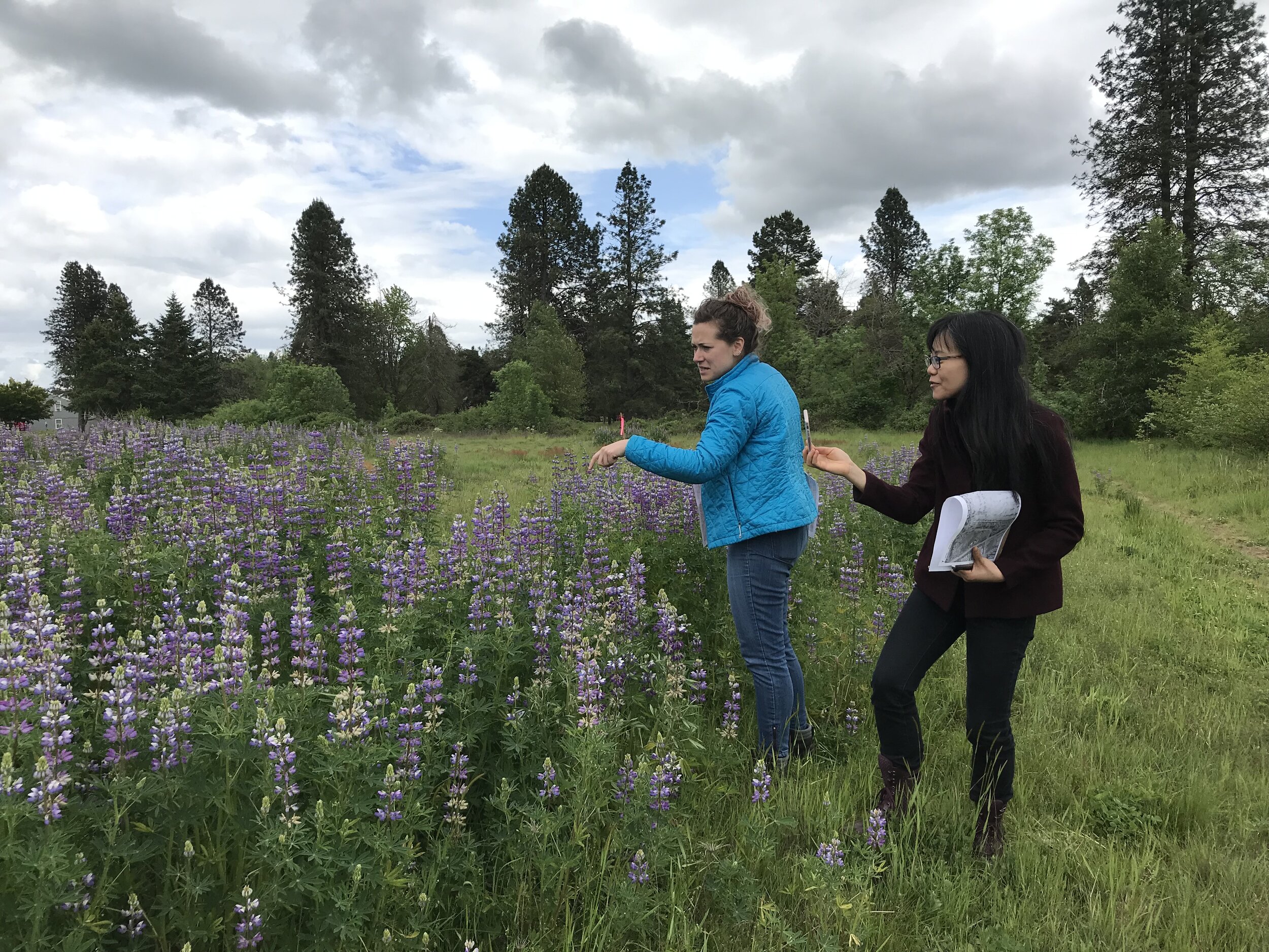
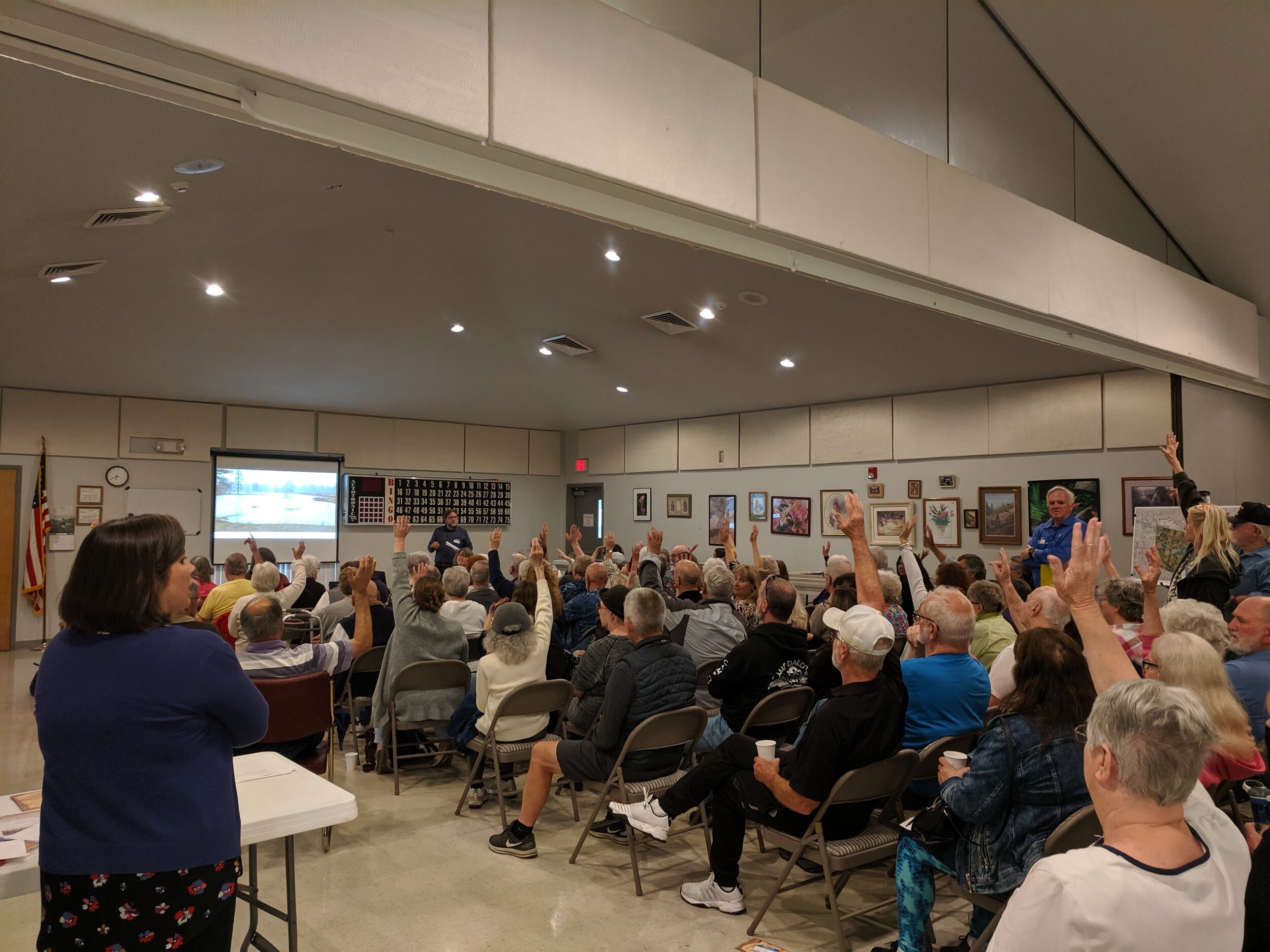
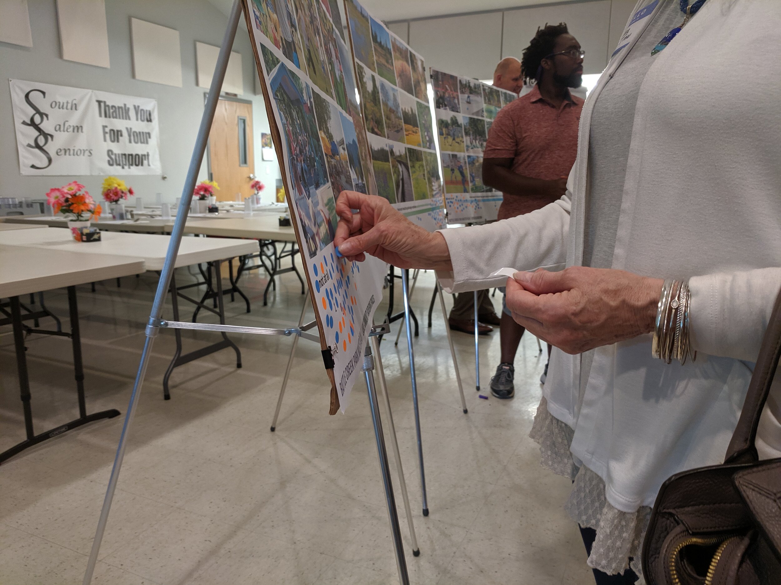
The city also received input from more than 800 responses to a first online survey and from more than 80 community members that attended both public open houses. From that feedback, three conceptual site improvement options for the master plan were created, each focusing on a different theme (habitat, recreation, blending of habitat and recreation). Some park features are in all three options, such as trails and flood retention, but other features vary or are unique to each option.

visualization of battle creek park in winter with viewing platform
Opt3-summer.jpg
Opt3-winter.jpg

Birds_Eye_waln entrance.jpg


series of images illustrating battle creek park improvements for public engagement

Westmoreland Park Nature Based Play

Westmoreland park from drone during sunset, people playing on logs and rocks, a stream and a pond below

The Westmoreland Nature-Based Play Area is a pilot project for Portland Parks and Recreation. GreenWorks collaborated with Portland Parks & Recreation to replace an outdated playground with a nature-based play environment. GreenWorks focused on developing a context-sensitive design that would reference the specific characteristics of the site and its surrounding community. Extensive outreach was built into the design process.

logs come to a point with children climbing, standing on piles of rocks on a cloudy day

GreenWorks led a comprehensive public involvement and consensus building process that resulted in unique play elements, which were custom-made for this park that celebrate the community’s vision.

The design team included environmental artist, Adam Kuby. Adam collaborated with the design team on the overall conceptual design of the playground that represents the restoration of the adjacent Crystal Springs. He helped envision these artistic elements as play features within the design.

Sustainable features include water conservation, drought-tolerant planting design, efficient irrigation, native or native-adaptive plant material, sustainable stormwater management, incorporation of salvaged concrete re-purposed for water play elements and many salvaged logs for climbing features and custom benches. This project opened in 2014 and is “wildly” popular with children and adults alike. The project was awarded the ASLA Oregon Honor Award.

sand play area with children playing, parents sitting on benches on sunny day
mature plants and a sand play area separated by a wood fence on a sunny day

Learn more from Americans for the Arts, KATU2 and US Army Corps of Engineers videos made before the park’s construction, and from PDXParent.

Independence Landing Waterfront Park

Conceived of a an extension of Riverview Park, Independence landing offers users a number of passive recreation opportunities.

Greenworks is honored to be working with the City of Independence to implement the vision set forth in the Open Space Master Plan completed in 2015. The current work on Independence Landing improves a key piece of public waterfront located immediately south of Riverview Park, the flagship of the Independence park system. Designed in tandem with the with the large waterfront re-development on the old Valley Concrete Site, Independence Landing  is one piece in a larger orchestrated effort to revitalize downtown Independence and support commercial growth.

Man-Walks_Park_Willamette_Riverfront_Path.JPG
Independence_Landing_South-View_Oregon_Waterfront.JPG

Included in the plan are a waterfront multi-use trail with a river overlook, a shaded patio and lawn space able to accommodate flexible programming, a sizeable restoration planting area braided by soft surface trails and a grove of shade trees in which the user can find informal, private seating areas. This implementation of the Open Space Master Plan sets the stage for the continued expansion of improved public waterfront southward along the Willamette River and strengthens the downtown, pedestrian connections to the waterfront.

The success of this project has been a measure of how well the project team has worked together. Shawn Irvine and David Clyne with the City of Independence and Steve Ward with Westech Engineering have been instrumental in guiding the design process, representing the diverse community of Independence and streamlining the construction of this exciting new park space.

Conceptual Visualization

Independence landing riverfront park plan graphic birdseye
Independence Waterfront Park Perspective Plan Drawing

Tanner Springs Park

tannerspringspark_8_looking north_for_web.jpg
Tanner Springs Urban Wetland.jpg

GreenWorks collaborated with Atelier Dreiseitl of Germany to design Tanner Springs Park, an urban park in Portland’s Pearl District. Envisioned as an urban park with a wetland focus, the park serves the developing surrounding neighborhood as well as visitors to the area. The sustainable design features innovative uses of water and stormwater, creating a refuge for people and wildlife in the midst of this bustling downtown neighborhood. The design process was highly interactive involving the citizens of Portland through a series of public workshops.

The springs connect the park to Tanner Creek that at one time flowed openly through this area; today it flows through large pipes beneath the city streets. Since the design of the park attempts to recapture the area’s past with its native wetlands and flowing runnels, the name is fitting.
— Portland Parks & Recreation

This one-acre park in the center Portland’s Pear District, Tanner Springs Park is the second of three parks envisioned by the City and Peter Walker Partners. With Walker’s Jamison Square Park serving as an active gathering space for the neighborhood, the Tanner Springs Park design team was charged with making this park, two blocks north of Jamison, contemplative and quiet, designed for personal reflection. The park was to incorporate water and a pedestrian boardwalk that was part of the original master plan.

As the City of Portland settled on the banks of the Willamette River in the late 19th century, it avoided the marshy area north of downtown. This area, where Tanner Creek entered Couch Lake, was an important off-channel rearing area for juvenile salmon, though unrecognized at the time.  As railroad commerce became increasingly important to the young city, Couch Lake was drained and filled to accommodate a large rail yard with the dozens of railroad sidings needed by freight trains to haul out the region’s timber.  Tanner Creek was buried in a pipe deep beneath the developing city.

Art_Wall_pan.jpg

The block now known as Tanner Springs Park is located right in the center of historic Couch Lake, near the Tanner Creek channel. By the 1980’s this area of rail yards, industrial facilities and warehouses began to be redeveloped. Portlanders began to envision a new neighborhood, directly adjacent to downtown, a place where people could live and work in an energetic urban environment.

It is this rich mix of natural and cultural history that the design team wished to incorporate into the Tanner Springs Park.  We visualized peeling back the skin of the city to discover the forgotten wetland.

Conceptualized as a tilted plane, the park captures a transect of the major natural plant communities historically found in the Willamette Valley:

  • freshwater pond

  • emergent wetland

  • wet prairie

  • oak woodland

All plants in the park are native to the Willamette Valley, from the wetland sedges to the stately Oregon White Oak tree used to “invade” the urban streetscape on the western edge of the park.

A spring bubbles up at the top of a large open grassy meadow, trickling down to a wetland pond, sunken 6 feet below street level. The east edge of the pond is scribed by an undulating “Art Wall” constructed of reclaimed railroad rails, some nearly a century old. Lawn terraces, like urban bleachers, run down opposite sides of the park providing lunchtime seating and vantage points to enjoy the scenery.  Pedestrian paths within the park are crafted from recycled basalt cobblestones, once found in the streets of the neighborhood.  This is a place of many historic references, from a natural creek and wetland, to the memory of industry and train yards, to today’s modern city.

However, Tanner Springs Park is not a wetland museum.  It is an urban habitat.  It has its own authentic ecology while utilizing art for interpretation. Though inspired by nature, it is an urban park, with precise terraces and walls creating a frame for the organic core. 

The pond is cleansed biologically, without added chemicals.  All stormwater runoff from the entire block is directed into the cleansing biotope, rather than out to the curb and gutters of surrounding streets.  Vegetation within the park is also managed without chemicals, in order to protect the biological viability of the pond.

Portland_Tanner Springs Park_copyright_ GreenWorks.jpg
PC: Tom Good

PC: Tom Good

Metro Graham Oaks Nature Park in Wilsonville

Graham_Oaks_Plaza_Interpretive_Overlook.jpg

GreenWorks provided schematic design, construction documents, and construction administration for this $1.4 million, 205-acre regional park in Wilsonville. The design process engaged the City of Wilsonville, the adjacent Elementary School, and its direct neighbor–Villebois Community–to create a Nature Park that truly reflected the needs of its community while staying true to Metro’s project goals. The design imparts a hierarchy of trails to facilitate access to natural areas such as restored oak savannah, woodlands, wetlands, and riparian forests. The regional Tonquin Trail provides regional access to the park, while secondary loop trails and forest hiking trails offer additional scenic, leisure routes. The integration of art was an important design element to Graham Oaks. The park’s entrance is designed to provide a strong sense of place and includes numerous sustainable site features (i.e., stormwater facilities in the parking lot, a green roof picnic shelter and native plantings throughout). The gateway interpretive plaza introduces visitors to the wildlife and history of the area, while viewpoints, plazas, bridges, boardwalks and interpretive features throughout the site help visitors enjoy the unique attributes of the park while striking  a careful balance between access and restoration. The park serves many roles as an educational tool to the neighboring Elementary School, a neighborhood Park to nearby Villebois Park and a regional destination for access to nature and recreation.

Graham_Oaks_Birdseye_Trail_Rendering.jpg
grahamoakspark_website_062118_03.jpg
grahamoakspark_website_062118_02.jpg
grahamoakspark_website_062118_01.jpg
GrahamOaksPark_20_Wetland_Overlook_sm.jpg
graham_oaks-2.jpg
Graham Oaks Nature Park_reduced.jpg

Hood River Waterfront Park

GreenWorks provided master planning and design services for the waterfront park in Hood River. The 6-acre park lies north of downtown between the Hood River Event Site and “The Hook” (a protected harbor for learning windsurfing) on property donated by the Port of Hood River. The Park helps connect the community to the Columbia River through a family-friendly public gathering space that accommodates a wide spectrum of uses. Our team went on to provide design services. Design features include beach and swimming access to the Columbia River, innovative children’s play facilities, and flexible areas for large community events and festivals. In addition, the park reclaims eight hundred feet of riverbank, laying back the slope and restoring the river’s edge with a wide variety of native riparian plants. The park sits north of commercial use sites to the south and has improved connectivity to the waterfront and increased economic development and commercial revitalization.

Hood-River-Waterfront_Park_Detail_Birdseye.JPG
HoodRiverWaterfrontPark_7_reduced.jpg

Hogan Butte Nature Park

Hogan_Butte_Viewpoint.JPG

Hogan Butte is a 43 acre park south of downtown Gresham and west of US 26. Hogan Butte has a rich natural history that is highly visible on-site and from the stunning 270 degree views from the top of the butte (with views of Mt. Hood, Mt. St. Helens, Mt. Adams, Mt. Rainier, the Columbia River Gorge and the City of Gresham). The position of the property and connections into the community provide unique opportunities for public access and education.

diagram showing elevation change with amenities like viewpoints, shelters, and a LABYRINTH


GreenWorks developed the Master Plan for the site, which recognized the unique value of the Hogan Butte site, both as a natural asset and community asset. The Master Plan meets community assessed needs and protects the natural environment. Program elements included: protecting and restoring natural resources, providing public access, appropriate infrastructure such as restrooms and parking, trails, signage and education. Hogan Butte has a rich natural history that is highly visible on-site and from the stunning 270 degree views from the top of the butte. The position of the property and connections into the community provide unique opportunities for public access and education.


“…a half-mile paved pathway snakes its way to the top. From the crest of the butte is a great view of Mount St. Helens, Mount Adams and Mount Hood, while the mountain finder situated there promises occasional peeks of Mt. Rainier and Mt. Jefferson too.” - The Oregonian

“At the top elevation of 930 feet, take in a stunning ‘Volcanic Viewpoint,’ a panoramic view of Mt. Hood, Mt. St. Helens, Mt. Adams, Mt. Rainier, the Columbia River Gorge and city of Gresham. Walk the half-mile paved interpretive loop trail and enjoy picnic areas with views of the forest. Educational signage is available in Russian and Spanish. An ADA-accessible parking lot has 20 spaces.” - Oregon Metro

Conceptual Visualizations

2006 quality visualization of pathway winding around a hill with picnic shelters and a meadow

Bend Whitewater Park

aerial image of deschutes river flowing through Bend, oregon, past the old mill district at sunset

On the Deschutes River, the Colorado Avenue Dam maintains water surface elevations upstream in the Mill District, but is located in an area of the river that is heavily used by boaters, kayakers, and tubers. Prior to this project, the dam and footbridge configuration blocked downstream passage and required all river users to exit the river and portage around the impediment, exposing a high number of low-skilled users to the potential of being swept into the dam.

people line a pedestrian bridge above people in tubes and on rocks in the deschutes river, the old mill smokestacks in the background

A team that included GreenWorks designed this project to provide safe passage over the existing dam. In addition to the in-water recreational components, the design includes increased habitat diversity along the river by incorporating fish passage and on-bank habitat restoration, design improvements to McKay Park, and replacement of the pedestrian bridge.

The project is made up of three distinct channels:

  1. The Passageway Channel with modest rapids for people floating the river with tubes,

  2. The Whitewater Channel with four wave features for more experienced whitewater enthusiasts, and

  3. The Habitat Channel, with no public access, provides habitat to local and migratory wildlife.

    Opened in 2015, the new Bend Whitewater Park enhances recreation by allowing river users to travel through the dam without having to portage and improves riverfront habitat in an ecologically sensitive area.

aerial view illustration of river passing through three distinct channels with car and pedestrian bridge on upstream end

George Rogers Park

GreenWorks prepared the Master Plan and design services for George Rogers Park located along the Willamette River in Lake Oswego. The project created visual and physical connections to the Willamette River and between elements within the park. Gateway enhancements, interpretive elements, and improved waterfront access were key design components. Creating a cohesive plan was paramount and included unifying the Barbecue Terrace with the Memorial Garden Terrace. The design also provided a soft canoe launch and waterfront access improvements. Boardwalks connected terraces and provided overlooks to the public beach area. The project removed existing pavings within the floodplain and provided mitigation plantings for all encroachments in the floodplain and greenway.

GeorgeRogers_reduced.jpg
GeorgeRogersPark_13_reduced.jpg
03_George_Rogers_Park_reduced.jpg
DSC_0152.JPG
MM_George Rogers Park.JPG
L1.2bsm.jpg
GeorgeRogerswalkreduced.jpg

Spring Park

North Clackamas Parks and Recreation District and the City of Milwaukie partnered to improve in-stream and riparian areas and a new trail access at Spring Park in Milwaukie, Oregon. As the project Landscape Architect, GreenWorks analyzed the topography and sensitive areas to find the ideal location for a soft surface trail, boardwalk, and overlook that would improve access and provide excellent user experience within the restored riparian landscape.

Spring_View_01.jpg
Spring_Park_Interpretive_reduced.jpg
Spring_Park_Boardwalk_reduced.jpg
Spring_Park_Overlook_reduced.jpg

Brian Booth State Park Master Plan

GreenWorks assisted Oregon Parks and Recreation Department (OPRD) in the development of a master plan for a large property of approximately 1283 acres of wetlands, meadows, orchard and forest just south of Newport, Oregon. GreenWorks sought to enhance the site’s valuable ecological characteristics while offering diverse recreational activities such as beach access, paddling, bird watching, and walks in the marshland and hiking in upland meadows. The master plan includes hiking, biking and equestrian trail systems, water trail access and boat ramps, a boardwalk, campgrounds, cabin areas, interpretive areas and administration areas

Brian_Booth_State_Park.jpg
12036_Preferred_Alt_reduced.jpg

Astoria Visioning, Planning, and Wayfinding

As part of a comprehensive visioning project, GreenWorks helped to envision the future of the Astoria riverfront. The design team assisted in planning for open space and pedestrian connections that reinforce the values of the community and preserve the special character of this historic city. GreenWorks also helped facilitate visioning workshops and provided the community with imagery, plans, and strategies to guide future development. The National Oceanic and Atmospheric Administration (NOAA) honored this project with its Walter B. Jones Memorial and NOAA Excellence Awards. GreenWorks went on to develop concepts for the Astoria Riverwalk with the goal of developing a multi-modal approach that accommodates a historic trolley line, business access for deliveries, bicycle traffic, as well as a pedestrian trail along the waterfront complete with wayfinding elements. The design character for the Riverwalk elements reflects industrial waterfront themes. Sketches were prepared to show unifying themes incorporated into varied settings along the waterfront. GreenWorks also developed the wayfinding plan for downtown Astoria. The scope includes preparing a concept plan detailing locations of proposed improvements and illustrations of signage components. Working closely with the City and Downtown Association representatives, GreenWorks prepared a set of signage typologies to provide the community with a cohesive downtown wayfinding plan.

astoriawayfinding_website_061918_01.jpg
astoriawayfinding_website_061918_02.jpg
AstoriaRiverwalk_2_11th_Ave_West_2.jpg

Canemah Bluff

Canemah Bluff is a 300-acre natural area owned and maintained by Metro within Oregon City. GreenWorks worked with Metro to develop public access to the sensitive oak savannah and woodland, which included improving hiking & walking trails, new boardwalk, foot-bridge, and scenic overlook.

During the Public Involvement phase, GreenWorks helped engage the community and gain support from a highly motivated neighborhood group. We prepared a design that reflected both Metro’s and the neighborhood’s goals for minimal impact to natural resources, yet provided for a safe place for users to enjoy the natural area. GreenWorks produced graphic presentation materials that helped convey the design so both the client and community could fully understand and appreciate what the end product would look like once built.

20170429Canema5_reduced.jpg
20170429Canema24.jpg
20170429Canema41_reduced.jpg
20170429Canema2_reduced.jpg

Ridgewood View Park Reservoir

GreenWorks aided Tualatin Valley Water District (TVWD) in replacing an outdated reservoir with a new one adjacent to Ridgewood View Park in Beaverton. The new water project required extensive piping and construction staging on the Tualatin Hills Parks and Recreation District (THPRD) park site. In turn, TVWD needed to upgrade the amenities in Ridgewood View. GreenWork’s proposed new park elements including open lawn, paths, parking, picnic shelters, access to natural areas, playgrounds, and a bocce ball and tennis court on top of the reservoir. Innovative elements for the project included terraced rain gardens that treat and convey stormwater from the roof of the reservoir. The park’s new rain gardens help screen the 15’ wall of the reservoir in the park and provide an educational resource for TVWD, THPRD, and the residents of the neighborhood.
 

ridgewoodview_website_062118_01.jpg
Stratoscape - Ridgewood_0499.JPG
ridgewoodview_website_062118_02.jpg
ridgewoodview_website_062118_03.jpg
ridgewoodview_website_062118_04.jpg

Silver Falls State Park Nature Play Area

9_reduced.jpg

  Have you ever wanted to nap like a cougar, climb into an anthill, build a bird’s nest or dig for insects like a bear? All these activities will soon be possible at the Silver Falls State Park Nature Based Play Area. GreenWorks has started work on phase one of the interpretive natural play area in the Park. The idea grew out of the Oregon Parks and Recreation ‘Stepping Stones’ program with the goal to get kids outside and connected with nature.  A 2009 series of workshops with educators, OPRD staff, designers and of course kids, developed themes, ideas and concepts using the Stepping Stones methodology. When completed the Silver Falls Play area will consist of 16 animal themed play areas. Each play area is dedicated to a certain animal and designed for a specific age group of kids. The young and young at heart can explore a series of play areas situated in a fir and fern wonderland. The first phase of construction will include bear, ant, cougar and bird themed areas. GreenWorks provided OPRD with design support from schematic design workshops to construction documents and construction administration.

SilverFalls1_reduced.jpg
6_reduced.jpg
Ant-Bear_Play.jpg

Multnomah Falls Concept Plan

The ultimate goal of this project was to create a vision for the iconic and historic Multnomah Falls site to improve safety and access issues from Interstate 84, to amend pedestrian access and visitor experience of the site, and to re-connect the Multnomah Creek with a natural confluence to the Columbia River. With multiple stakeholders, including the U.S. Forest Services, Oregon Department of Transportation (ODOT), Oregon Parks and Recreation Department (OPRD), the Columbia River Gorge Commission and the Columbia Estuary Partnership. GreenWorks led a multi-disciplinary team to master plan and develop a vision for the future of Multnomah Falls as a new gateway experience of the Gorge. The design team provided conceptual design, master planning, visual analysis, and a circulation Study. The team developed the concept around a comprehensive reconfiguration of the Interstate 84 Multnomah Falls interchange with a new full interchange design and access to Benson State Recreation Area and bridge crossing of Multnomah Creek. The Vision Plan includes a daylighted and restored Multnomah Creek with a natural alluvial fan to the Columbia River for fostering chum salmon habitat.

Multnomah_Falls_Birdseye_sm.jpg

Fairview Woods Park

DSC_9279_reduced.jpg

Fairview Woods Park is a renovation of an existing open space to a neighborhood Park and an example of where we successfully used a sustainability filter to improve park conditions and facilities. Some trails and interpretation existed at the park but graffiti, inappropriate park use and gunfire were common in the park and neighbors were concerned about safety. GreenWorks and SWCA environmental developed a conceptual plan and construction documents to address park safety and upgrade facilities to meet neighborhood recreation needs and provide access to wetland and riparian areas. We also addressed creek and wetland protection and sustainability on site by including native plant community restoration, vegetation management to provide visual corridors, minimal tree removal, use of downed woody debris for interpretive and plaza features, wetland trail improvements, trail decommissioning, minimized parking including ADA space, and upgraded trails to meet ADA standards.

Mirror Pond Visioning Project

GreenWorks consulted with Bend Parks and Recreation District on alternatives to provide four different solutions for the community to consider for the iconic Mirror Pond on the Deschutes River in Bend, Oregon. Each option, ranging from taking out a dam to dredging or something in between, will illustrate the visual impact, cost estimates, regulatory requirements, challenges and opportunities.

MirrorPondGIFreduced.gif

Mt. Rainier National Park Paradise Visitor Center

GreenWorks provided site planning and design services for the Paradise Historic Landmark District in Mount Rainier National Park.  In addition to participating in a Cultural Landscape Workshop and contributing to the Cultural Landscape Report, we assisted in the siting and design of a new 15,000 square foot Visitor Center, site plazas and trailheads.  We also evaluated the possibility of future alternative modes of transportation within the National Park.  GreenWorks prepared construction documents for all pedestrian amenities and site features in the area, including restoration of native alpine meadows.

MORA_FinalPlan_labeled_reduced.jpg
rainier_vis_simcam3smLT.jpg

Mill and Midland Parks Master Plans

GreenWorks worked with Portland Parks and Recreation on the Master Plans for Mill Park and Midland Park in Southeast Portland.  The two parks are in a concurrent process due to their close proximity to each other and are in ethnically diverse and low income neighborhoods. The team participated in a unique public outreach approach with PP&R to increase the City’s efforts to involve and receive feedback from community members that have historically been underrepresented during the public process. Greenworks aided by attending focus meetings with community leaders and preparing graphics that are very clear with translations in Vietnamese and Spanish. The Master Plan was finalized at the end of 2017.

Office_Board_MillMidland_reduced.jpg