Hogan Butte Nature Park

Hogan_Butte_Viewpoint.JPG

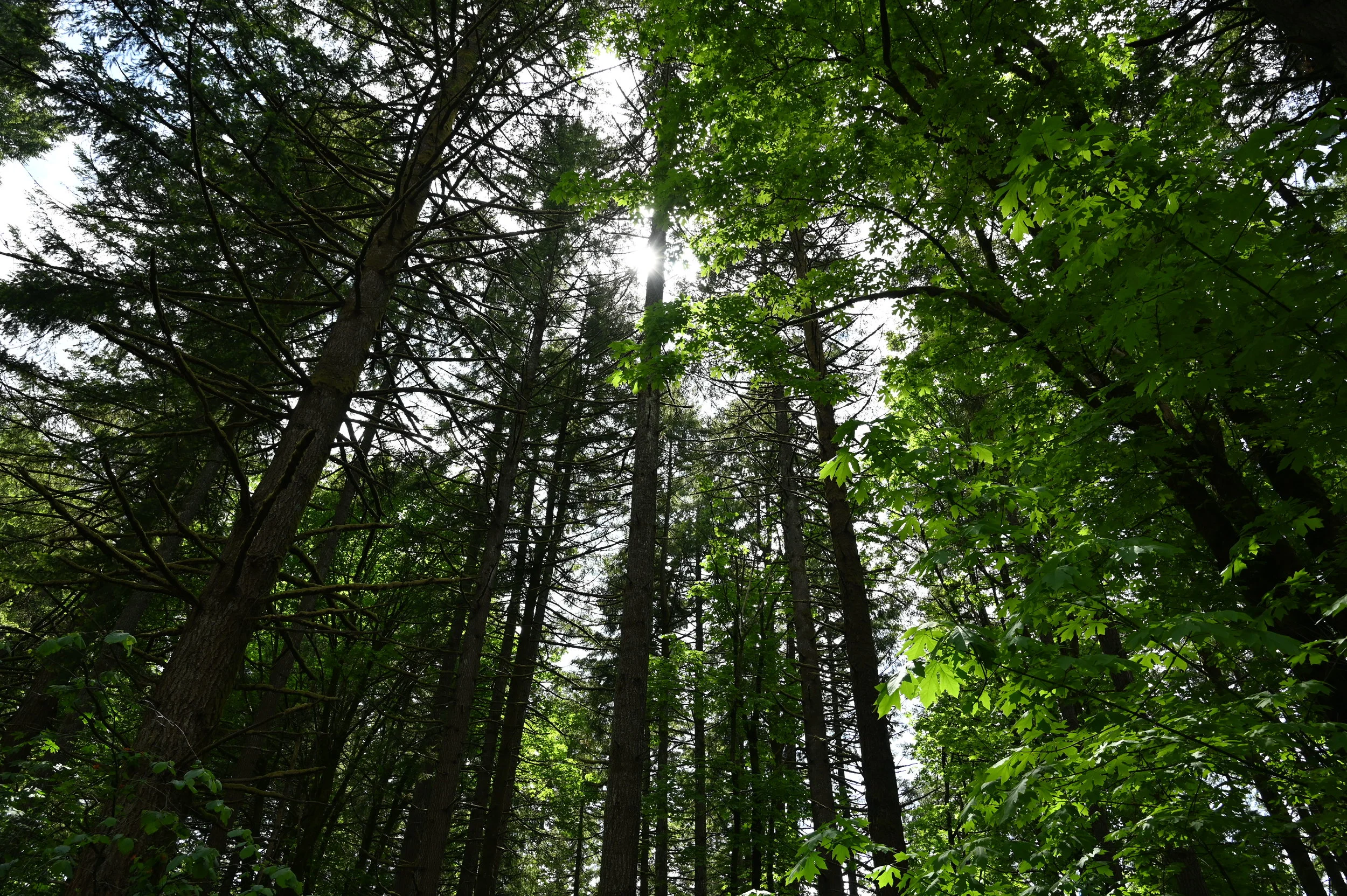
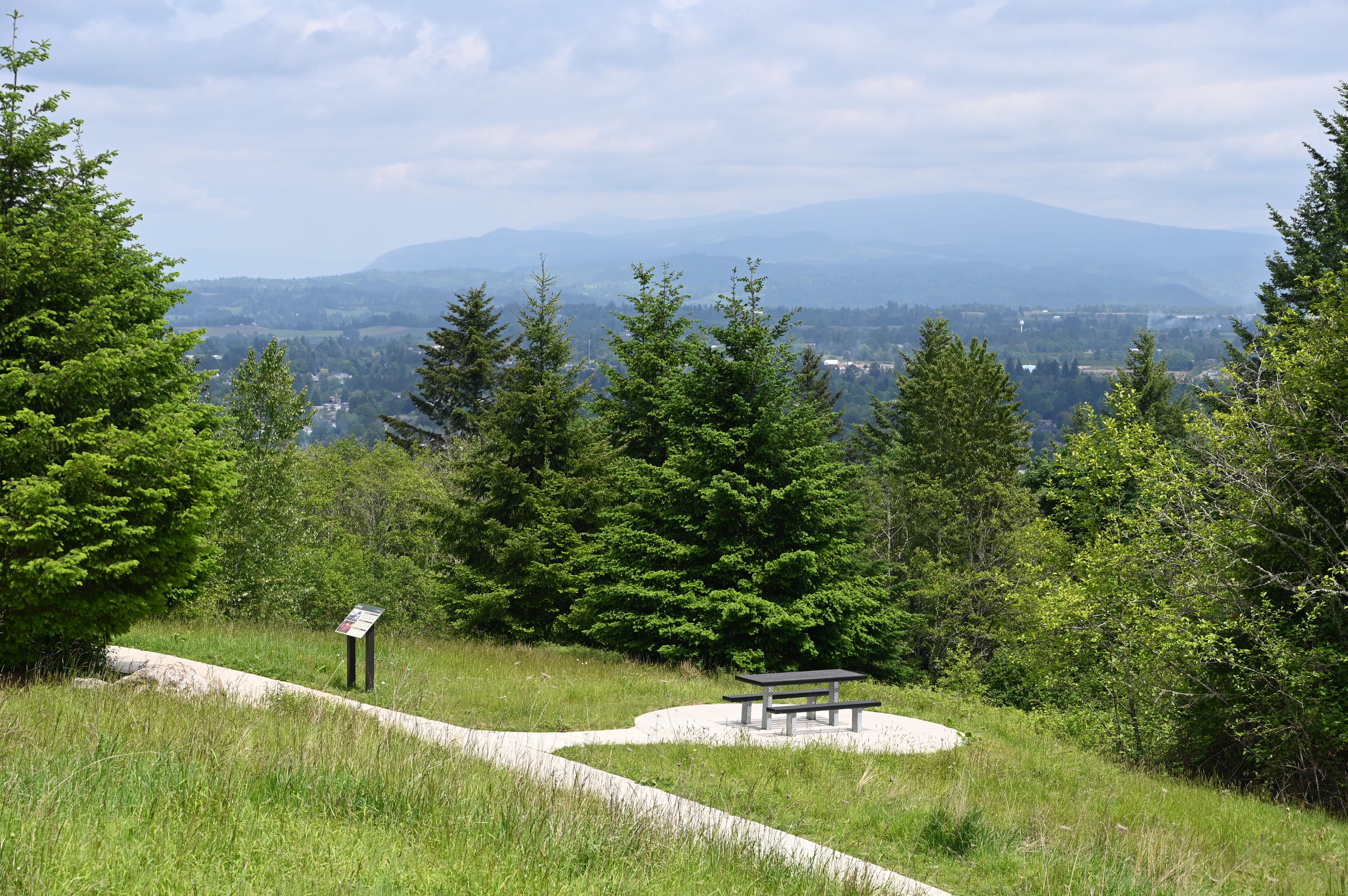
Hogan Butte is a 43 acre park south of downtown Gresham and west of US 26. Hogan Butte has a rich natural history that is highly visible on-site and from the stunning 270 degree views from the top of the butte (with views of Mt. Hood, Mt. St. Helens, Mt. Adams, Mt. Rainier, the Columbia River Gorge and the City of Gresham). The position of the property and connections into the community provide unique opportunities for public access and education.

diagram showing elevation change with amenities like viewpoints, shelters, and a LABYRINTH


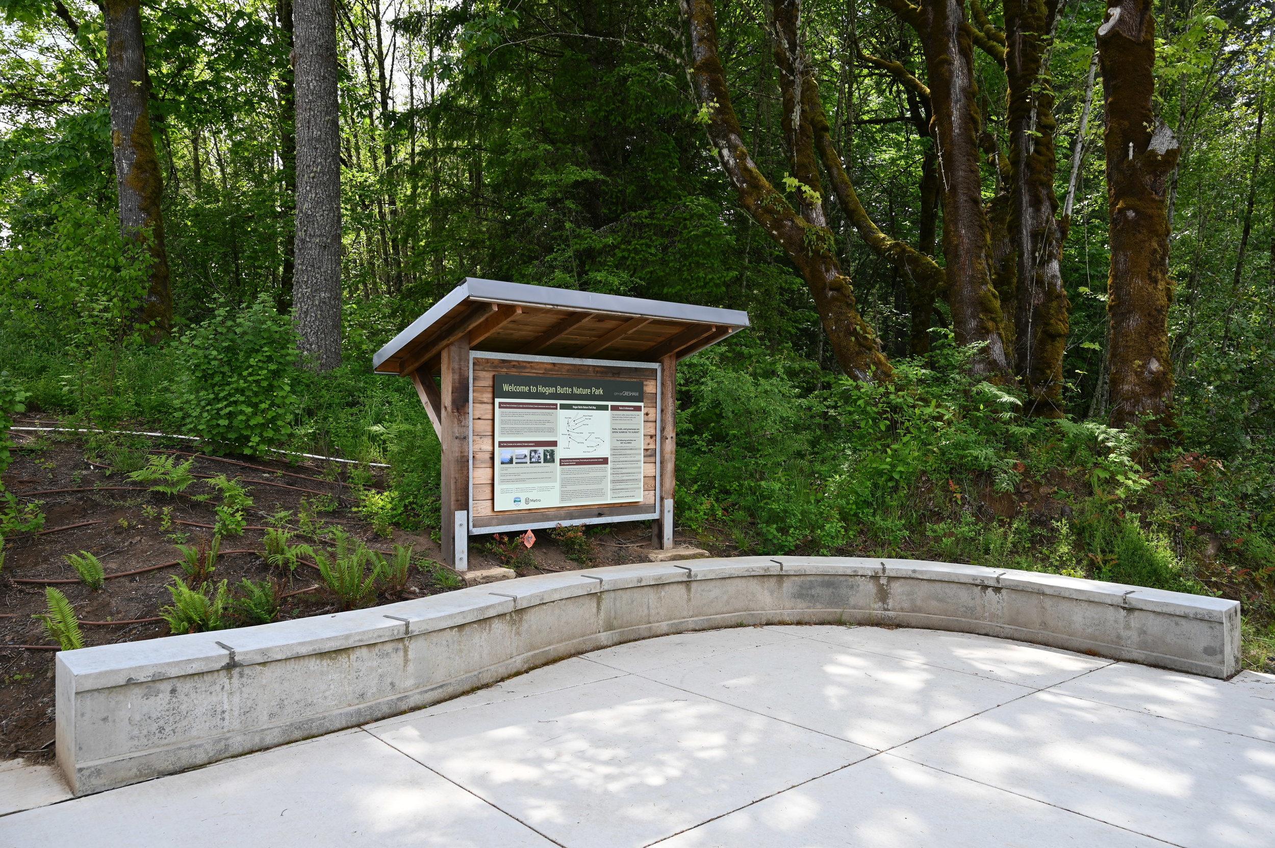
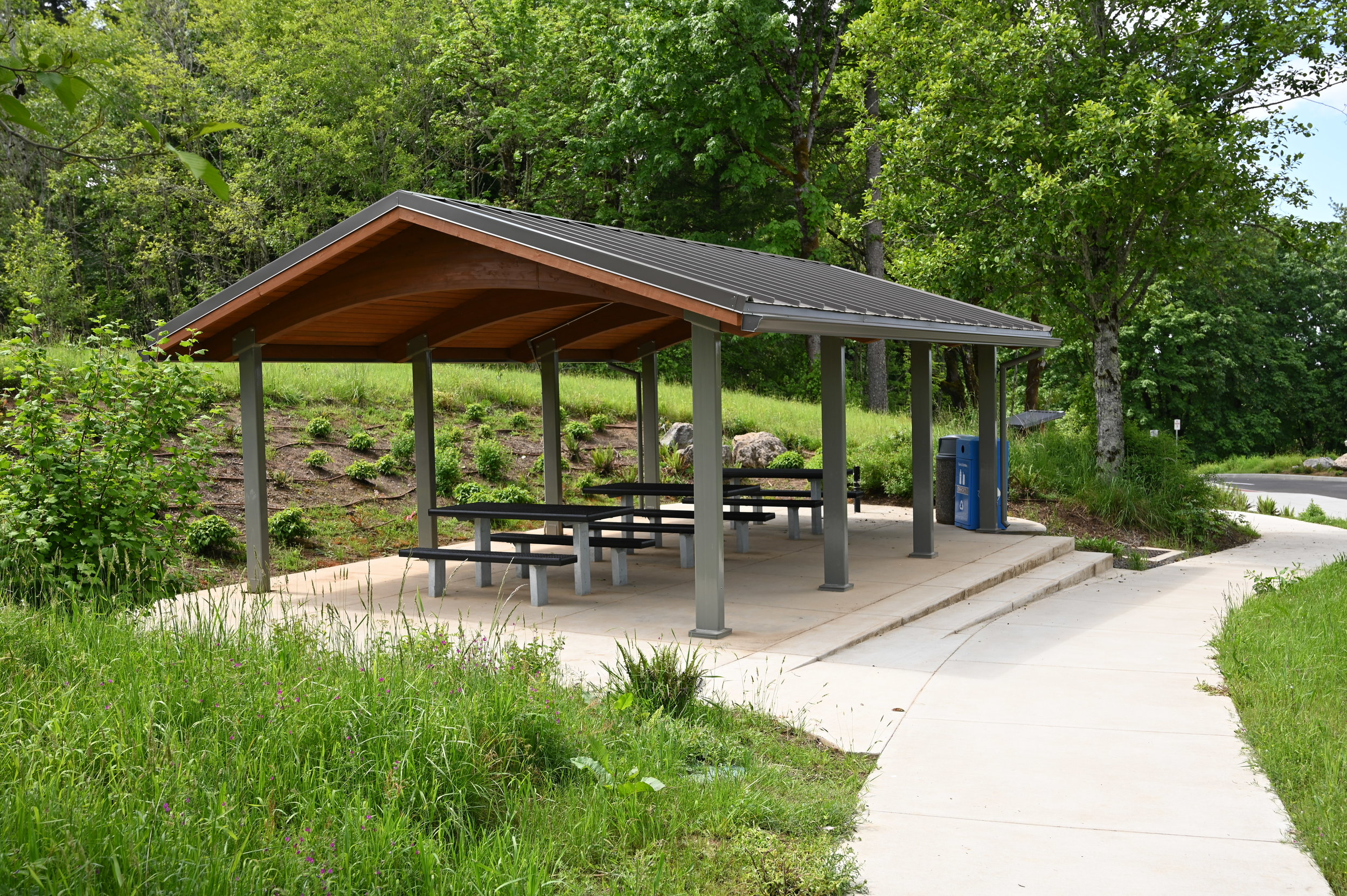
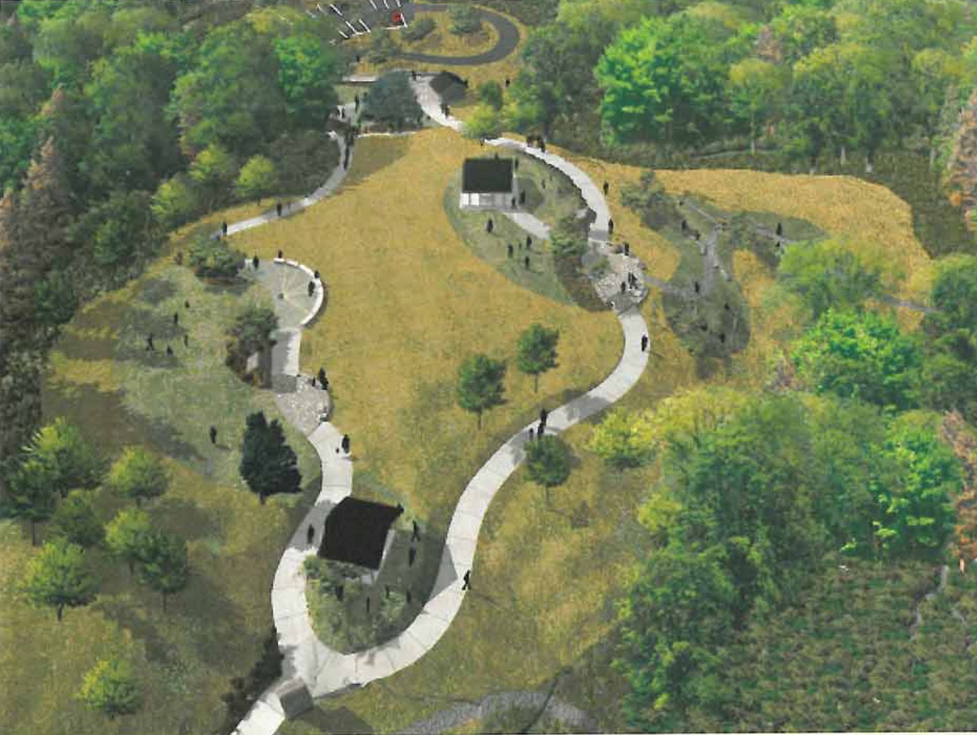
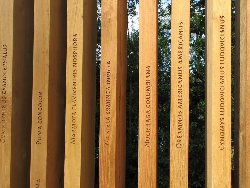
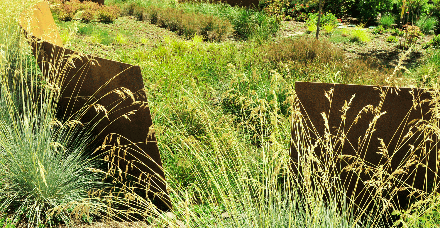
GreenWorks developed the Master Plan for the site, which recognized the unique value of the Hogan Butte site, both as a natural asset and community asset. The Master Plan meets community assessed needs and protects the natural environment. Program elements included: protecting and restoring natural resources, providing public access, appropriate infrastructure such as restrooms and parking, trails, signage and education. Hogan Butte has a rich natural history that is highly visible on-site and from the stunning 270 degree views from the top of the butte. The position of the property and connections into the community provide unique opportunities for public access and education.


“…a half-mile paved pathway snakes its way to the top. From the crest of the butte is a great view of Mount St. Helens, Mount Adams and Mount Hood, while the mountain finder situated there promises occasional peeks of Mt. Rainier and Mt. Jefferson too.” - The Oregonian

“At the top elevation of 930 feet, take in a stunning ‘Volcanic Viewpoint,’ a panoramic view of Mt. Hood, Mt. St. Helens, Mt. Adams, Mt. Rainier, the Columbia River Gorge and city of Gresham. Walk the half-mile paved interpretive loop trail and enjoy picnic areas with views of the forest. Educational signage is available in Russian and Spanish. An ADA-accessible parking lot has 20 spaces.” - Oregon Metro

Conceptual Visualizations

2006 quality visualization of pathway winding around a hill with picnic shelters and a meadow

George Rogers Park

GreenWorks prepared the Master Plan and design services for George Rogers Park located along the Willamette River in Lake Oswego. The project created visual and physical connections to the Willamette River and between elements within the park. Gateway enhancements, interpretive elements, and improved waterfront access were key design components. Creating a cohesive plan was paramount and included unifying the Barbecue Terrace with the Memorial Garden Terrace. The design also provided a soft canoe launch and waterfront access improvements. Boardwalks connected terraces and provided overlooks to the public beach area. The project removed existing pavings within the floodplain and provided mitigation plantings for all encroachments in the floodplain and greenway.

GeorgeRogers_reduced.jpg
GeorgeRogersPark_13_reduced.jpg
03_George_Rogers_Park_reduced.jpg
DSC_0152.JPG
MM_George Rogers Park.JPG
L1.2bsm.jpg
GeorgeRogerswalkreduced.jpg

Spring Park

North Clackamas Parks and Recreation District and the City of Milwaukie partnered to improve in-stream and riparian areas and a new trail access at Spring Park in Milwaukie, Oregon. As the project Landscape Architect, GreenWorks analyzed the topography and sensitive areas to find the ideal location for a soft surface trail, boardwalk, and overlook that would improve access and provide excellent user experience within the restored riparian landscape.

Spring_View_01.jpg
Spring_Park_Interpretive_reduced.jpg
Spring_Park_Boardwalk_reduced.jpg
Spring_Park_Overlook_reduced.jpg

The Confluence Project - Sandy River Bird Blind

GreenWorks provided site design, agency coordination, permitting services and construction administration to the Confluence Project throughout the planning, design and construction of the Sandy River Bird Blind project.  The Bird Blind project is one of several environmental and historical art installations artist Maya Lin commissioned for the Confluence Project to celebrate the journey of exploration and discovery of Lewis and Clark.
At the end of a 1.2 mile trail, built primarily by volunteers, you stroll up a gently curving 150-foot ramp to the Bird Blind, constructed of sustainably harvested, durable black locust wood. From this quiet spot, you can view birds and wildlife that inhabit the area today as you learn about the flora and fauna-some of which are now extinct, endangered or threatened species that existed on this site 200 years ago. The artwork serves as a lasting reminder of the impact humans have had on the environment and as a model for a new way to envision the connection between people and the natural world.
The black locust wood used to build the bird blind is a long-lasting, sustainable hardwood that is considered an invasive species in the Northwest. Using locally harvested black locust for this project supports efforts to eradicate the tree from our native forests and reinforces the Confluence Project’s goal of promoting sustainability. The vertical wooden slats of the bird blind are inscribed with the name and current status of each of the 134 species Lewis and Clark noted on their westward journey.

IMG_0038.JPG
2808730787_12b0dbc1c7_bird blind 3.jpg

West Eugene Wetland Center

The West Eugene Wetlands Education Center will build a framework for learners to embark on their quest for knowledge and understanding of wetland ecology. The Center is located in the watershed of the Long Tom River, a major tributary of the Willamette River. The West Eugene Wetlands comprise 3,000 acres of rare habitat, protected and restored by the West Eugene Wetlands Partnership, a unique partnership of state, federal and private agencies. GreenWorks is providing landscape architectural services for the design of the center using the highest standards of sustainability. Moving beyond the requirements of LEED Platinum Certification, we are looking at how to restore and enhance the site for wildlife and plants, including the endangered Fender’s Blue Butterfly and Kincaid’s Lupine. Restoration of the disturbed upland habitats and sensitive design will provide a balance between protected habitat and thriving human activity and commerce. The site design includes plaza entry areas, green roofs, parking lots, site circulation, trails, and interpretive areas.

westeugenewetlands_sketch.jpg

Sherman Pass Scenic Byway

GreenWorks developed a Scenic Byway Master Plan for a 32 mile long National Scenic Byway consisting of three major components: Strategy, Interpretive Guide, and Implementation Guide. The key objective was to develop a marketable identity for the Scenic Byway. We developed interpretive themes, corridor improvements and site designs for 11 major waysides, overlooks, and interpretive sites. In the preliminary stages we used GIS in creating a base map of the corridor to serve as a reference through out the project. We then developed construction drawings and specifications for implementation at several sites.

ShermanPass_overlook.JPG
Sherman-Pass-Gateway-Sign.jpg
Sherman-Pass-Site-ID-Sign.jpg