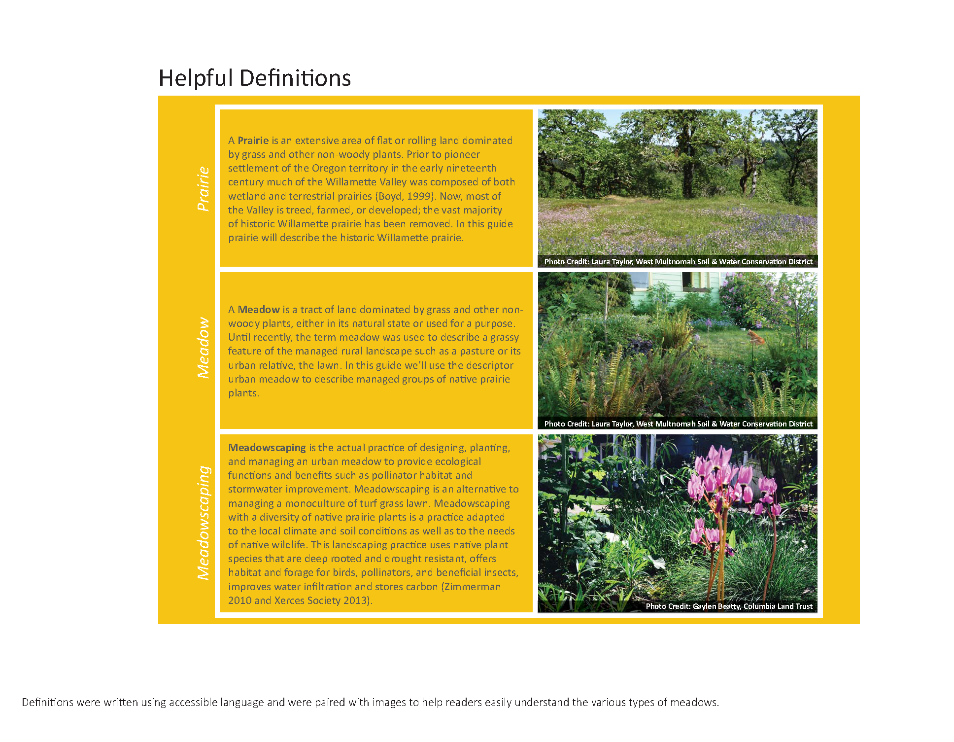
Lacamas Creek Pump Station

Baz_Park_Concept_plan_graphic_pump_station_sewer.jpg
Lacamas_trailhead_Concept_plan_graphic.jpg

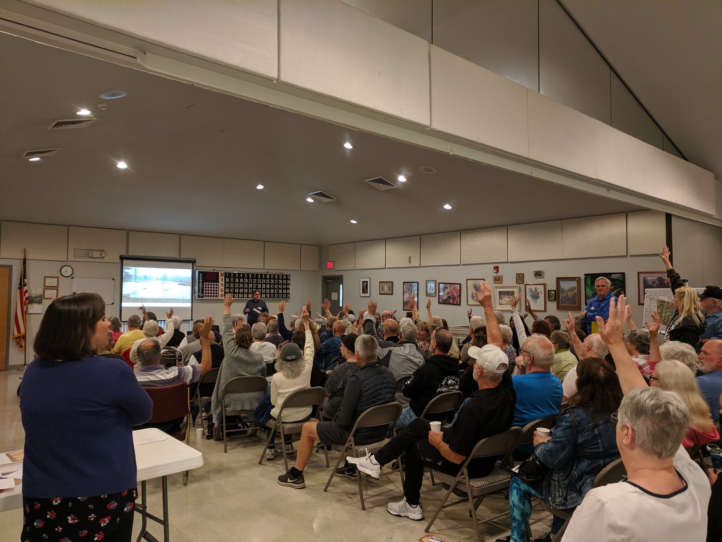
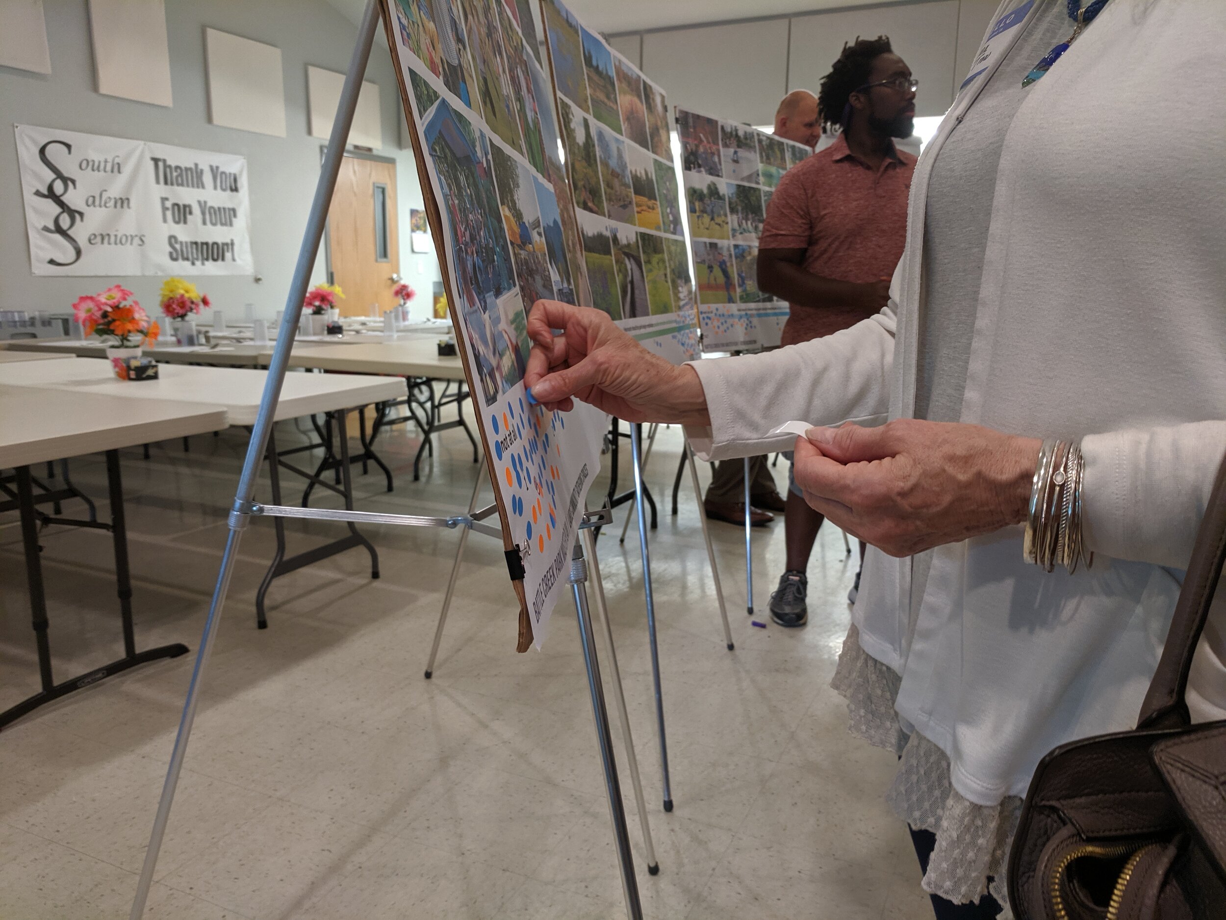
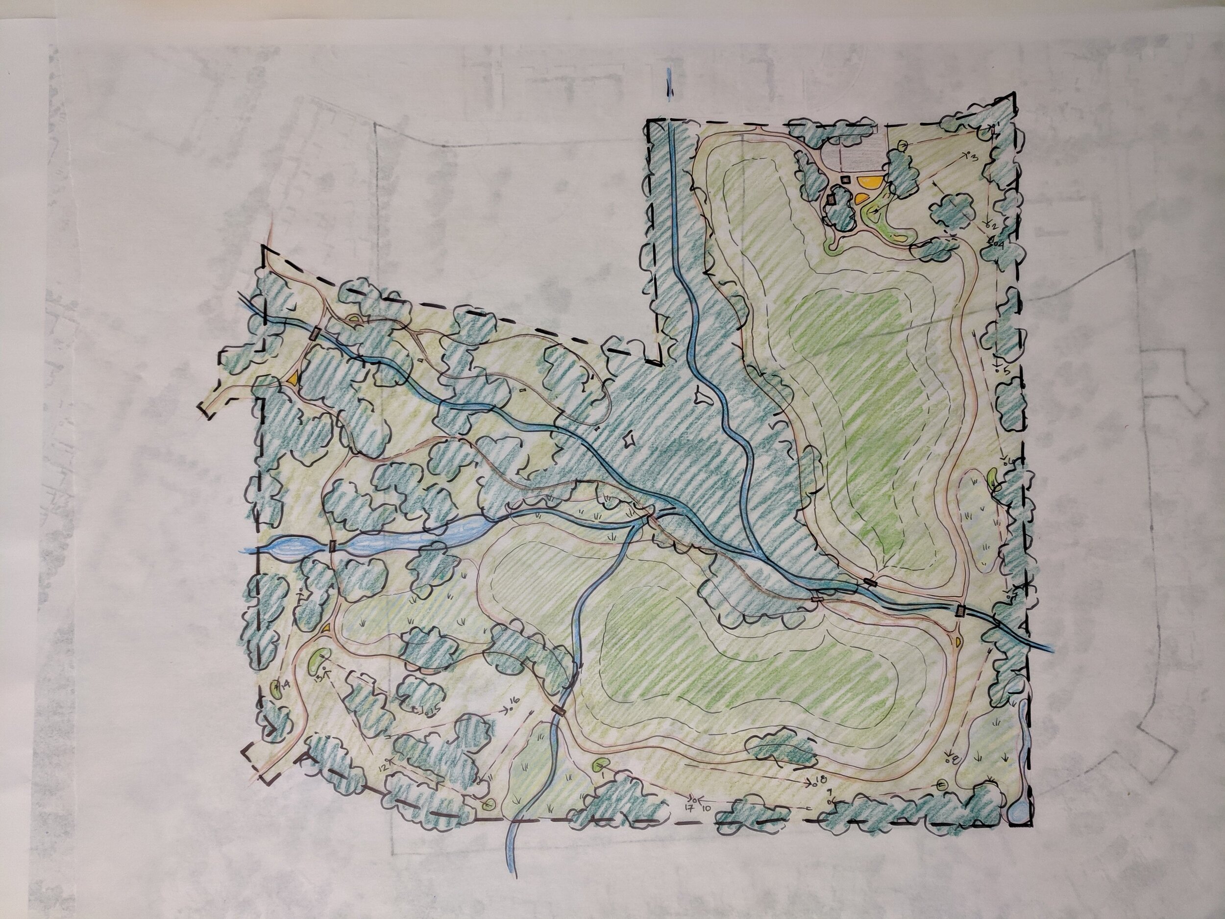
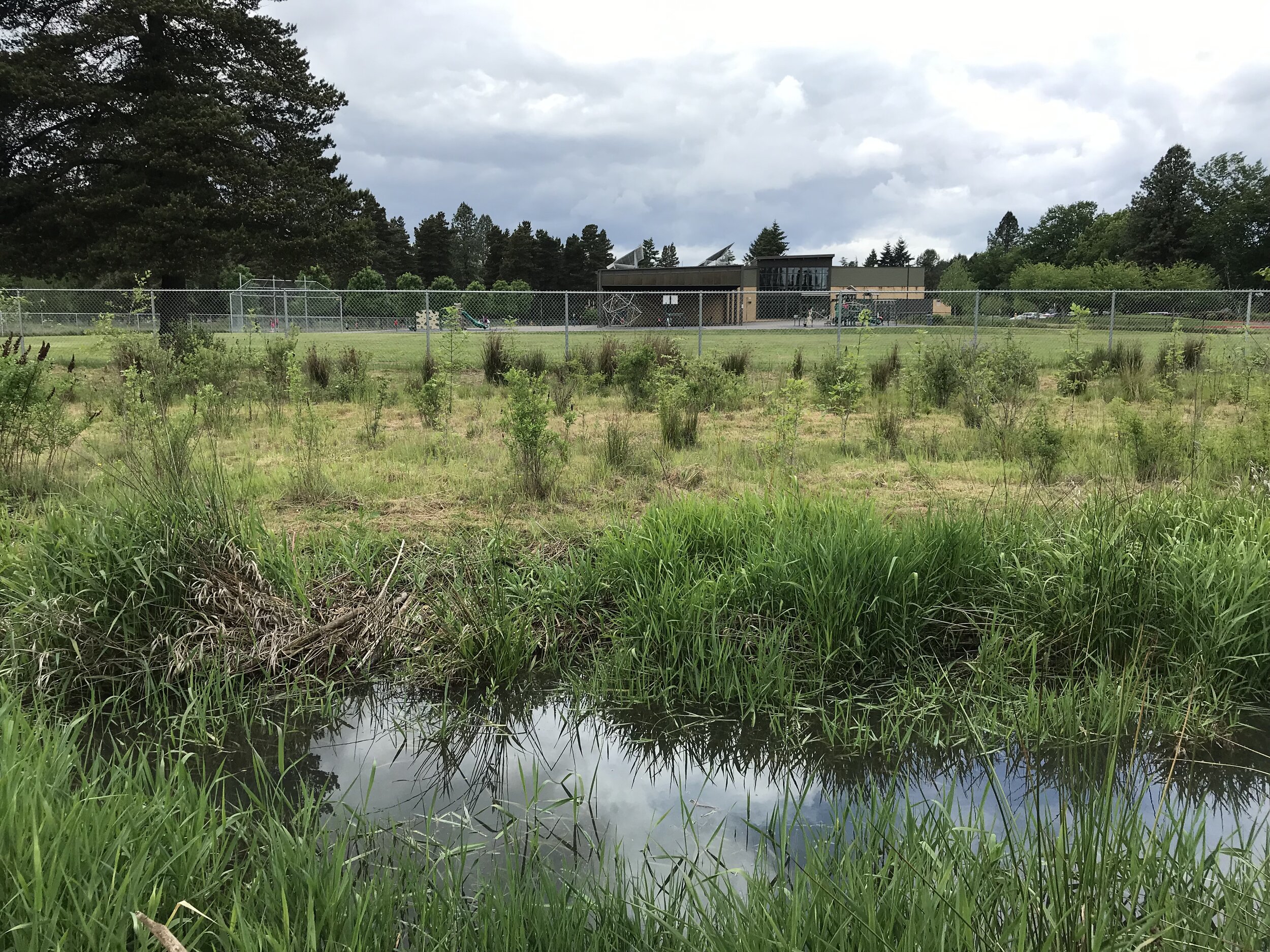
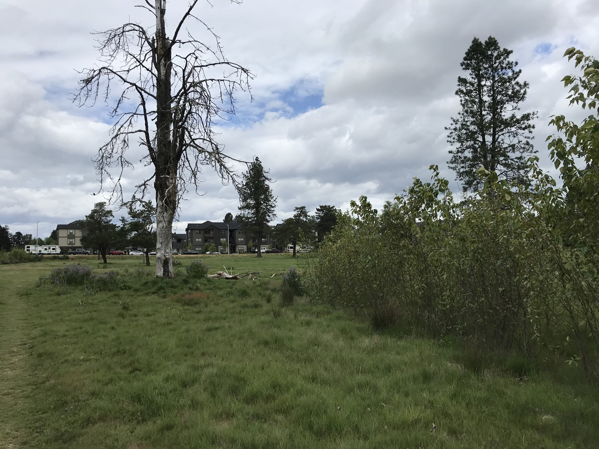
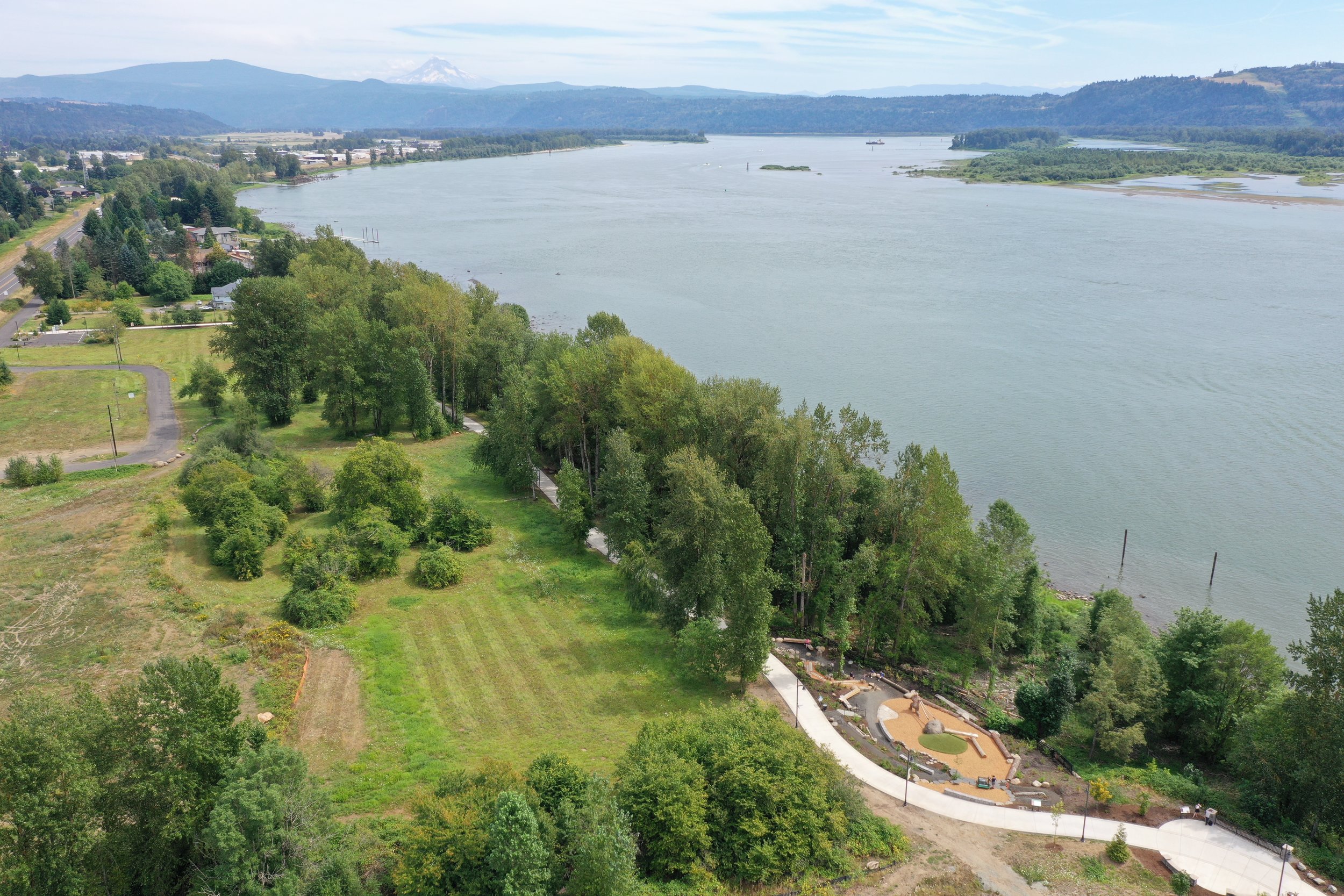
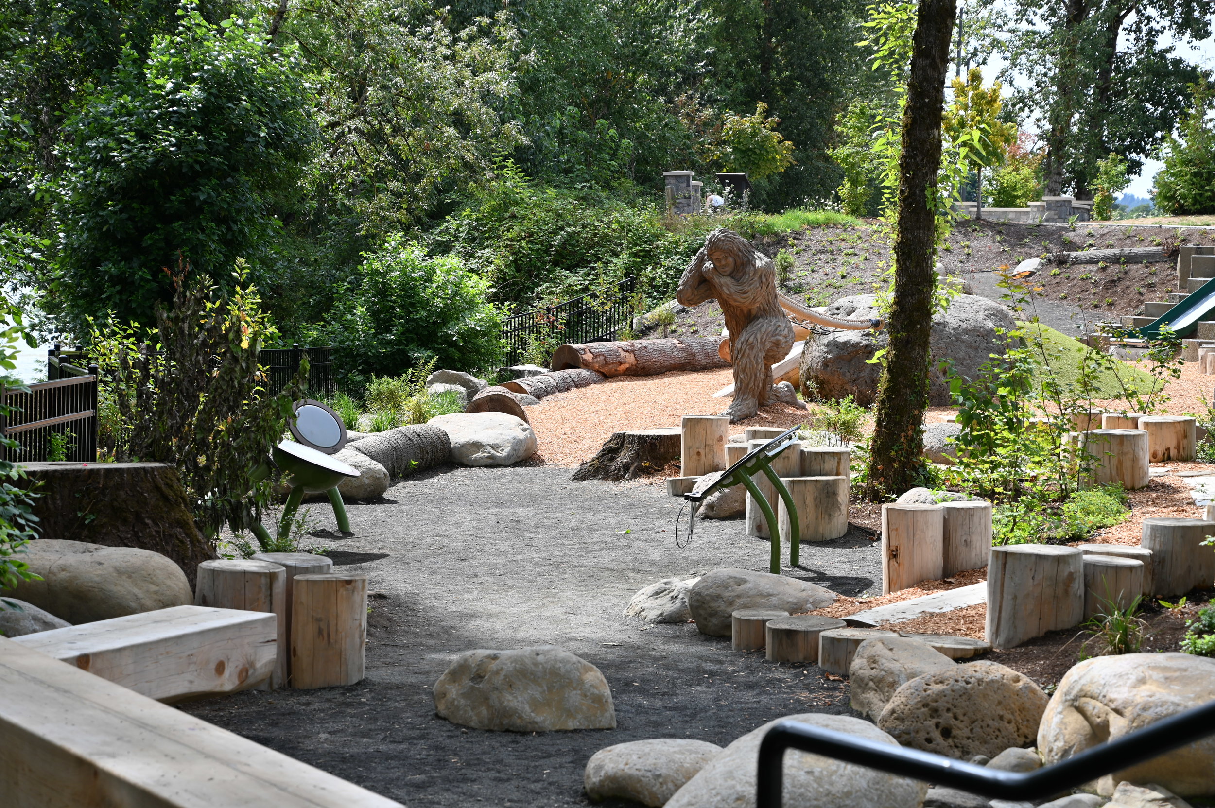
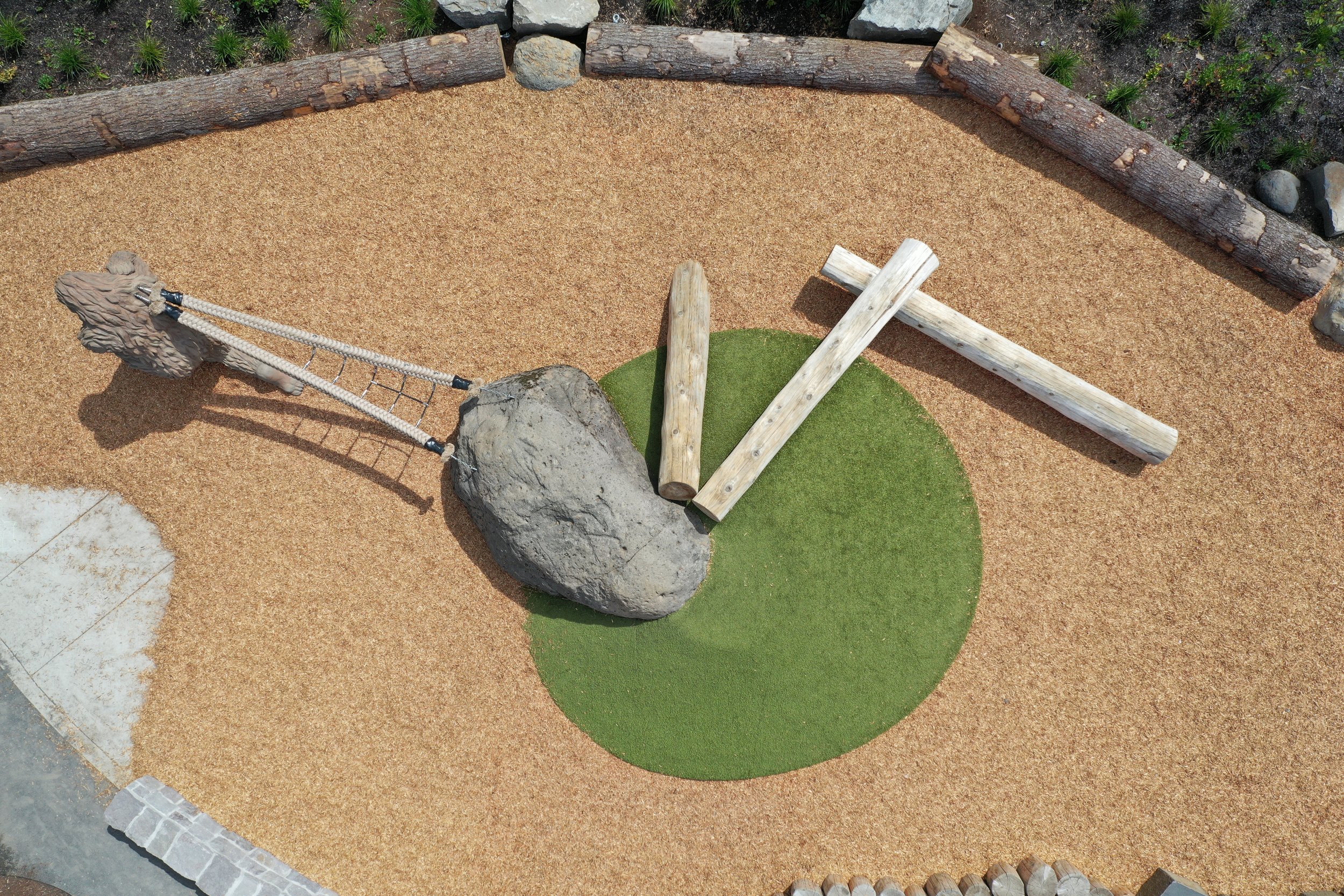
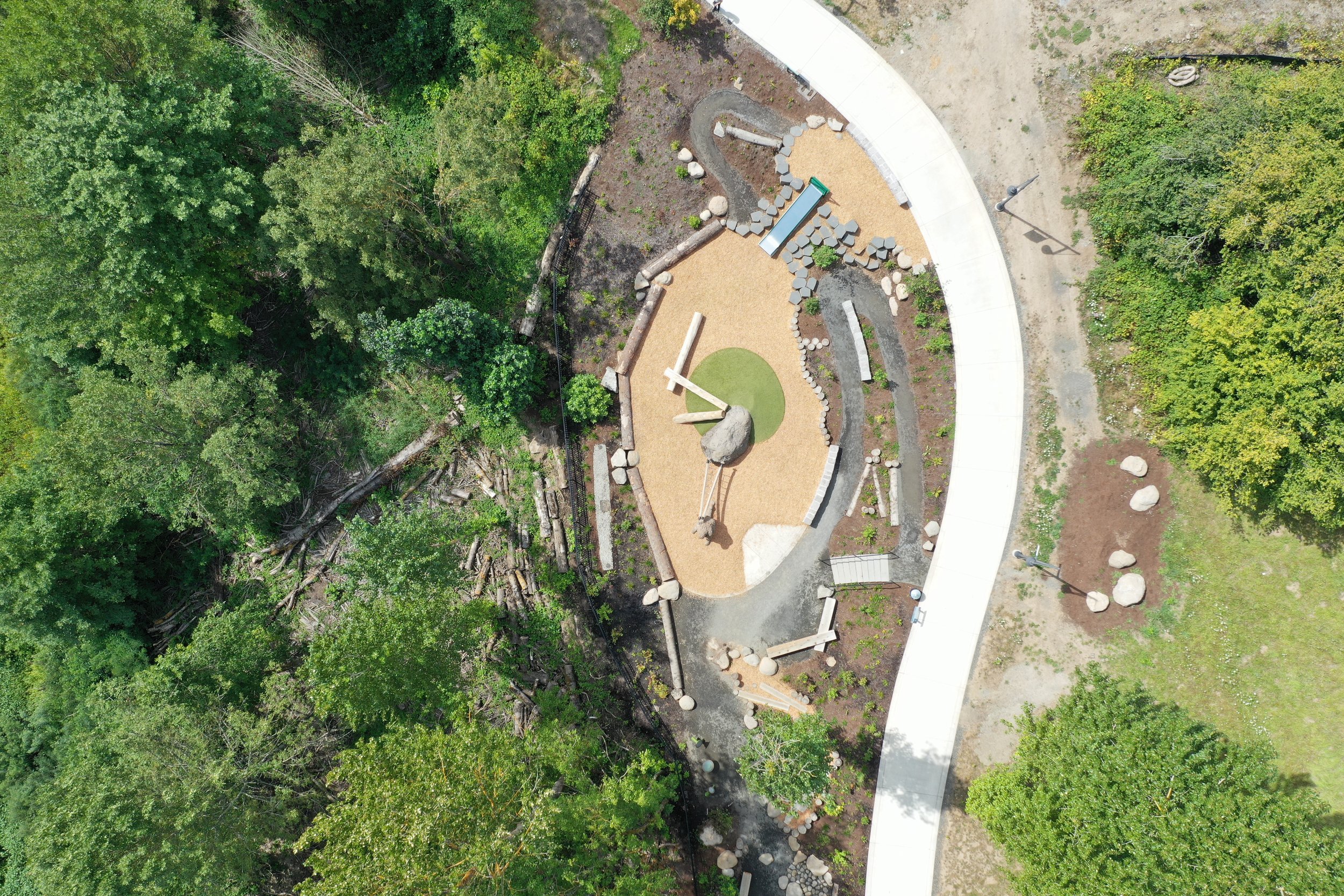
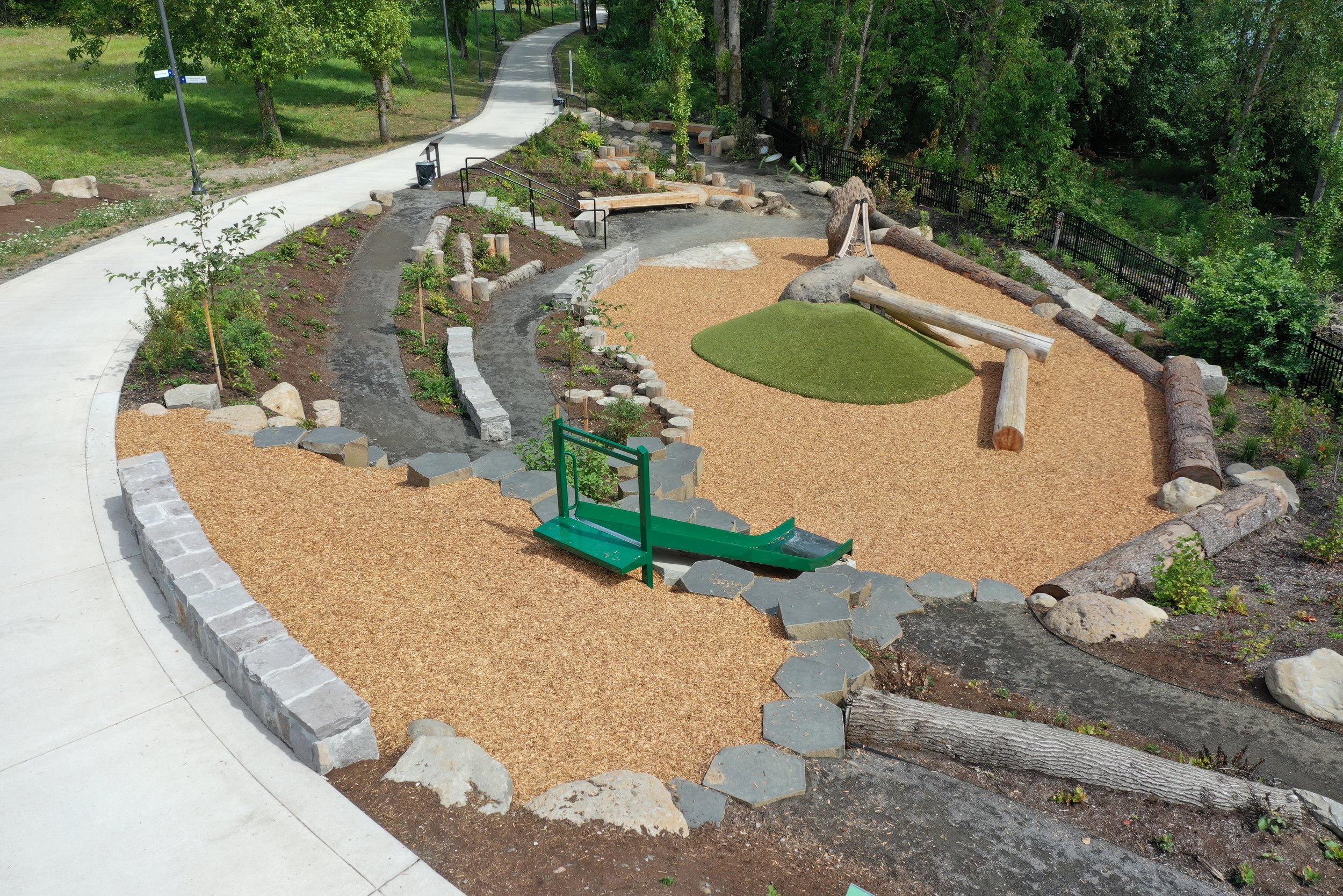
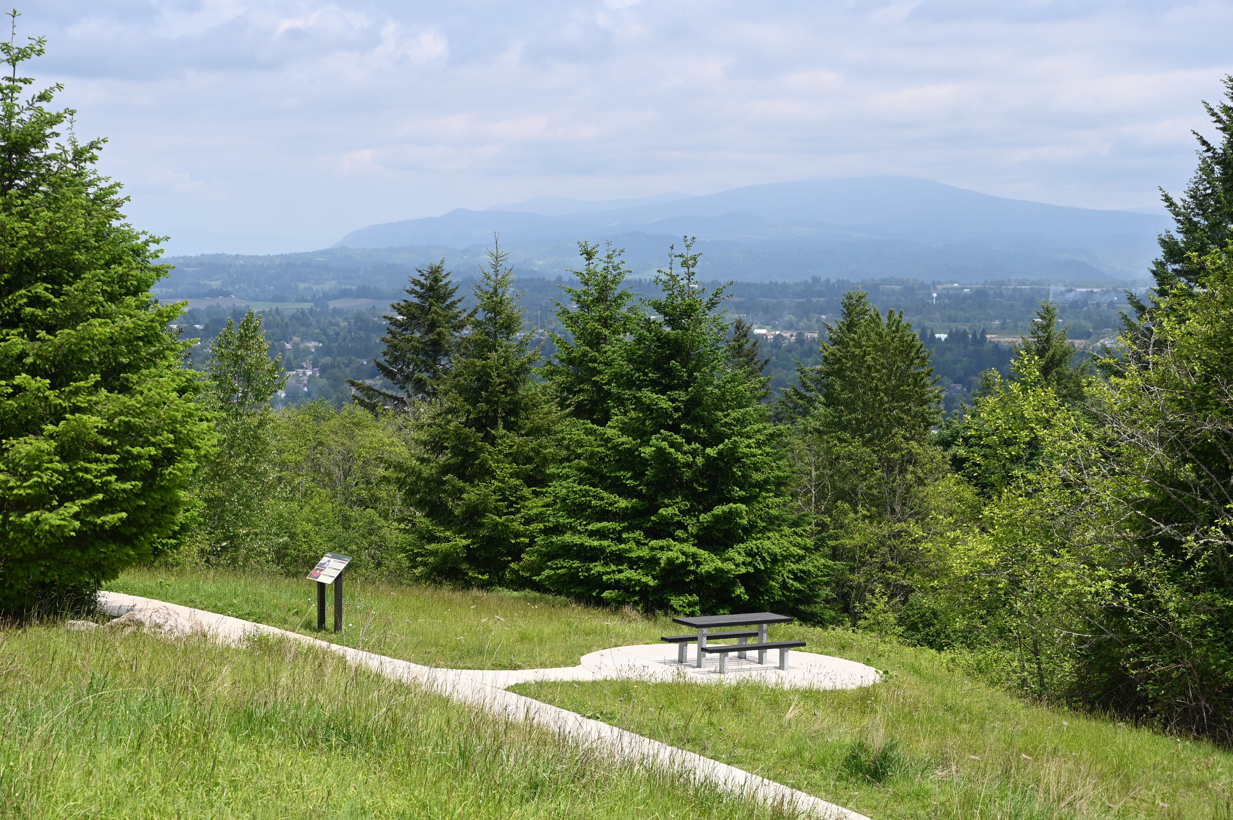
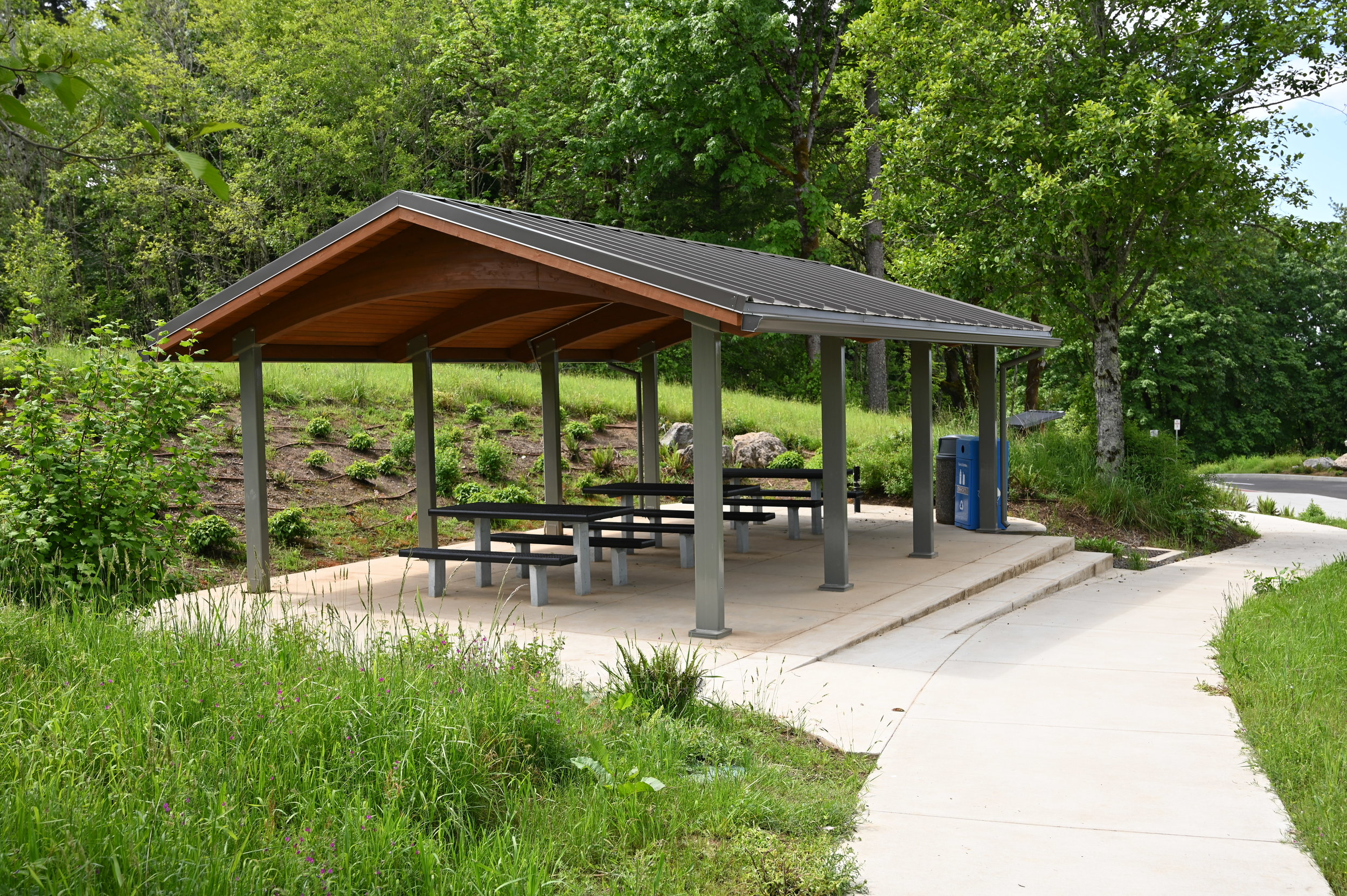
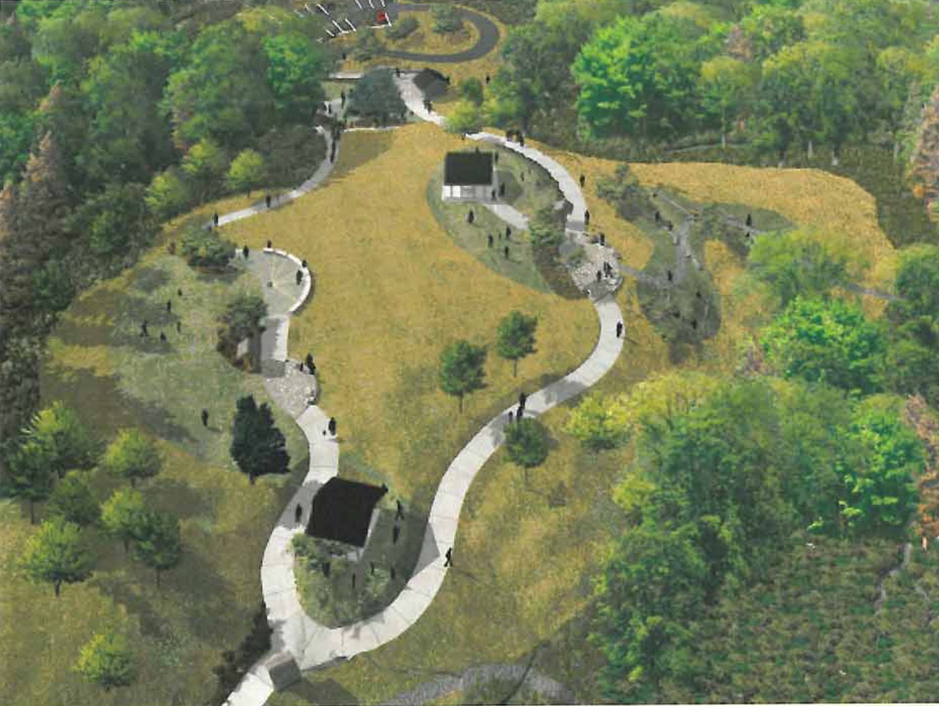
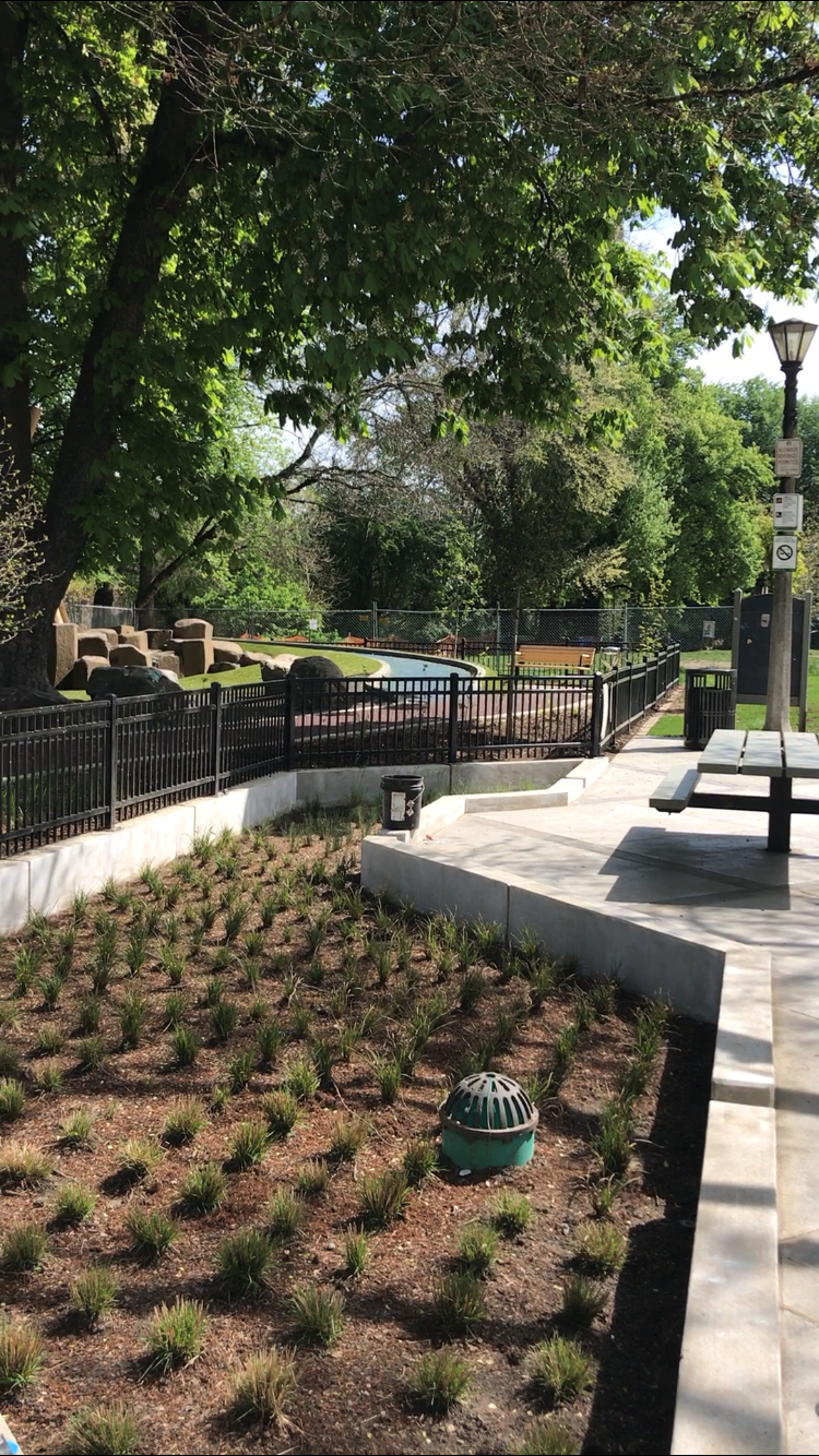
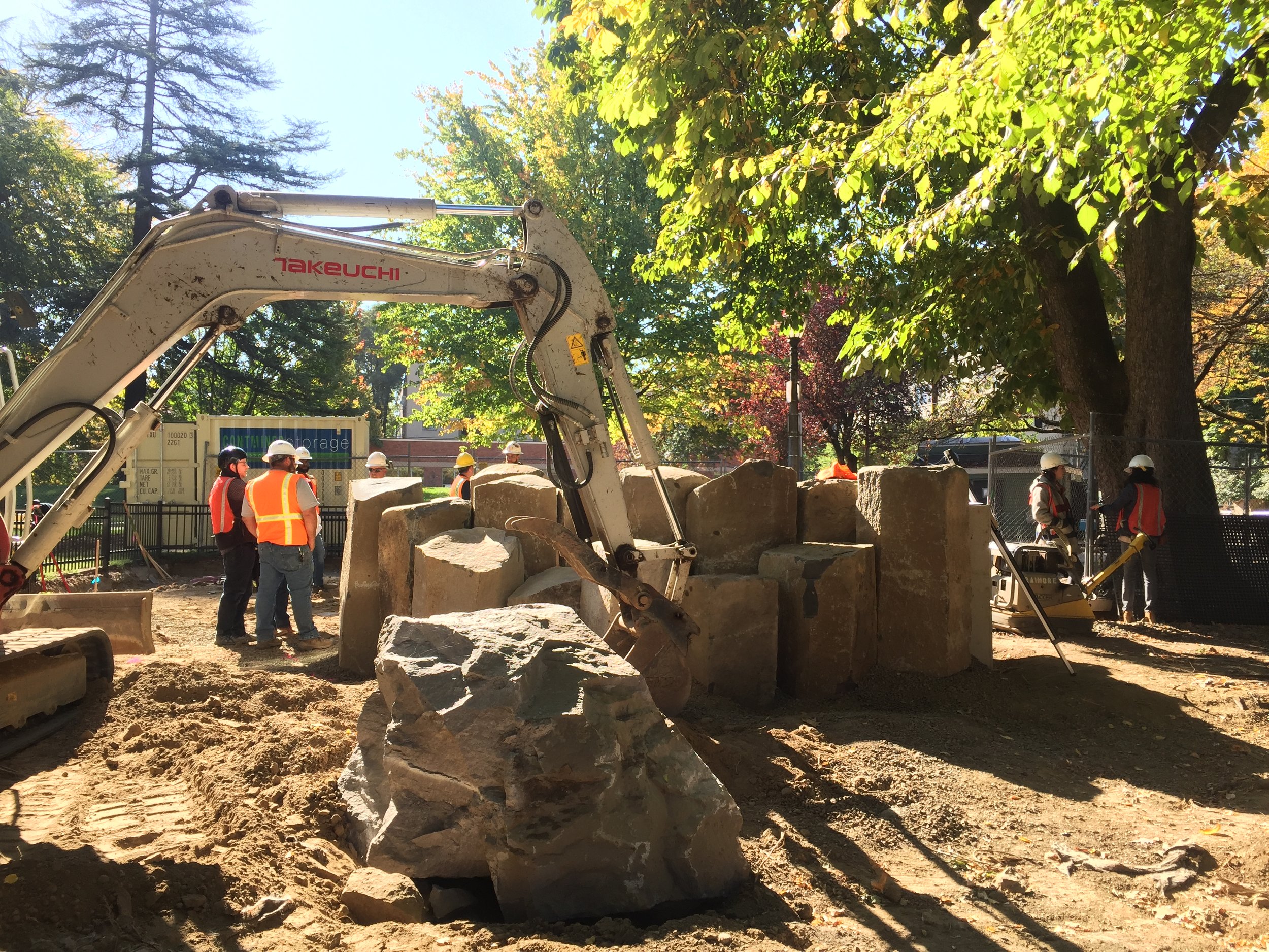
GreenWorks and our team members developed a conceptual design to integrate a park, trailhead, and parking area at Lacamas Creek Trailhead to a pump station.  We also designed landscape improvements to the pump station itself, as well as one at nearby Baz Park, in Camas, Washington.

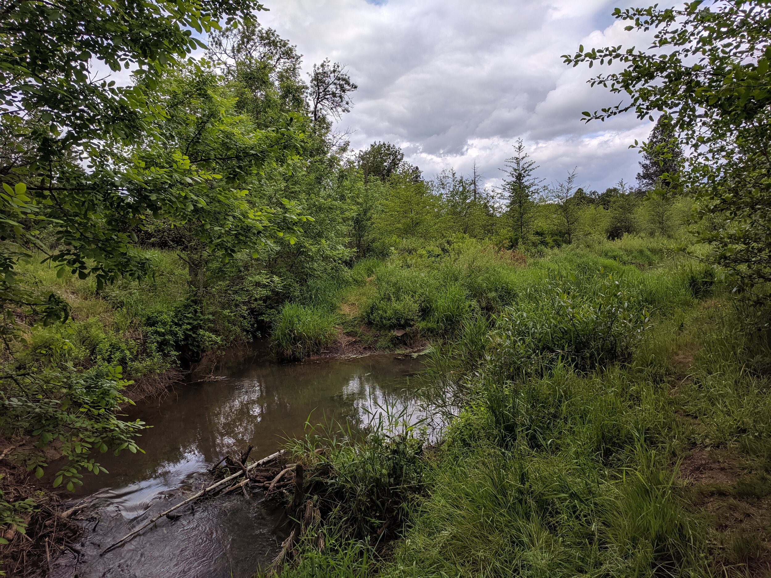
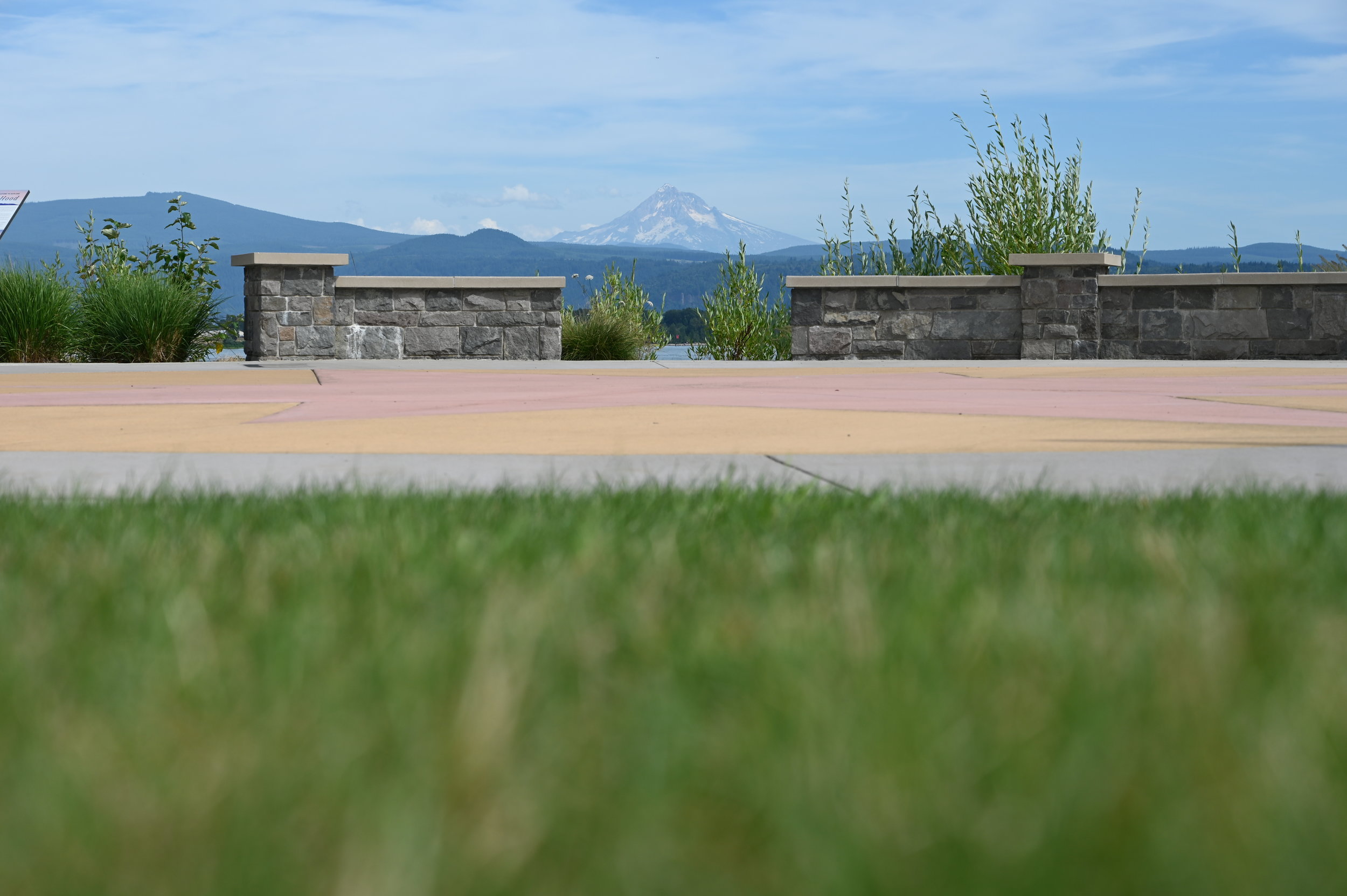
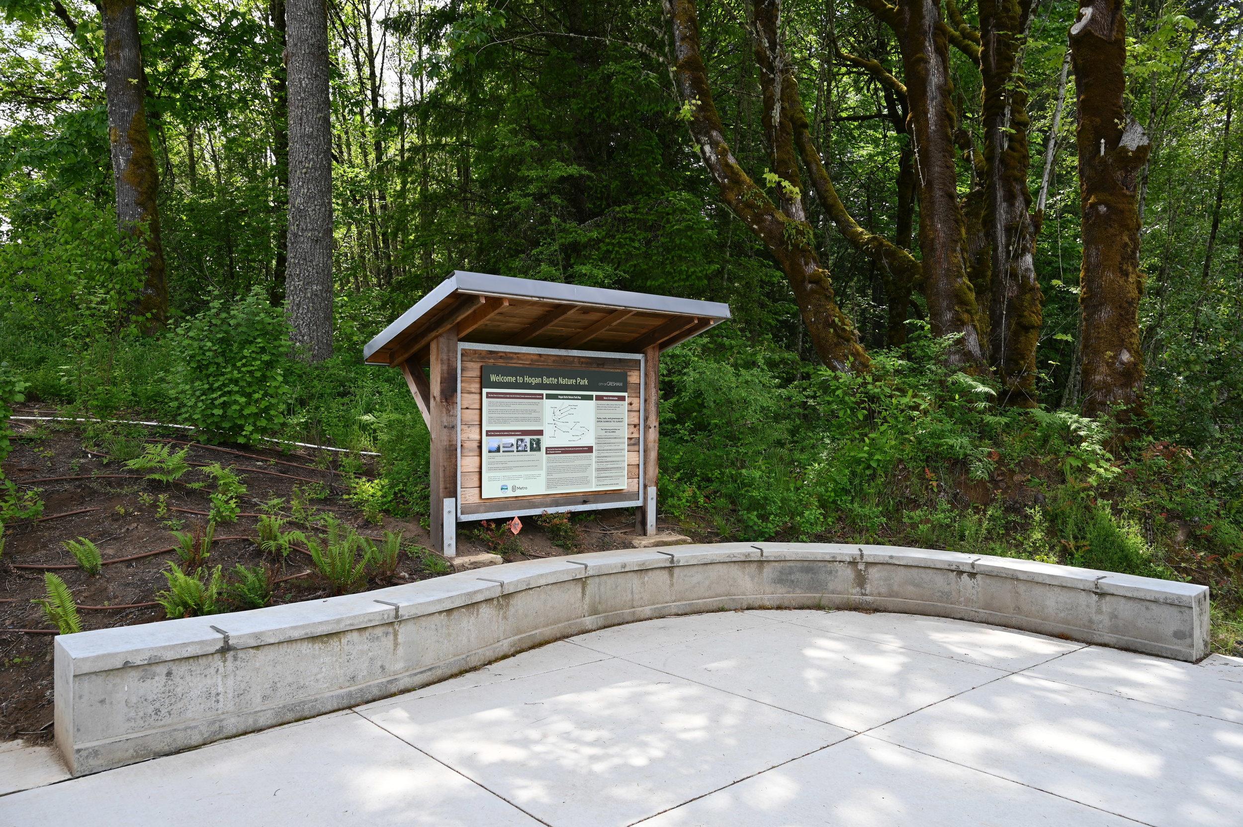
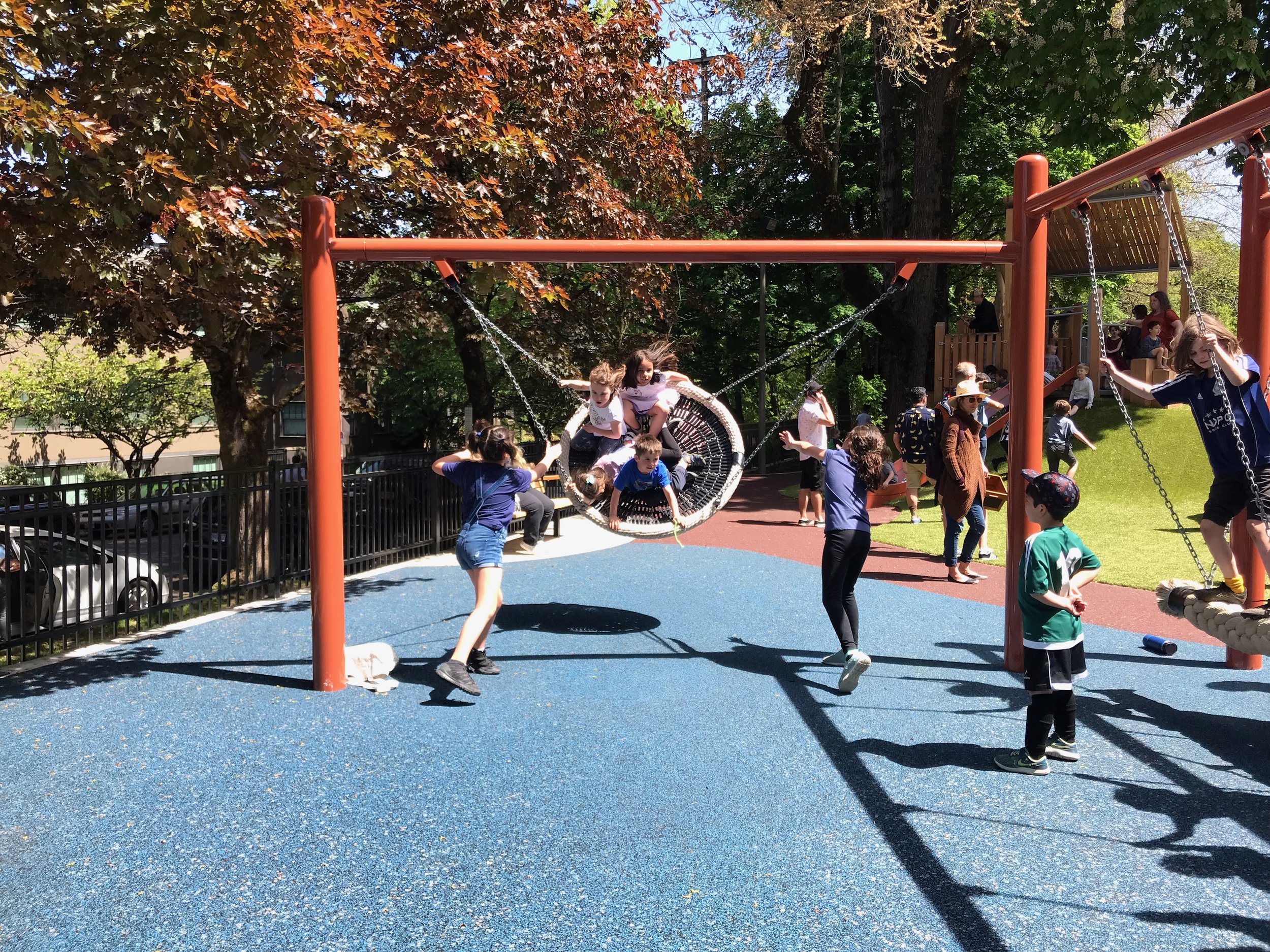
The Lacamas Creek Trailhead is the beginning of a regional trail connecting several parks including Lacamas Lake and Round Lake. The team’s design includes a picnic area, flush restrooms, trailhead signage, and paved parking; as well as recommendations for invasive plant removal and native plant restoration as mitigation for impacts to the land while constructing the pump station and trailhead.

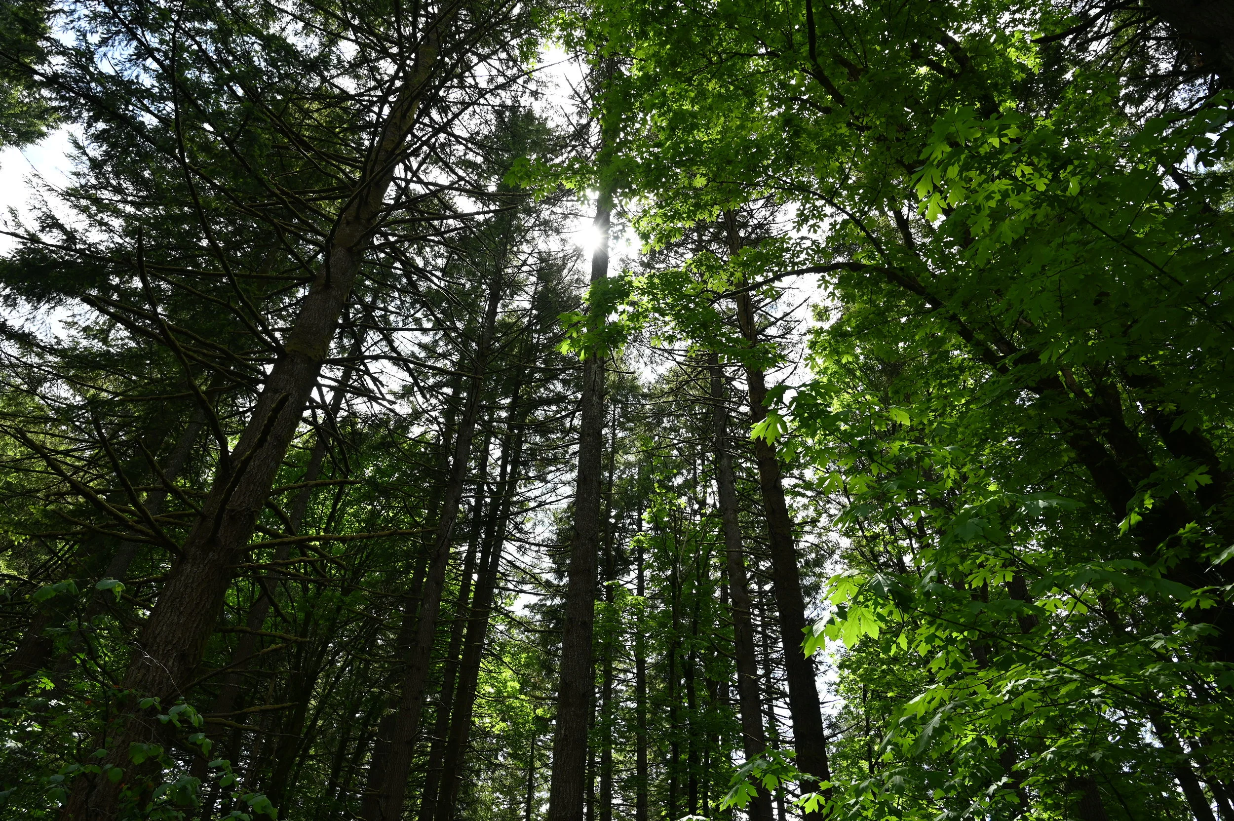
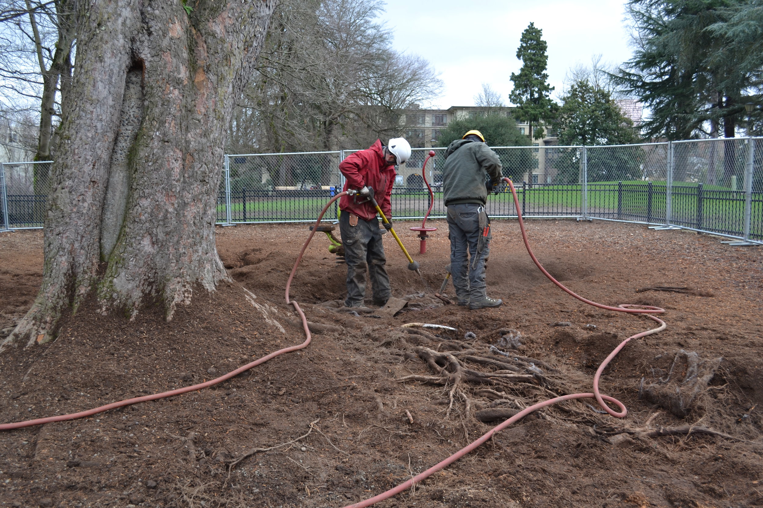
GreenWorks also provided arborist services, including inventory, evaluation, and recommendations for existing trees on park sites and along pipe routes from the new pump stations.

Barton Park Master Plan

Barton_OPRD_Presentation_Illustrative-site_plan.jpg

Barton County Park is a 122-acre regional park located along the north side of the Clackamas River and offers many recreational opportunities including overnight camping, picnicking, hiking, and accessing the Clackamas River. During the summer months, many people from around the region use Barton as a place to access the Clackamas for a three-hour float to the Carver Boat launch. Both Barton and Carver have experienced capacity and safety issues with the proximity to our region’s growing population and ever-growing interest in recreating close to home.

The County has also incorporated three new parcels into the complex which will offer the ability to expand the current program and provide new uses at the park. GreenWorks has assembled a multi-disciplinary team to analyze the existing transportation issues inside and outside the park, which are caused by peak-season use. The team will prepare a Master Plan to address safety, user experience, capacity, and revenue generation while incorporating the new undeveloped areas into the overall the park. 

Barton_OPRD_Presentation.jpg
Barton_park_Neighborhood_Presentation_regional_plan.jpg

Latourette Park

IMG_0578-2.jpg

Latourette Park resides in the historic, residential district of Oregon City. This old park was once the home of a community swimming pool that was filled in and now is the only flat space in the neighborhood. Oregon City hired Greenworks to help the design for renovating the park which includes a new nature play area, accessible pathways, sports court, and planting areas. The concept was completed in the summer of 2018, and construction documents in 2020, and construction is nearing completion. 

Latourette Park under construction in the fall of 2020.

Latourette Park under construction in the fall of 2020.

plan graphic for latourette park’s redevelopment
Latourette_Park_Oregon_City_Construction_Overhead_View_Drone.jpg
community work day with nonprofit Depave, where old surfacing was removed
Backhoe_Latourette_Park_Oregon_City_Construction.jpg

Salem Riverfront Park Amphitheater

Salem Riverfront Park Amphitheater Design by GreEnWorks

Salem Riverfront Park Amphitheater Design by GreEnWorks

Salem Riverfront Park Amphitheater under Construction

Salem Riverfront Park Amphitheater under Construction

Salem Riverfront Park is one of Salem’s premier, treasured, and well used parks. Through a robust public outreach process, GreenWorks and City staff worked with focus groups and the public to develop and prioritize concepts for park improvements and additions.  A key feature in the new addition to the park is a new, larger amphitheater designed to complement a proposed covered stage and a river viewing terrace with dramatic views of the Peter Courtney Minto-Island Bridge.

Relocating the covered stage and amphitheater to the south end of the park means Salem can host larger events in the park and take advantage of the soon to be upgraded areas: nature play area, terraced overlook seating, playground, splash pad, pavilion, and seasonal ice rink.  


Spring 2021 Construction of Salem Riverfront Park Amphitheater

Spring 2021 Construction of Salem Riverfront Park Amphitheater

Salem Amphitheater band shell under construction, Minto island bridge behind

Salem Amphitheater band shell under construction, Minto island bridge behind

Willamette Water Supply Program Raw Water Facility

grounded-persp.jpg
17111_bank-vis-2yr.jpg

GreenWorks is working with Black & Veatch team to provide landscape architecture services for Willamette Water Supply Program’s Raw Water Facility. The existing park at the treatment plant will be restored after construction, including a replacement overlook at the top of the riverbank, plus trails along the riverbank leading to two smaller overlooks. A new electrical building in the upper site will be screened with a combination of tall berms and vegetation, in consideration of neighbors and users of two adjacent multi-use paths. GreenWorks is also designing large mitigation planting areas, to compensate for natural areas disturbed by construction. GreenWorks developed graphics to illustrate the park improvements on the riverbank, for use in permitting and public meetings.

Willamette Water Supply Program Water Treatment Plant

18046_Admin_Concept_Page_1.jpg

GreenWorks is providing landscape design services for the WWSP WTP in Sherwood for Willamette Water Supply. Greenworks is working closely with team to ensure site security by laying out and detailing walls fencing and plantings around the plant. The plant will have an administrative building with a courtyard for employees and the public. GreenWorks is designing the courtyard as well as incorporating interactive education component that leads to a boardwalk where there is a preserved kolk pond created over 15,000 years ago by glacial floods. Other tasks GreenWorks is providing includes landscape design for plant entries stormwater facilities and interior landscape.

18046_Admin_Concept_Page_3.jpg
2019_04_29_WWSP_WTP_1.0_LANDCAPE_PDR_Page_39.jpg
IMG_20190612_095822247.jpg

The Meadowscaping Handbook: Designing, Planting and Managing an Urban Meadow

The Meadowscaping Handbook_Images_Page_3.png

GreenWorks was honored to work with great scientists and ecologists of Portland to create planting diagrams for Meadowscaping diagrams and compile this great publication. We would like to thank Mary Logabo and Carolyn Lindberg with the West Multnomah Soil and Conservation District for trusting us with their ideas, words and photos. And special thanks to Mark Griswold Wilson with Mark Griswold Wilson Urban Ecology for introducing GreenWorks to WMSWCD.

Meadowscaping is a landscape type that supports pollinators, helps reduce our ecological footprint, conserves and increases biodiversity, and bolsters our awareness of natural and cultural heritage. To make this landscape accessible to, and implementable by, a diverse audience, a local Willamette Valley district and group of regional ecologists and landscape professionals collaborated to create The Meadowscaping Handbook: Designing, Planting and Managing an Urban Meadow. Capturing knowledge and “lessons learned” in a fun and accessible format, the book includes beautiful original graphic renderings, easy-to-understand language, and a thoughtful structure that leads the reader clearly and confidently through the handbook. The book, which was released in 2016 and is available for free to anyone who would like it, has received extremely positive feedback from the community and is already into a second print-run (with over 500 copies distributed around the Pacific Northwest region of the United States and British Columbia, Canada).

The Meadowscaping Handbook_Images_Page_4.png
The Meadowscaping Handbook_Images_Page_1.png

Purpose: Meadowscaping is the practice of designing, planting, and managing urban meadows in order to provide ecological functions and benefits such as habitat and stormwater improvement. As intensive urbanization and agriculture, pesticide use, and diseases/parasites continue to weigh heavily on pollinators, meadowscaping offers important habitat in spaces that would otherwise be devoid of beneficial native plant species. Meadowscapes not only support pollinators, but also help to reduce our ecological footprint, conserve and increase biodiversity, and increase awareness of our natural and cultural heritage. The Meadowscaping Handbook was, therefore, designed to help gardeners, landscape professionals and ecologists in the Willamette Valley implement their own meadowscapes. As a how-to publication, the book provides guidelines, examples, and instructions for planning, designing, planting, and maintaining meadows on small urban plots (less than 0.25 acres in size) using plants that are native to the Willamette Valley.

Audience: The Meadowscaping Handbook was specifically written and designed for a broad audience of gardeners, landscape professionals and ecologists. The writers and designers struck an important balance between accessibility (for gardeners), high-level design (for landscape professionals) and academically cited research (for ecologists) through word-choice, tone, style, diagrams, and graphics. By capturing both first-hand experiences as well as data, the handbook is a relatable guide that is useful to anyone who is interested in learning more about or implementing a meadowscape.

Message: The Meadowscaping Handbook clearly and creatively captures a comprehensive approach to planning, designing, installing, and maintaining meadowscapes. From defining meadow types to providing extensive plant lists and design templates, the book is a comprehensive yet accessible resource that inspires and educates readers to try meadowscaping for themselves.

Impact: This guide has helped beginning gardeners to professional ecologists understand urban meadows. Since the guide has an extensive appendix with practical resources, users have been able to use the book to create their own meadow spaces. Five hundred copies of the book have been distributed around the Pacific Northwest region of the United States and British Columbia, Canada, and the response has been incredibly enthusiastic with quotes from readers including,"Best book I have ever come across for our purposes; it covers everything! I read it from cover to cover in one night," and "Such a beautiful and useful book. So readable!"

Distribution Method: The Meadowscaping Handbook is available for order or download on the client’s website for free and has been distributed by the client at numerous conferences and community events.

Look Ahead: The client has successfully distributed the entire first print run of The Meadowscaping Handbook and has already ordered a second printing! Each version of the book will be updated to make sure that the book stays up-to-date and accurate.

Wade Creek Park

2019_01_07_Wade_Creek_Preferred.jpg

Wade Creek Park Phase III

Greenworks and our sub-consultant Otak worked with the City of Estacada on a preliminary design for Wade Creek Park Phase III, a 3-acre park in Estacada, Oregon. The City has a vision of turning a pond located behind the library into a flowing stream as well as improving its outfall for maintenance and safety. The team conducted a geomorphic and hydrology study, and an assessment of the site by providing surveys for topography and tree health. Two alternatives were presented to the public. In order to cast a wider net of responses, GreenWorks created an on-line survey. The final design comprising of a riffle, pool, and channel complex with riparian plantings, an amphitheater, and walking trails was presented to City Council in early March of 2019 and was approved.

Rendering credit: Otak + Greenworks

Rendering credit: Otak + Greenworks

Conceptual Design for the Wade Creek Park Community Building

We worked as a sub-consultant to Otak to provide design services for the Wade Creek Park Community Building, located to the northwest of the Estacada Public Library in Estacada, Oregon. The building will consist primarily of a multi-purpose room of +/- 1,000 square feet and accommodating approximately 75 to 100 people. The space will adapt to allow many different gatherings using include mobile partitions to subdivide the room. The building will also include a covered stage as part of a planned outdoor amphitheater. The plan includes additional spaces such as a small kitchen, storage room for furniture, utility closets and bathrooms. The conceptual design integrated with and was influenced by the Wade Creek Park Phase Ill master plan. GreenWorks was essential to the project’s coordination, test-fitting the proposed building layouts. The final product of our work was a conceptual design set that expresses the new building’s layout, elevations, roof plan, and assumed materials for the building. A cost estimate was provided as well. The conceptual design was used by the City of Estacada to pursue funding for the project.

Battle Creek Wetland Park

Battle_Creek_Park_Visualization_Birdseye_west facing.jpg

GreenWorks is currently working with the City of Salem, preparing a master plan for Battle Creek Park, a large 56-acre undeveloped park property in South Salem.  The site, a former golf course, is currently undeveloped, with creeks, wetlands, trees and open space. Urban growth in South Salem has created flooding issues in the adjacent neighborhoods and downstream from the park, thus the property was purchased for both park and flood mitigation functions.

The goal for the Battle Creek Park master plan is to develop a multi-use park that balances recreational use with flood mitigation. GreenWorks is exploring ways to integrate flood plain mitigation so that the park looks and feels natural versus looking like a large, engineered detention facility.

The city also received input from more than 800 responses to a first online survey and from more than 80 community members that attended both public open houses. From that feedback, three conceptual site improvement options for the master plan were created, each focusing on a different theme (habitat, recreation, blending of habitat and recreation). Some park features are in all three options, such as trails and flood retention, but other features vary or are unique to each option.

visualization of battle creek park in winter with viewing platform
Opt3-summer.jpg
Opt3-winter.jpg

Birds_Eye_waln entrance.jpg


series of images illustrating battle creek park improvements for public engagement

Salem Riverfront Park Master Plan

Salem_1_50_MP_board.jpg

Salem Riverfront Park is one of Salem’s premier, treasured, and well used parks. GreenWorks partnered with the City of Salem to update the master plan for Salem Riverfront Park, incorporating an additional four acres of land on the south end of the park.  

The large open lawns, open air amphitheater and views of the Willamette River make the park a favored place for large and small events held throughout the year and it’s a popular place for walking, jogging and getting a breath of fresh air.

Through a robust public outreach process, GreenWorks and City staff worked with focus groups and the public to develop and prioritize concepts for park improvements and additions. A key feature in the new addition to the park is a new, larger amphitheater designed to complement a proposed covered stage and a river viewing terrace with dramatic views of the Peter Courtney Minto-Island Bridge.

Relocating the covered stage and amphitheater to the south end of the park means Salem can host larger events in the park and take advantage of the soon to be upgraded areas: nature play area, terraced overlook seating, playground, splash pad, pavilion, and seasonal ice rink.  

Our updated master plan includes a floating river walk, expanded dock facilities for kayak and canoe rentals, and space for fishing. We also improved connections to other Salem parks, including a future trail along adjacent Pringle Creek and existing links to Wallace Marine Park.

Hood River Community Housing

GreenWorks and Carleton-Hart Architects are working with the Columbia Valley Housing Authority to develop new affordable housing in Hood River, Oregon. The project connects residents with nature, provides opportunities to play, and is sited sensitively to reduce impacts on existing topography and vegetation. Stormwater planters, permeable paving, and use of native and adapted plantings complement other amenities for residents, including seating areas, a playground, community garden beds, picnic spots, trails woven throughout the site, connections to transit, and a new multi-purpose regional trail for maximum accessibility.

Hood_River_Community_Housing_B.jpg

St. Helens Riverfront Connector

2019_02_12_Draft_Riverfront_Connector_Plan_Page_001.jpg

GreenWorks helped the City of St. Helens, Oregon plan a new road between popular parts of town. We provided design and planning services for anticipated growth and increased traffic between highway 30 and the Riverfront District. Pedestrian and bicycle safety and connectivity are integral to the plan, as well as efficient traffic flow, including that of large trucks. GreenWorks produced 3D video visualizations and illustrative plans to help the city decide on a preferred option.

Westmoreland Park Nature Based Play

Westmoreland park from drone during sunset, people playing on logs and rocks, a stream and a pond below

The Westmoreland Nature-Based Play Area is a pilot project for Portland Parks and Recreation. GreenWorks collaborated with Portland Parks & Recreation to replace an outdated playground with a nature-based play environment. GreenWorks focused on developing a context-sensitive design that would reference the specific characteristics of the site and its surrounding community. Extensive outreach was built into the design process.

logs come to a point with children climbing, standing on piles of rocks on a cloudy day

GreenWorks led a comprehensive public involvement and consensus building process that resulted in unique play elements, which were custom-made for this park that celebrate the community’s vision.

The design team included environmental artist, Adam Kuby. Adam collaborated with the design team on the overall conceptual design of the playground that represents the restoration of the adjacent Crystal Springs. He helped envision these artistic elements as play features within the design.

Sustainable features include water conservation, drought-tolerant planting design, efficient irrigation, native or native-adaptive plant material, sustainable stormwater management, incorporation of salvaged concrete re-purposed for water play elements and many salvaged logs for climbing features and custom benches. This project opened in 2014 and is “wildly” popular with children and adults alike. The project was awarded the ASLA Oregon Honor Award.

sand play area with children playing, parents sitting on benches on sunny day
mature plants and a sand play area separated by a wood fence on a sunny day

Learn more from Americans for the Arts, KATU2 and US Army Corps of Engineers videos made before the park’s construction, and from PDXParent.

Independence Landing Waterfront Park

Conceived of a an extension of Riverview Park, Independence landing offers users a number of passive recreation opportunities.

Greenworks is honored to be working with the City of Independence to implement the vision set forth in the Open Space Master Plan completed in 2015. The current work on Independence Landing improves a key piece of public waterfront located immediately south of Riverview Park, the flagship of the Independence park system. Designed in tandem with the with the large waterfront re-development on the old Valley Concrete Site, Independence Landing  is one piece in a larger orchestrated effort to revitalize downtown Independence and support commercial growth.

Man-Walks_Park_Willamette_Riverfront_Path.JPG
Independence_Landing_South-View_Oregon_Waterfront.JPG

Included in the plan are a waterfront multi-use trail with a river overlook, a shaded patio and lawn space able to accommodate flexible programming, a sizeable restoration planting area braided by soft surface trails and a grove of shade trees in which the user can find informal, private seating areas. This implementation of the Open Space Master Plan sets the stage for the continued expansion of improved public waterfront southward along the Willamette River and strengthens the downtown, pedestrian connections to the waterfront.

The success of this project has been a measure of how well the project team has worked together. Shawn Irvine and David Clyne with the City of Independence and Steve Ward with Westech Engineering have been instrumental in guiding the design process, representing the diverse community of Independence and streamlining the construction of this exciting new park space.

Conceptual Visualization

Independence landing riverfront park plan graphic birdseye
Independence Waterfront Park Perspective Plan Drawing

Tanner Springs Park

tannerspringspark_8_looking north_for_web.jpg
Tanner Springs Urban Wetland.jpg

GreenWorks collaborated with Atelier Dreiseitl of Germany to design Tanner Springs Park, an urban park in Portland’s Pearl District. Envisioned as an urban park with a wetland focus, the park serves the developing surrounding neighborhood as well as visitors to the area. The sustainable design features innovative uses of water and stormwater, creating a refuge for people and wildlife in the midst of this bustling downtown neighborhood. The design process was highly interactive involving the citizens of Portland through a series of public workshops.

The springs connect the park to Tanner Creek that at one time flowed openly through this area; today it flows through large pipes beneath the city streets. Since the design of the park attempts to recapture the area’s past with its native wetlands and flowing runnels, the name is fitting.
— Portland Parks & Recreation

This one-acre park in the center Portland’s Pear District, Tanner Springs Park is the second of three parks envisioned by the City and Peter Walker Partners. With Walker’s Jamison Square Park serving as an active gathering space for the neighborhood, the Tanner Springs Park design team was charged with making this park, two blocks north of Jamison, contemplative and quiet, designed for personal reflection. The park was to incorporate water and a pedestrian boardwalk that was part of the original master plan.

As the City of Portland settled on the banks of the Willamette River in the late 19th century, it avoided the marshy area north of downtown. This area, where Tanner Creek entered Couch Lake, was an important off-channel rearing area for juvenile salmon, though unrecognized at the time.  As railroad commerce became increasingly important to the young city, Couch Lake was drained and filled to accommodate a large rail yard with the dozens of railroad sidings needed by freight trains to haul out the region’s timber.  Tanner Creek was buried in a pipe deep beneath the developing city.

Art_Wall_pan.jpg

The block now known as Tanner Springs Park is located right in the center of historic Couch Lake, near the Tanner Creek channel. By the 1980’s this area of rail yards, industrial facilities and warehouses began to be redeveloped. Portlanders began to envision a new neighborhood, directly adjacent to downtown, a place where people could live and work in an energetic urban environment.

It is this rich mix of natural and cultural history that the design team wished to incorporate into the Tanner Springs Park.  We visualized peeling back the skin of the city to discover the forgotten wetland.

Conceptualized as a tilted plane, the park captures a transect of the major natural plant communities historically found in the Willamette Valley:

  • freshwater pond

  • emergent wetland

  • wet prairie

  • oak woodland

All plants in the park are native to the Willamette Valley, from the wetland sedges to the stately Oregon White Oak tree used to “invade” the urban streetscape on the western edge of the park.

A spring bubbles up at the top of a large open grassy meadow, trickling down to a wetland pond, sunken 6 feet below street level. The east edge of the pond is scribed by an undulating “Art Wall” constructed of reclaimed railroad rails, some nearly a century old. Lawn terraces, like urban bleachers, run down opposite sides of the park providing lunchtime seating and vantage points to enjoy the scenery.  Pedestrian paths within the park are crafted from recycled basalt cobblestones, once found in the streets of the neighborhood.  This is a place of many historic references, from a natural creek and wetland, to the memory of industry and train yards, to today’s modern city.

However, Tanner Springs Park is not a wetland museum.  It is an urban habitat.  It has its own authentic ecology while utilizing art for interpretation. Though inspired by nature, it is an urban park, with precise terraces and walls creating a frame for the organic core. 

The pond is cleansed biologically, without added chemicals.  All stormwater runoff from the entire block is directed into the cleansing biotope, rather than out to the curb and gutters of surrounding streets.  Vegetation within the park is also managed without chemicals, in order to protect the biological viability of the pond.

Portland_Tanner Springs Park_copyright_ GreenWorks.jpg
PC: Tom Good

PC: Tom Good

Metro Graham Oaks Nature Park in Wilsonville

Graham_Oaks_Plaza_Interpretive_Overlook.jpg

GreenWorks provided schematic design, construction documents, and construction administration for this $1.4 million, 205-acre regional park in Wilsonville. The design process engaged the City of Wilsonville, the adjacent Elementary School, and its direct neighbor–Villebois Community–to create a Nature Park that truly reflected the needs of its community while staying true to Metro’s project goals. The design imparts a hierarchy of trails to facilitate access to natural areas such as restored oak savannah, woodlands, wetlands, and riparian forests. The regional Tonquin Trail provides regional access to the park, while secondary loop trails and forest hiking trails offer additional scenic, leisure routes. The integration of art was an important design element to Graham Oaks. The park’s entrance is designed to provide a strong sense of place and includes numerous sustainable site features (i.e., stormwater facilities in the parking lot, a green roof picnic shelter and native plantings throughout). The gateway interpretive plaza introduces visitors to the wildlife and history of the area, while viewpoints, plazas, bridges, boardwalks and interpretive features throughout the site help visitors enjoy the unique attributes of the park while striking  a careful balance between access and restoration. The park serves many roles as an educational tool to the neighboring Elementary School, a neighborhood Park to nearby Villebois Park and a regional destination for access to nature and recreation.

Graham_Oaks_Birdseye_Trail_Rendering.jpg
grahamoakspark_website_062118_03.jpg
grahamoakspark_website_062118_02.jpg
grahamoakspark_website_062118_01.jpg
GrahamOaksPark_20_Wetland_Overlook_sm.jpg
graham_oaks-2.jpg
Graham Oaks Nature Park_reduced.jpg

Hood River Waterfront Park

GreenWorks provided master planning and design services for the waterfront park in Hood River. The 6-acre park lies north of downtown between the Hood River Event Site and “The Hook” (a protected harbor for learning windsurfing) on property donated by the Port of Hood River. The Park helps connect the community to the Columbia River through a family-friendly public gathering space that accommodates a wide spectrum of uses. Our team went on to provide design services. Design features include beach and swimming access to the Columbia River, innovative children’s play facilities, and flexible areas for large community events and festivals. In addition, the park reclaims eight hundred feet of riverbank, laying back the slope and restoring the river’s edge with a wide variety of native riparian plants. The park sits north of commercial use sites to the south and has improved connectivity to the waterfront and increased economic development and commercial revitalization.

Hood-River-Waterfront_Park_Detail_Birdseye.JPG
HoodRiverWaterfrontPark_7_reduced.jpg

Washougal Waterfront Nature Play Area

Eegah the Sasquatch pulls erric the erratic boulder at washougal waterfront nature play area
Children play on sasquatch statue named “Eegah”

GreenWorks was hired by The Port of Camas-Washougal to design a new nature play area adjacent to the Columbia River. The play area is a highlight along a mile-long trail that begins at Washougal Waterfront Park and meanders along the shoreline of the Columbia River. The design for the playground encompasses a broad spectrum of play experiences for children of all ages and abilities using natural materials to encourage physical, social, and exploratory play.

The focal point of the play is a large erratic boulder nicknamed “Erric the Erratic” which is a remnant from the Ice Age Floods. Other components include an embankment slide, musical instruments, log climbers, and a discovery trail that winds through the forest. The Conceptual Design Alternatives were recently prepared and presented to the Port with final concept completed in January of 2017. The park opened to the public on June 7th!

A computer generated 3d design depicting Children Playing sasquatch eegah and Erric the Erratic
Children climb on a Rope Stretching between Sasquatch Eegah and Erric the Erratic Boulder

Hogan Butte Nature Park

Hogan_Butte_Viewpoint.JPG

Hogan Butte is a 43 acre park south of downtown Gresham and west of US 26. Hogan Butte has a rich natural history that is highly visible on-site and from the stunning 270 degree views from the top of the butte (with views of Mt. Hood, Mt. St. Helens, Mt. Adams, Mt. Rainier, the Columbia River Gorge and the City of Gresham). The position of the property and connections into the community provide unique opportunities for public access and education.

diagram showing elevation change with amenities like viewpoints, shelters, and a LABYRINTH


GreenWorks developed the Master Plan for the site, which recognized the unique value of the Hogan Butte site, both as a natural asset and community asset. The Master Plan meets community assessed needs and protects the natural environment. Program elements included: protecting and restoring natural resources, providing public access, appropriate infrastructure such as restrooms and parking, trails, signage and education. Hogan Butte has a rich natural history that is highly visible on-site and from the stunning 270 degree views from the top of the butte. The position of the property and connections into the community provide unique opportunities for public access and education.


“…a half-mile paved pathway snakes its way to the top. From the crest of the butte is a great view of Mount St. Helens, Mount Adams and Mount Hood, while the mountain finder situated there promises occasional peeks of Mt. Rainier and Mt. Jefferson too.” - The Oregonian

“At the top elevation of 930 feet, take in a stunning ‘Volcanic Viewpoint,’ a panoramic view of Mt. Hood, Mt. St. Helens, Mt. Adams, Mt. Rainier, the Columbia River Gorge and city of Gresham. Walk the half-mile paved interpretive loop trail and enjoy picnic areas with views of the forest. Educational signage is available in Russian and Spanish. An ADA-accessible parking lot has 20 spaces.” - Oregon Metro

Conceptual Visualizations

2006 quality visualization of pathway winding around a hill with picnic shelters and a meadow

Couch Park Inclusive Playground

A child runs along the accessible pathway at couch park in Northeast Portland

A child runs along the accessible pathway at couch park in Northeast Portland

Couch Park is located in the Historic Alphabet District in NW Portland. Sharing ownership with Portland Public Schools, the park is the official home of Metropolitan Learning Center’s playground. The park also has a large 10,000 sf plaza that is an abandoned Right-of-Way that is used as a major North-South pedestrian thoroughfare. Finally, there are the rolling, grassy berms and pathways surrounded by a dense canopy of trees that make up the remainder of the park. The re-design of the plaza and playground was the highest priority and most costly of all the 2016 Bond Projects dedicated to refurbishing aging parks and playgrounds in Portland. 

The old wood playground structure beloved by the MLC students was removed in 2015 due extensive structural rot and multiple hazards. The plaza was no longer ADA accessible due the the humps and bumps from differential settlement between concrete bands and brick pavers. The plaza and playground had old trees, some that were in poor conditions, others that would present challenges for designing and construction around without serious impacts.

The playground, Portland’s first inclusive playground on the west side, is designed for kids of all ages and abilities and is a true hybrid of natural elements and factory built play equipment.  The focal point being a fort on a mound that skirts between large trees to make kids feel like they are in a tree fort, is by far the coolest thing in the playground that kids will use as a centerpiece to create their own adventures and games.

The design for the plaza and playground are within the same footprint as the previous spaces as required by the language of the bond. The plaza’s bold paving patterns are based on the historic grid of bricks and concrete bands but use different textures of concrete to replicate the  historic paving pattern. 

A distinguishing characteristic of the design is demonstrated in the forward thinking of incorporating sustainable stormwater practices into parks and urban plazas. The design showcases vegetated stormwater planters as a primary space maker verses pushing them to the side to inconsequential spaces as mandatory minimum add-ons. The flow through planters define the circulation zones, separate the playground from the plaza, create edges for sitting, and provide a healthy splash of color to a very urban neighborhood.